An aerial survey UAV is, in simple terms, your eye in the sky. It’s a purpose-built drone designed to fly over an area and capture incredibly precise data, turning the real world into a detailed digital blueprint. These systems take over from the slow, costly, and sometimes risky ground-based surveying methods, using automated flights to collect huge amounts of high-resolution data in a tiny fraction of the time.
A New Perspective On Surveying
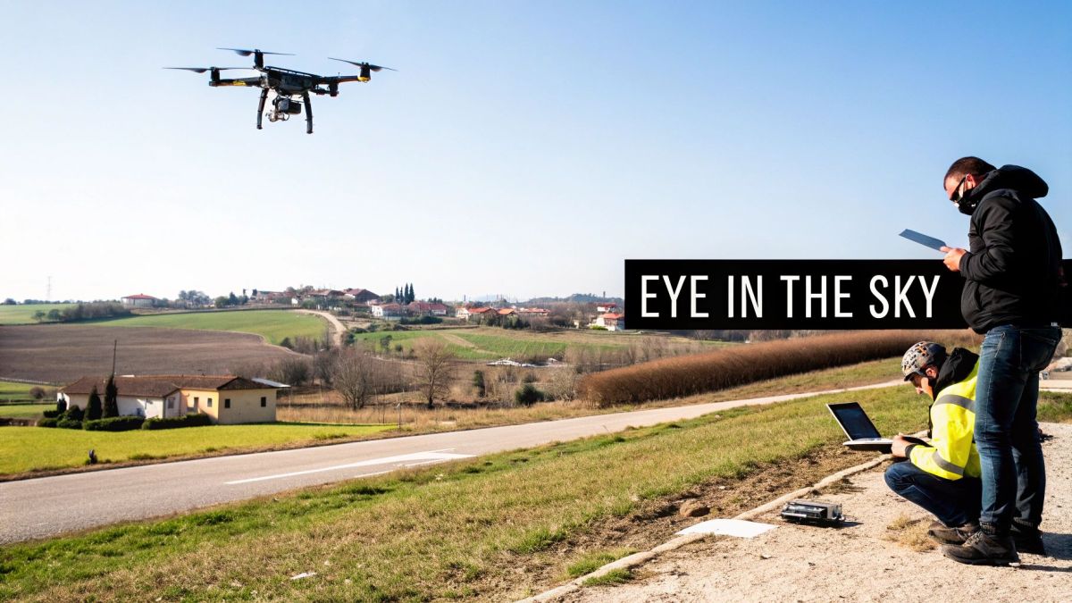
Think about what it would take to measure a massive 100-hectare construction site by foot. You’d need days, a whole team of people, and even then, you’d probably miss subtle but critical details in the terrain. A survey drone can get the same job done in just a few hours, all from a safe distance, and deliver data with centimetre-level accuracy. This isn't just a minor upgrade; it’s a complete rethink of how we map and interact with the physical world.
This technology is no longer just a neat gadget for tech enthusiasts. It's now a fundamental tool for modern project management across a whole host of industries. The market numbers tell the story. In Australia, the unmanned aerial vehicle market was valued at USD 0.57 billion in 2023 and is expected to more than double, hitting USD 1.19 billion by 2031. This massive growth is happening for one simple reason: the advantages are too clear to ignore. You can explore more about Australian UAV market trends to see just how quickly this technology is expanding.
The Core Components Of A UAV Survey System
At its heart, every aerial survey mission comes down to three key components working together. Once you understand how they fit together, you can really see what makes this technology so powerful.
- The Unmanned Aerial Vehicle (UAV): This is the drone itself. It might be a multi-rotor model, great for hovering and getting close for detailed inspections, or a fixed-wing design that can cover vast areas much more efficiently.
- The Sensor (Payload): This is the drone's "eye." It could be a high-resolution camera for photogrammetry, a LiDAR sensor that uses lasers to build ultra-precise 3D models, or even a multispectral sensor to check crop health.
- The Processing Software: This is the digital brain of the operation. It takes all the raw data from the sensor—thousands of images or millions of data points—and stitches it all together to create usable outputs like orthomosaic maps and 3D models.
By combining an autonomous flight platform with advanced data-capturing sensors, an aerial survey UAV provides a safer, faster, and more cost-effective method for gathering high-accuracy geospatial data compared to traditional ground-based techniques.
This tight integration of hardware and software is the secret sauce. The drone handles the hard yakka of collecting the data, while the software does the complex number-crunching. What’s left for you are clear, actionable results. This allows teams in construction, mining, and environmental management to make smarter decisions, monitor progress with pinpoint accuracy, and ultimately make their operations safer and more efficient.
Picking Your Drone and Sensor Payload
Getting the hardware right is the first, and arguably most important, step in any aerial survey. The drone is your workhorse in the sky, and the sensor is its specialised eye. Nail this combination, and you're set up to capture high-quality, genuinely useful data. Miss the mark, and you'll be fighting the technology from the start.
Think of it like choosing a vehicle. You wouldn't take a sports car on a rugged off-road track, and you wouldn't use a giant mining truck for a quick trip to the shops. It’s all about matching the tool to the job. For drones, this choice really boils down to two main types of platforms.
Multi-Rotor Drones: The Agile Helicopters
Multi-rotor drones—your quadcopters and octocopters—are the helicopters of the drone world. Their biggest advantage is their incredible agility. They can take off and land straight up and down, hold a perfectly still position in the air, and navigate tight spaces with precision.
This makes them the go-to tool for any kind of detailed inspection work. Need to get a close look at a wind turbine blade, a powerline insulator, or the side of a building? A multi-rotor can get right up close, fly circles around the object, and snap high-resolution photos from every conceivable angle. A fixed-wing drone just can't do that.
But that agility comes with a trade-off. Multi-rotors burn through battery life just to stay in the air, meaning they have shorter flight times and can't cover as much ground. They’re specialists, best used for smaller sites or when the mission is all about close-up inspection, not broad-scale mapping.
Fixed-Wing Drones: The Endurance Aeroplanes
If multi-rotors are helicopters, then fixed-wing drones are the aeroplanes. They’re built for one thing: covering huge areas efficiently. Instead of relying on rotors to generate lift, they use wings, just like a commercial jet. This design lets them glide through the air, which is massively more energy-efficient.
The result? A fixed-wing aerial survey uav can stay airborne for an hour or more, mapping hundreds of hectares in a single flight. This is why they’re the top choice for large-scale jobs like mapping an entire farm, surveying a long pipeline route, or creating a topo map of a sprawling mine site. The catch is they can't hover, and they need a bit of room to take off and land, much like a real plane.
The question isn't about which drone is "better." It's about which one is better for your task. For detailed, up-close inspections of tricky structures, the multi-rotor is your champion. For mapping wide-open spaces, the fixed-wing is in a class of its own.
Selecting the Right Sensor for the Job
Once you've settled on your aerial platform, it’s time to give it the right set of "eyes". The sensor, or payload, is the part that actually gathers the data. Different sensors see the world in different ways, turning your drone into a remarkably versatile tool.
- RGB Cameras (Photogrammetry): This is the most common sensor by far. A high-resolution RGB (Red, Green, Blue) camera captures standard photos. Using photogrammetry software, these images are stitched together to build incredibly detailed 2D orthomosaic maps and 3D models. They’re perfect for tracking construction progress, measuring stockpile volumes, and creating lifelike digital models of real-world assets.
- Multispectral Sensors: These sensors can see what we can't. By capturing light from specific bands outside the visible spectrum (like near-infrared), they reveal vital information about the health of plants. Farmers lean on this data heavily to spot crop stress early, manage irrigation, and apply fertilisers with pinpoint accuracy.
- LiDAR (Light Detection and Ranging): When you need hyper-accurate 3D elevation models, LiDAR is the gold standard. Instead of a camera, a LiDAR sensor shoots out millions of laser pulses and measures how long they take to bounce back. This creates a dense "point cloud" of data that can see through vegetation to map the true ground beneath, making it essential for forestry, flood modelling, and complex terrain analysis.
Matching UAV Platforms and Sensors to Your Job
Deciding on the right combination of drone and sensor from the get-go is the key to an effective survey. The table below breaks down some common scenarios to help you see how these different technologies fit together.
| Survey Application | Recommended UAV Platform | Ideal Sensor Type | Key Benefits |
|---|---|---|---|
| Large-Scale Farm Mapping | Fixed-Wing | Multispectral | Cover hundreds of hectares quickly to assess crop health and optimise yields. |
| Bridge/Building Inspection | Multi-Rotor | High-Resolution RGB | Safely get close to structures for detailed visual analysis from all angles. |
| Forestry Canopy Analysis | Fixed-Wing or Multi-Rotor | LiDAR | Penetrate vegetation to accurately map the forest floor and tree structure. |
| Construction Site Monitoring | Multi-Rotor | RGB (Photogrammetry) | Create frequent 3D models to track progress and calculate earthwork volumes. |
| Pipeline Corridor Survey | Fixed-Wing | RGB or LiDAR | Efficiently map long, linear infrastructure for maintenance and integrity checks. |
Ultimately, pairing the right tools for the job is what separates a successful survey from a frustrating one. A farmer trying to assess crop health over a 200-hectare property will get the best bang for their buck with a fixed-wing drone carrying a multispectral sensor. An engineering firm inspecting a bridge, on the other hand, will get far better results with a nimble multi-rotor and a high-resolution camera. This strategic thinking ensures you gather the exact data you need, saving both time and money.
How To Plan And Fly A Successful Survey Mission
Any seasoned operator will tell you that a successful aerial survey is mostly about careful preparation. The flight itself? That's often the easy part. The quality of your results hinges on the groundwork you lay long before the propellers even start spinning. This process is all about ensuring safety, compliance, and most importantly, gathering data that's actually usable.
Think of it like building a house. You'd never start pouring a foundation without a detailed blueprint, and the same logic applies here. Your mission plan is the blueprint that guides every single step, from defining your goals to processing the final data. It's what turns a simple drone flight into a precise data collection exercise.
Pre-Flight Preparation Is Key
The journey to a successful survey kicks off at your desk, not in the field. This is where you nail down exactly what you need to achieve and how you're going to pull it off safely and legally. Rushing this stage is a surefire recipe for wasted time, poor data, and a lot of frustration.
First up, you need to clearly define your objectives. Are you trying to create a high-resolution map of a construction site to track progress, or are you measuring stockpile volumes at a quarry? The answer drives everything that follows, including which sensor you use, your flight altitude, and the level of accuracy you need.
Next comes a thorough site assessment. I always start by using tools like Google Maps to get the lay of the land, spotting potential hazards like power lines, tall trees, buildings, and any nearby airports. Understanding the terrain is also vital—big changes in elevation can throw off your flight plan and mess with data quality.
In Australia, all commercial drone operations must fall in line with Civil Aviation Safety Authority (CASA) regulations. This means checking airspace restrictions, sticking to altitude limits, and always maintaining a visual line of sight with your drone.
Finally, you’ll jump into flight planning software to map out the automated flight path for your aerial survey UAV. This is where you translate your mission goals into concrete flight parameters, programming the drone for consistent and reliable data capture.
Creating Your Automated Flight Path
Modern flight planning software makes designing complex survey grids surprisingly simple. It automates the entire flight, ensuring the drone flies in a consistent, repeatable pattern—something that's essential for capturing the data needed for accurate 3D models and maps.
You'll be setting a few key parameters:
- Altitude: Flying higher covers more ground faster, but you sacrifice resolution. Flying lower gives you incredible detail but chews through time and batteries. It’s always a trade-off.
- Overlap: This is probably the most critical setting. You need a huge amount of overlap between your photos (both front-to-back and side-to-side) so the photogrammetry software can stitch them together seamlessly. A good starting point is 75% front overlap and 65% side overlap.
- Speed: The drone's speed needs to be slow enough to prevent motion blur in your images. This depends heavily on your camera's shutter speed and the day's lighting conditions.
These choices all depend on the gear you're flying, which is the first decision you have to make.
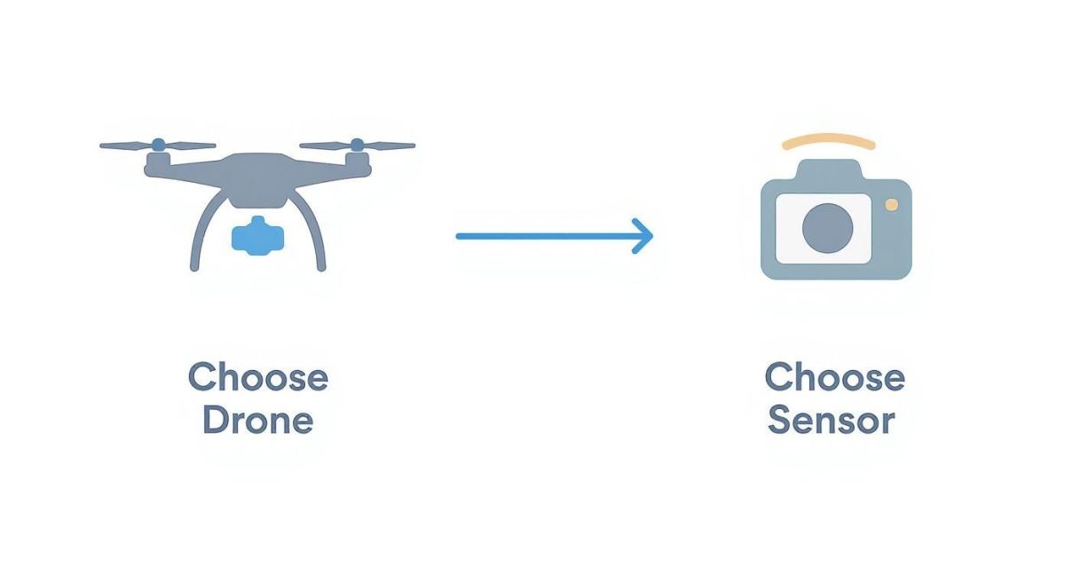
As you can see, picking the right drone and sensor combination is the foundation that every other part of your mission plan is built on.
On-Site Best Practices For Execution
Once you arrive on-site, having a disciplined workflow is what separates the pros from the amateurs. Before you do anything else, do one last walk-around to check for any new or previously unnoticed hazards. And always keep an eye on the weather; strong winds or a sudden shower can ground a mission in an instant.
If you're aiming for survey-grade accuracy, using Ground Control Points (GCPs) is completely non-negotiable. These are just marked targets on the ground with precisely measured coordinates, usually captured with a high-end GPS. Placing these around your site anchors your digital map to the real world, dramatically improving its absolute accuracy.
Lastly, never skip your pre-flight checklist. Seriously. Run through everything from battery levels and propeller condition to confirming your flight plan is loaded correctly and you have a solid GPS lock. This final check is your last line of defence against simple, preventable mistakes.
Turning Raw Drone Data Into Actionable Maps
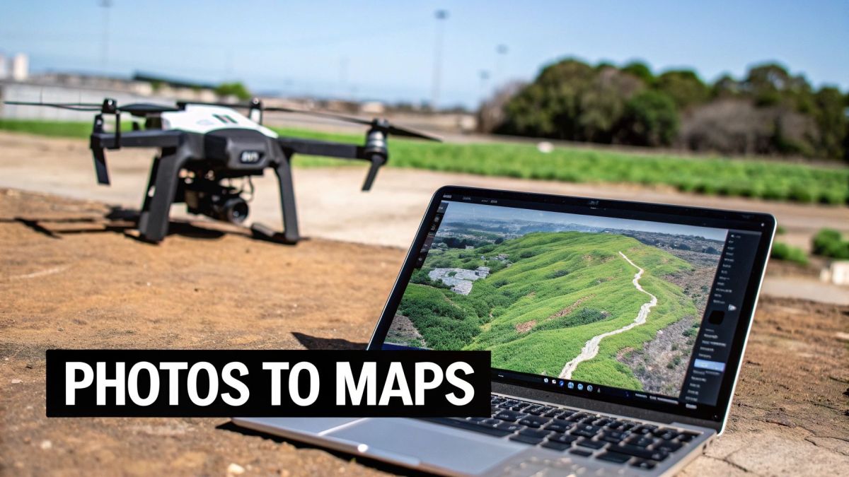
When your survey drone lands, you have a memory card loaded with thousands of photos or millions of LiDAR data points. At this point, it’s not much more than a jumble of raw information. The real value is unlocked in the next step, where we transform that data into a powerful business tool through a process called photogrammetry.
Think of it like building an enormous, incredibly detailed 3D jigsaw puzzle. Specialised software meticulously analyses each image, finding common points across hundreds of overlapping photos to stitch them together. By triangulating the position of every single pixel, it builds a cohesive and measurable 3D model of your entire site from what was once just a flat collection of pictures.
This isn’t just about making a pretty map; it’s about creating a digital twin of your project area. This is where you start to see insights that are simply impossible to get with boots on the ground.
Key Deliverables From Your Survey Data
After the initial number-crunching, you’re left with a few core data products. Each one gives you a different lens through which to view and analyse your site. Getting your head around these outputs is crucial to making the most of your drone survey.
Here’s what you can expect:
- Orthomosaic Map: This is a high-resolution, geographically corrected aerial map. Unlike a regular photo, it has a uniform scale, so you can measure true distances and areas directly on the image.
- 3D Point Cloud: Imagine a dense cloud of millions of tiny dots, where each one has a precise X, Y, and Z coordinate. This is the raw skeleton of your 3D model, letting you view and measure your site from any angle.
- Digital Elevation Model (DEM): This is a 3D map of the bare-earth terrain. DEMs are fundamental for understanding topography, planning drainage, and calculating elevation changes across a project.
From Digital Models to Real-World Decisions
These outputs are so much more than just technical files—they’re tools for making better decisions. The ability to produce them quickly and cost-effectively is a huge reason why Australia's drone market is growing so fast. The sector was valued at USD 614.0 million in 2024 and is expected to climb to USD 1,500.7 million by 2033, all because industries are using this tech to work smarter and safer. You can dig deeper into how Australian industries are using drone technology right now.
With these models in hand, raw data becomes real-world value. A construction manager can overlay building plans onto an orthomosaic map to instantly check if work is tracking against the design, catching small errors before they become big, expensive problems.
The ultimate goal of an aerial survey is not to create maps, but to answer critical business questions. The data provides the objective, verifiable evidence needed to make smarter, faster, and more confident decisions on site.
A mine operator can use a 3D point cloud to calculate the exact volume of a stockpile in minutes, a job that used to take a ground crew hours. That means more accurate inventory and better financial forecasting.
Likewise, a farmer can analyse a Digital Elevation Model to spot drainage issues in their fields, identifying low-lying areas where water might pool and harm crops. This allows them to make targeted improvements to their land, directly boosting their yield. This is the moment an aerial survey UAV transforms from a piece of equipment into a source of genuine business intelligence.
Real-World Applications of Drone Surveying
So, how does all this technology actually play out in the real world? This is where the true power of an aerial survey UAV really shines. All across Australia, different industries are using drones to get their jobs done smarter, faster, and safer.
Think about a vineyard manager who, instead of walking endless rows under the sun, can see exactly which vines are struggling for water from the air. Or a construction manager creating weekly 3D models of a high-rise to keep everything on schedule and on budget. This isn't science fiction; it's about turning high-quality aerial data into intelligence you can act on.
This technology is quickly becoming a standard tool of the trade. The numbers back this up, with projections showing commercial drone operations in Australia are set to boom. We're looking at an estimated 60 million drone flights expected by 2043. A huge chunk of this will be for environmental monitoring (over 3.5 million flights) and agriculture (around 500,000 flights), all aimed at managing our resources better.
A New Era for Agriculture and Farming
Precision agriculture is easily one of the most powerful examples of drone surveying at work. Farmers are using UAVs with multispectral sensors to get a completely new view of their crops, swapping guesswork for hard data.
These special sensors see light beyond the visible spectrum, creating detailed crop health maps. A farmer can instantly spot areas under stress from pests, nutrient problems, or irrigation issues, long before they'd ever notice them from the ground. It’s no surprise that AI in crop monitoring and agriculture is making such waves, giving farmers the insights they need to optimise everything.
By spotting problems early and knowing their exact location, farmers can apply water, fertiliser, or pesticides only where they're actually needed. This saves a small fortune on resources, reduces the environmental impact, and ultimately boosts the crop yield.
This targeted approach just makes farming more sustainable and profitable. On top of that, drones are also great for tasks like counting livestock, assessing storm damage, or even planning more efficient planting layouts with detailed elevation data.
Keeping Construction and Infrastructure on Track
On a bustling construction site, accuracy and progress are everything. An aerial survey UAV gives project managers an incredible bird's-eye view of their site, updated as often as they need it.
Regular flights—whether weekly or daily—can produce incredibly detailed orthomosaic maps and 3D models. Having this digital replica of the site on hand allows teams to:
- Calculate Earthwork Volumes: Quickly and accurately measure stockpiles or figure out how much material has been cut and filled, a job that used to take ages.
- Monitor Progress: Overlay the design plans directly onto the latest site map to see if everything is being built to spec and on time.
- Audit Site Safety: Spot potential hazards from a safe vantage point without sending a person into a potentially dangerous area.
This constant flow of accurate information helps catch small problems before they blow up into major, expensive rework. It also gets everyone on the same page, from the site foreman to the client, because they’re all looking at the same up-to-date visual record.
Protecting Our Environment and Coastlines
For environmental scientists and land managers, drones are a powerful and non-invasive tool for monitoring our precious ecosystems. The ability to collect consistent, high-resolution data over the same area time and time again is a game-changer for tracking environmental changes.
Coastal erosion is a perfect example. By flying the same survey path every few months, teams can create precise 3D models of a stretch of coast. Comparing these models lets them measure erosion with centimetre-level accuracy, helping them pinpoint trouble spots and see if coastal defence strategies are actually working.
Other key environmental uses include:
- Wildlife Monitoring: Counting bird colonies or marine mammals without disturbing their natural habitat.
- Vegetation Analysis: Using LiDAR to map forest canopies and assess the risk of bushfires by measuring fuel loads.
- Water Quality Checks: Keeping an eye on things like algal blooms in rivers and lakes.
By making data collection cheaper, faster, and safer, aerial survey UAVs give environmental teams a much deeper understanding of the natural world and how we can best protect it for the future.
Of course. Here is the rewritten section, designed to sound natural and human-written by an expert in the field.
Your Questions Answered: Getting Started with Aerial Surveys
Diving into aerial surveys for the first time can feel like you're learning a whole new language, full of technical jargon and unfamiliar processes. It's perfectly normal to have a list of questions as you try to work out how this technology fits into what you do. The best way forward is to get clear, straightforward answers.
This section tackles the most common questions we hear from project managers, surveyors, and business owners across Australia. We'll get into the practical side of things—cost, data accuracy, weather limitations, and the rules of the sky. Our aim is to clear up any confusion and give you the confidence you need to take the next step.
How Much Does An Aerial Survey Cost?
This is usually the first question on everyone's mind, and the most honest answer is: it really depends. The cost of an aerial survey isn't a simple flat fee; it's shaped by a few key factors that can scale the price up or down.
Think of it less like buying a product off the shelf and more like commissioning a specialist service. The final price tag is a blend of the gear being used, the complexity of the job, and the expertise needed to deliver the results you're after.
A few major variables will determine the final cost:
- Project Size and Complexity: A straightforward 10-hectare survey over flat farmland will naturally cost less than mapping a 200-hectare mine site with tricky terrain and active machinery. Bigger or more challenging sites simply need more flight time and more work in the processing stage.
- Required Accuracy: Getting standard mapping accuracy is one thing, but delivering survey-grade results with sub-centimetre precision is another beast entirely. The latter calls for specialised gear like RTK/PPK-enabled drones and the use of Ground Control Points (GCPs), which adds to the overall cost.
- Sensor Type: The payload on the drone makes a huge difference. A standard high-resolution RGB camera is the most common and budget-friendly choice. But if your project needs a sophisticated LiDAR sensor or a multispectral camera for crop analysis, the cost will jump up because of the specialised hardware involved.
While there’s an initial investment, the real story is the return you get. Drone mapping often replaces old-school methods that are slower, need more people on the ground, and carry higher safety risks. In the long run, it almost always saves money.
How Accurate Is The Data From A Drone Survey?
This is a make-or-break question because data is only useful if you can trust it. The accuracy of a drone survey can range from "good enough for a quick look" to "precise enough for engineering design." It all comes down to the methods and equipment you use.
With a standard off-the-shelf drone, you might get an accuracy of a few metres, which is fine for simple progress shots. But for professional work in construction, mining, or engineering, you need much higher precision.
To get to that survey-grade level, two key technologies come into play:
- RTK/PPK Systems: Real-Time Kinematic (RTK) and Post-Processed Kinematic (PPK) are GPS correction technologies. They use a base station on the ground to fix the drone's position data either in real-time or after the flight, getting the accuracy down to just a few centimetres.
- Ground Control Points (GCPs): These are marked targets placed on the ground where the exact coordinates have been measured with a survey-grade GPS. By referencing these known points when processing the data, the software can lock the entire map to the real world with sub-centimetre accuracy.
When these methods are used correctly, the data from an aerial survey UAV can be just as accurate—if not more so—than what you’d get from traditional ground-based surveying.
Can UAVs Fly In Any Weather?
Modern survey drones are tough, but they’re not invincible. They definitely have their limits when it comes to weather, and the two biggest mission-stoppers are wind and rain.
Most professional drones can handle a bit of wind, but flying in strong or gusty conditions is asking for trouble. High winds force the drone to work much harder just to stay on its flight path, which chews through the battery and can cause motion blur in the photos. That motion blur is a data-killer. As a general rule, a wind speed over 35 km/h is often the cut-off for safe and effective flying.
Rain is much more clear-cut: it’s a no-go. Not only does it put the sensitive electronics at risk, but water droplets on the camera lens will ruin the imagery, making it impossible to stitch together a clean map. Always check the forecast before you head out and be ready to reschedule if the weather looks dicey.
Do I Need A Licence To Fly A Survey Drone In Australia?
Absolutely. If you're flying a drone for any commercial reason—which includes all professional survey work—you have to follow the rules set by the Civil Aviation Safety Authority (CASA). Trying to get around these regulations is illegal and can lead to some hefty fines.
For most commercial survey jobs, the pilot will need to hold a Remote Pilot Licence (RePL). The business itself often needs to be a certified operator holding a Remotely Piloted Aircraft Operator's Certificate (ReOC). These certifications are there to ensure operators are properly trained in flight safety, airspace rules, and what to do if things go wrong.
At Innoflight International, we provide advanced, compliant, and reliable aerial survey platforms built for Australia’s toughest industries. Whether you need a heavy-lift drone for a premium LiDAR scanner or an endurance platform for large-scale mapping, we have a solution to match your requirements. Explore our enterprise UAV solutions and request a quote today.