Drone service providers aren't just companies with cool tech; they are specialized teams that capture critical data for major industrial work. For sectors like utilities, mining, and infrastructure, the right aerial intelligence can be a game-changer for safety, efficiency, and making the right call on the ground.
Start with Your Problem, Not Their Drone
Before you even think about talking to a drone service provider, you need to get crystal clear on what you’re trying to achieve. The goal is to turn your core business problem into a clear set of technical requirements. It’s the only way to find a true partner.
Too often, organizations just ask for "a drone survey." This is where things go wrong. Without a solid brief, you can easily end up with a provider whose capabilities don't match your operational reality. You might get data that isn't good enough, or worse, pay a premium for overly-detailed data you'll never use.
It all comes down to defining the "why" before you get lost in the "how."
Translate Your Business Problem into Technical Specs
So, where do you begin? Start by pinpointing the biggest operational headache you're facing. Nailing this down will steer every other decision you make.
Let's walk through a real-world example. A utility company's number one concern is wildfire risk from vegetation growing too close to its power lines. This is more than just a maintenance chore; it’s a massive safety and compliance mandate with huge financial and public safety consequences. The objective is to find these hazards with pinpoint accuracy across hundreds of miles of remote terrain.
Your project brief is your north star. It makes sure you and any potential provider are on the same page about objectives, deliverables, and what a successful project actually looks like.
This single problem immediately dictates the kind of technology you'll need. To survey long, linear assets like power lines, you need a drone with serious endurance. If the crew has to land every 20 minutes to swap batteries, the whole operation becomes slow, expensive, and a logistical nightmare.
Suddenly, a technical spec is directly tied to a business outcome. A provider flying a platform with exceptional flight time can cover vast corridors in one go, cutting down on field time and crew costs. The result? You get actionable data faster and can address fire risks before they become disasters.
Define the Data and Deliverables You Actually Need
Once you’ve defined the problem, it’s time to get specific about the data. For that utility company, the ideal outcome is a report that flags exactly where vegetation is too close to the wires. This means the deliverables must include:
- LiDAR Data: You need this to build an accurate 3D model of the power lines and the vegetation around them.
- Accuracy Standards: The data has to be precise enough to confidently measure the distance between a tree branch and a power line.
- Deliverable Format: The final files—like a classified point cloud—must plug directly into the utility’s existing GIS software.
Here's another common scenario. A mine operator needs dead-on accurate volumetric calculations for their stockpiles. Even small errors in measurement can cause major financial headaches in inventory and production forecasting. The business needs verifiable, repeatable data for their inventory audits.
This requirement points directly to a provider whose drone can carry a top-tier, survey-grade LiDAR sensor. The Evolution Flight Peregrine, for example, features a high payload capacity specifically engineered to carry these advanced sensors. This isn't about lifting something heavy; it's about generating a much denser point cloud. This superior data quality is what enables the millimeter-level accuracy required for reliable volumetric calculations, turning a routine survey into a high-value business intelligence tool the finance department can trust.
Evaluating a Provider's Technical Capabilities
Alright, you’ve nailed down your project brief. Now comes the part where many teams get bogged down: sifting through the technical specs of potential drone service providers. It’s easy to get lost comparing spec sheets, but those numbers are useless unless you can directly connect them to your project's success.
Think of a provider's hardware as the engine room of your operation. The drones, the sensors, the whole setup—this is what will make or break your project out in the field. Don't let a slick brochure with impressive flight times or payload capacities fool you. Your job is to pressure-test those claims against what you actually need to accomplish.
From Spec Sheets to Business Outcomes
Let's walk through a real-world example. Imagine you're tasked with corridor mapping for a new pipeline. These projects are massive, often stretching for hundreds of kilometers across rugged, remote terrain. The biggest challenge? Getting the survey done on time and on budget. Any delay at this early stage creates a costly domino effect for the entire project.
This is where a provider’s technical guts truly matter. For a huge corridor map, flight endurance is everything. If a provider shows up with a drone that can only fly for 20-30 minutes at a time, they’ll be constantly landing, swapping batteries, and taking off again. That downtime adds up fast, blowing out your field time, labor costs, and project schedule.
The process of connecting your business problem to a concrete set of requirements for a provider looks something like this:
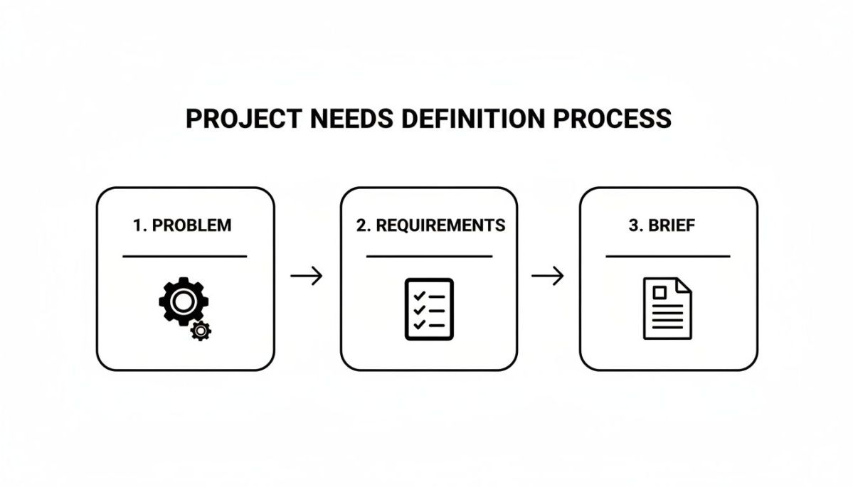
Starting with your core problem and working your way to a detailed brief is the only way to properly assess if a provider’s technical specs are up to the task.
Payload capacity is another classic example. It isn't just about lifting something; it's about lifting the right thing. A high-end LiDAR scanner, which you absolutely need for dense, survey-grade point clouds, is heavy. A provider using a heavy-lift platform like the Evolution Flight Peregrine has a massive advantage here because its 12kg payload capacity is specifically built to carry a superior sensor. And what does that mean for you? A better sensor captures far more data in a single flight. You get higher-density point clouds and more detailed models with less time in the air. The bottom line is a dramatic reduction in fieldwork, faster data on your desk, and a lower total project cost.
Don't just ask, "What's your drone's payload capacity?"
Instead, ask: "Can your drone carry a sensor that delivers a point cloud density of at least 200 points per square meter, and can you show me a sample dataset to prove it?"
Key Technical Questions to Ask Potential Providers
To really understand if a provider's fleet can handle your operational demands, you have to ask pointed questions that dig deeper than the spec sheet. You need to know how their gear performs in the real world, under pressure.
Here are a few critical areas I always investigate:
- Flight Endurance Under Load: What's the real flight time with the exact payload my project requires? A drone's advertised flight time is almost always with no payload attached.
- Wind and Weather Tolerance: What are the maximum wind speeds you can fly in and still capture stable, usable data? This is non-negotiable for coastal projects, in the mountains, or for emergency missions where you can't wait for perfect weather.
- Operational Range and Data Link: How far can the drone fly from the operator before the command or video link starts to degrade? For inspecting long assets like power lines or railways, a rock-solid, long-range data link is essential.
- Deployment and Pack-Down Time: From the moment your team arrives on-site, how fast can they get the aircraft in the air and start the mission? In an emergency, a 30-minute deployment is worlds better than a 90-minute one.
For an emergency management agency battling a wildfire, for instance, rapid situational awareness is life-saving. A provider whose drone can't handle a bit of wind is completely useless. In contrast, a team with a more robust platform can get airborne, stream live video to incident command, and give firefighters the intelligence they need to stay safe and deploy resources effectively.
Always, always tie the technical specs back to your operational reality.
Assessing Data Quality and Security Standards
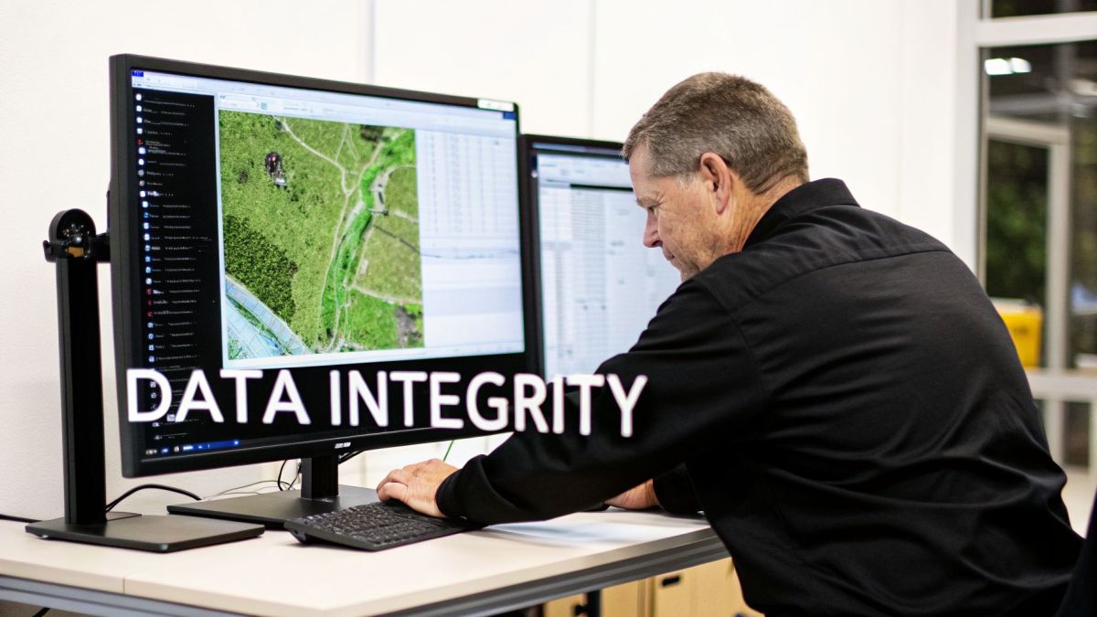
When you bring on a drone service provider, you're not just renting their equipment. You’re buying the data their systems capture. The drone is simply the collection tool—the data is the actual product. This simple fact changes everything. It means your focus shouldn't be on their fleet of drones, but on their entire data workflow, from the moment a sensor powers on to the final file landing in your system.
A top-tier provider must have an almost obsessive commitment to data quality. This isn't something you can just take their word for. You have to dig into their processes and, most importantly, get your hands on sample datasets that directly relate to your industry and the specific problem you're trying to solve.
From Point Clouds to Business Insights
Let's imagine you operate a pipeline and you're worried about subtle ground subsidence that could signal a future integrity risk. Your real challenge is spotting tiny, millimeter-scale ground movements over hundreds of kilometers of right-of-way. It's a classic needle-in-a-haystack scenario where walking the line is far too slow and expensive.
This is exactly where you need to challenge potential drone providers. Don't just ask if they have LiDAR. Ask to see a sample point cloud from a past pipeline project. Can you clearly make out ground features? Is the data dense enough for your engineers to model the terrain with the precision you need? A great provider can show you a dataset where you can actually see the kind of subtle changes you’re looking for.
The most revealing question you can ask a provider isn't, "What data can you give me?" It's, "Can you show me how your data solved a problem just like mine?" This immediately separates a sales pitch from proven experience.
Now, if you're with an EPC firm managing a massive infrastructure project, your needs are different. Your biggest headache is making sure all your as-built data plugs directly into your Building Information Modeling (BIM) or digital twin software. A data deliverable that takes your team hours of manual cleanup or format conversion is a direct blow to your project's budget and timeline.
A sophisticated provider gets this. They'll ask you upfront about your software platforms and deliver data that's ready to go—correctly formatted and perfectly aligned with your project's coordinate system. The ability to provide data that "just works" is a massive differentiator and a sign of a true professional.
The Non-Negotiables: Cybersecurity and Supply Chain
In our hyper-connected world, the data a drone captures over critical infrastructure is incredibly sensitive. A breach could expose vulnerabilities in a power grid, a dam, or a major port, creating huge operational and national security risks. Cybersecurity isn't a nice-to-have feature; it's a fundamental requirement.
This is where you need to look past the drone itself and scrutinize the provider’s entire operation. Where was the drone made? What software are they using for flight control and data processing? And critically, where is your data being stored and how is it protected?
A provider's commitment to their supply chain is a powerful clue to their security maturity. For example, a drone service provider that uses equipment from a manufacturer like Evolution Flight, which is actively pursuing Green UAS Certification, is demonstrating a clear grasp of these risks. This certification process involves deep cybersecurity vetting and confirms compliance with the US National Defense Authorization Act (NDAA) supply-chain requirements.
This isn't about ticking a compliance box; it has a direct business outcome. When you choose an NDAA-compliant provider, you know your sensitive asset inspection data is being handled on a secure, vetted platform. This drastically cuts the risk of that data falling into the wrong hands, protecting your organization from espionage, sabotage, and reputational damage.
A Checklist for Evaluating Data and Security
As you vet potential providers, use this checklist to guide your questions about their data and security standards.
Sample Data Review
- Can you show me sample datasets from a project in my industry?
- Is the resolution and accuracy good enough for what I need to do?
- Will these data formats integrate directly with my existing software?
Accuracy Verification
- Can you provide a formal accuracy report from a comparable past project?
- What’s your process for setting ground control and verifying the final data accuracy?
Cybersecurity Posture
- What are your data encryption standards, both for data in transit and at rest?
- Where will my data be stored (e.g., on-shore, in a specific cloud)?
- Do you have a formal data security policy I can review?
Supply Chain Integrity
- Are your primary drone platforms and sensors NDAA-compliant?
- Do you hold, or are you pursuing, any security-focused certifications like Green UAS?
Asking these tough, specific questions will help you filter out the pilots who just like to fly and find a true partner who understands the immense value—and sensitivity—of the data you’re trusting them to collect.
Checking for Credentials and Real-World Readiness
When you bring a drone service provider onto your site, you’re doing more than just hiring a contractor. You're handing over a measure of trust. You’re trusting them to fly sophisticated equipment in complex airspace, often directly over your most critical assets. Checking their credentials isn’t just about ticking boxes on a form; it’s one of the most important risk management steps you’ll take.
Before you even think about signing a contract, you need to see the paperwork. The provider must hold all the proper licenses from the local aviation authority—that’s CASA in Australia or the FAA in the US, for example. Ask for their Air Operator's Certificate (AOC) or its equivalent, and don't forget proof of comprehensive public liability insurance. If something goes wrong and they aren't covered, the legal and financial fallout could land squarely on you.
This scrutiny is more important now than ever. The global drone services market is booming, with projections showing a leap from $23.82 billion in 2025 to $30.54 billion in 2026. That’s a massive compound annual growth rate (CAGR) of 28.2%. While this growth is exciting, it also means the market is flooded with new and sometimes inexperienced operators. You need to be able to tell the pros from the newcomers. For a closer look at these trends, you can review detailed drone market growth statistics.
Don't Stop at the License
A license just means a provider is legally allowed to fly. It doesn't tell you if they're actually safe or competent. A truly professional drone service provider will have a well-documented Safety Management System (SMS). This isn't some dusty binder on a shelf; it’s the living, breathing rulebook for how they manage risk.
Ask to see it. A solid SMS should clearly outline their procedures for:
- Pre-flight risk assessments (like a JSA or JHA)
- Emergency response plans for various scenarios
- Incident reporting and, more importantly, investigation
- Keeping track of pilot training and flight currency
A well-defined SMS is a sign of a mature safety culture. It shows they’re thinking proactively about protecting their people, their equipment, and your assets.
This checklist is a great starting point for your initial conversations. It helps you quickly vet potential partners and ensure they meet the baseline requirements for safe and legal operations before you dive deeper into technical specifics.
Essential Compliance and Certification Checklist
Here's a quick checklist to help you verify a drone service provider's legal and operational compliance before you go any further.
| Verification Area | What to Ask For | Why It Matters |
|---|---|---|
| Aviation Authority Certification | A copy of their Air Operator's Certificate (AOC), ReOC, or FAA Part 107/135 certificate. | This is non-negotiable. It's the basic legal license to operate commercially. No certificate, no contract. |
| Public Liability Insurance | The Certificate of Currency for their insurance policy, ensuring it covers aviation operations. | Protects your organization from financial liability in case of an accident, injury, or property damage. |
| Safety Management System (SMS) | A copy of their SMS manual or key excerpts. | Proves they have a structured, proactive approach to safety beyond just basic legal compliance. |
| Pilot Credentials | Evidence of pilot licensing, training records, and recent flight experience (logbooks). | Confirms the people flying the missions are qualified, current, and experienced for the task at hand. |
| Cybersecurity Protocols | Documentation on their data handling, storage, and security policies. | Ensures your sensitive asset data is protected from capture to delivery and won't be exposed to threats. |
Having these documents in hand gives you the confidence that you're dealing with a legitimate and responsible operator.
Are They Genuinely Ready to Deploy?
Operational readiness is all about a provider's ability to get the job done safely and reliably, especially when things don't go according to plan. This is where their choice of equipment speaks volumes about their professionalism.
Imagine you need an urgent damage assessment after a major flood. The weather is still unpredictable, with high winds and rain. You need eyes in the sky now to guide your emergency crews, but your mission is dead in the water if your provider's drones can't handle the conditions.
A provider who shows up with a fleet of robust, all-weather platforms is one who has planned for this. For instance, a team that uses an aircraft like the Evolution Flight Kestrel is signaling that they've invested in equipment built for tough environments. That drone's IP43 rating and high wind tolerance aren't just specs on a datasheet—they are what allows them to fly and capture critical data while less capable drones are still in their cases. For first responders, that means getting intelligence faster, making better decisions, and potentially saving lives.
A provider's readiness isn't just about having a mobilization plan. It’s about having contingency plans for equipment failure, adverse weather, and airspace conflicts, ensuring mission continuity no matter what.
Before you sign anything, push them on their operational depth. What's the plan if a drone has a critical failure on-site? Do they have backup aircraft and sensors ready to go? What about a backup pilot? A provider who can give you clear, confident answers is one who is truly prepared for the realities of industrial and emergency work. That’s the kind of partner you can count on.
Getting Pricing and Service Agreements Right

Alright, let's talk about the paperwork. Once you’ve narrowed down your list of potential drone service providers, you’ll be looking at two key documents: the pricing proposal and the Service Level Agreement (SLA). Don't just skim these. They form the entire foundation of your partnership, spelling out every detail of cost, performance, and what happens when things don't go as planned.
Getting these wrong can lead to some nasty surprises and a project that falls short of expectations.
Pricing in the drone world is all over the map. For large-area mapping, some providers bill by the hectare. Others use a simple day rate for their crew and gear. For more complex jobs like infrastructure inspections, you'll often see a flat project-based fee. The key is to demand a quote that breaks everything down.
Decoding the Quote: What to Actually Look For
A professional provider will give you a transparent quote with no gray areas. You need to insist on an itemized list that covers more than just the flight itself.
Make sure the proposal clearly outlines these costs:
- Mobilization and Demobilization: The cost of getting the team and their equipment to your site and back home again.
- Data Acquisition: This is the actual "flying" part. It might be billed per day, per hour, or by the area you need covered.
- Data Processing: This is the behind-the-scenes work where raw data becomes something you can actually use, like point clouds or orthomosaics. Sometimes, this can cost just as much as the fieldwork.
- Reporting and Deliverables: Any charges for creating the final reports, analytics, or delivering the data in a specific format.
A vague, single-line quote is a huge red flag. Without this level of detail, you're opening yourself up to hidden fees that can blow your budget.
The Service Level Agreement: Your Guarantee of Quality
Honestly, the SLA is even more important than the price tag. This is where a provider’s promises become legally binding obligations. It’s your single best tool for making sure you get what you paid for.
Think of the SLA as your shield. For an emergency response team needing post-disaster imagery, a weak SLA could mean critical data arrives days too late. For a utility manager tracking vegetation encroachment, a fuzzy accuracy standard could force an expensive and time-consuming re-survey.
An SLA isn't just about what to do when things go wrong; it’s about defining what "right" looks like from the very beginning. It ties the provider’s performance directly to your business goals.
For example, say your industrial site needs constant aerial surveillance, but your biggest headache is drone downtime, which leaves you with critical security blind spots. A provider using the Evolution Flight Swift could write an SLA that guarantees a specific uptime. That's because the Swift’s hot-swappable payload system allows for rapid sensor changes in the field, minimizing ground time. This specific feature directly delivers your desired outcome of near-continuous coverage, ensuring your site remains secure.
New technology is making these kinds of performance guarantees more common for top-tier providers. Even innovations from other parts of the drone world, like automated delivery, are creating benefits for everyone. For instance, AI-driven battery management has increased average flight times by 27% since 2023. At the same time, automated droneports are cutting ground operations costs by 18-22%, which lets providers offer better pricing. These aren't just niche stats; they translate into more reliable and affordable services, whether you're doing LiDAR mapping or emergency response. You can find more details about these drone industry advancements in recent market analyses.
Must-Have Clauses in Your SLA
When you get that SLA draft, comb through it for clauses that protect you. A great partner will include these automatically, but you should always double-check.
Here's what to look for:
- Deliverables Definition: Exactly what are you getting? Be specific about file formats (e.g., .LAS, .TIFF, PDF report).
- Data Accuracy Standards: Insist on a number. For example, +/- 5cm horizontal and vertical accuracy.
- Delivery Timelines: Hard deadlines for when you'll receive both the raw data and the final processed files.
- Remedies for Non-Performance: What’s the plan if they miss the mark? This should spell out things like re-flying a mission at no cost or offering a service credit.
By carefully picking apart both the pricing and the SLA, you’re not just hiring a vendor. You’re building a real partnership based on clarity, accountability, and a mutual understanding of what success looks like.
Common Questions We Hear From New Clients
If you're new to sourcing aerial data, you've probably got a lot of questions. That’s a good thing. Asking the right questions upfront is the best way to find a reliable partner and avoid costly mistakes. Here are the answers to a few of the most common ones we get.
How Do I Know What Kind of Drone Service I Actually Need?
My best advice? Forget about the technology for a minute and focus entirely on the business problem you're trying to solve. Are you trying to get a handle on wildfire fuel loads, verify the exact volume of your stockpiles, or keep tabs on construction progress without sending people into a hazardous area?
Your core challenge points directly to the right solution. For instance, a huge pain point for industrial clients is inspecting massive, complex structures like transmission towers. It’s slow, often dangerous, and manual inspections can easily miss small but critical defects like hairline cracks or corrosion.
This is where a provider with a specialized platform can make a huge difference. By using the Evolution Flight Kestrel with its 61-megapixel camera payload, they can capture incredibly detailed shots from multiple angles. This high-resolution imagery allows your engineers to spot potential failures right from their desks—a massive leap forward in both safety and inspection accuracy that manual methods can't match.
What's the Real Difference Between a Drone Pilot and a Drone Service Provider?
This is a big one. A drone pilot is a licensed individual who can legally fly a drone for commercial purposes. Think of them as a skilled operator.
A professional drone service provider, on the other hand, is a complete business built around the entire data lifecycle. They bring a whole team to the table—data analysts, surveyors, and project managers—backed by robust safety management systems, proper liability insurance, and secure data protocols.
Choosing a full-service provider over a freelance pilot isn't just about getting a flight done; it's a critical risk management decision. A provider offers the operational depth and end-to-end accountability that a single pilot just can't match, ensuring your mission succeeds and your organization is protected.
What Should I Look For in a Provider's Insurance Policy?
Don’t just tick a box that says "has insurance." You need to dig into the details.
Make sure their policy specifically includes aviation liability coverage, not just a generic general liability policy. The coverage amount should also be high enough to cover the value of the assets they'll be flying near.
Always ask for their Certificate of Currency and read it. The policy needs to explicitly state that it covers commercial uncrewed aerial vehicle (UAV) operations. This simple check protects your organization from massive financial risk if something goes wrong.
Are All Drone Service Providers NDAA Compliant?
Absolutely not, and this is a deal-breaker for many organizations, especially in government, defense, or critical infrastructure.
NDAA (National Defense Authorization Act) compliance means the provider guarantees their drones and components aren't sourced from specific foreign countries that pose a security risk. You should always ask a potential provider for clear proof of their hardware's supply chain. It's the only way to be sure your sensitive data stays secure and your project meets federal requirements.
Ready to partner with a drone service provider that delivers on technical excellence and operational integrity? Evolution Flight offers secure, NDAA-compliant aerial solutions with advanced platforms built for the most demanding industrial applications. Learn more about how our technology can solve your challenges.