Picture a farm where you know exactly what every plant needs, almost as if it could tell you itself. That’s the reality of precision agriculture with drones. We’re talking about using unmanned aerial vehicles (UAVs) to collect incredibly detailed data from the fields. It’s a move away from guesswork and toward making decisions based on solid evidence, ultimately improving crop yields and making farming more sustainable.
The View from Above Is Changing Everything
For generations, farming has often involved treating an entire field the same way. You apply the same amount of water, fertilizer, and pesticide across every acre. This “one-size-fits-all” method can be wasteful, expensive, and hard on the environment. It doesn’t account for the fact that soil quality, moisture, and plant health can change drastically from one spot to another, sometimes just a few feet away. Farmers have always used their experience and what they could see with their own eyes, but the human eye can’t catch the earliest signs of trouble.
This is where drones completely change the game. These aren’t just flying cameras; they’re sophisticated data-gathering platforms. Outfitted with specialized sensors, they become the farmer’s eyes in the sky, revealing information that’s completely invisible from the ground. Drones can pinpoint the exact areas where crops are flourishing and, more importantly, where they’re starting to struggle—long before the problem becomes obvious. To really understand how big of a deal this is, it’s worth exploring how drones are redefining modern agriculture.
From Guesswork to Actionable Intelligence
At its core, the problem drones solve is uncertainty. By swapping assumptions for precise, geolocated data, farmers can make smarter choices much faster. This data-first mindset is becoming crucial as we figure out how to feed a growing global population while being good stewards of our natural resources.
You can see just how quickly this is catching on by looking at the numbers. The global market for agriculture drones was valued at around USD 2.74 billion and is expected to climb to an estimated USD 10.26 billion by 2030. That kind of rapid growth shows a clear demand for tools that help farmers use resources wisely and get the most out of every harvest. You can see more details about the growth of the agricultural drone market from Grand View Research.
With drones, farmers can shift from putting out fires to preventing them in the first place. Instead of spraying an entire field for a pest outbreak, they can treat just the few square meters that are actually affected, saving a massive amount of time and money.
This strategic approach brings a whole host of benefits that ripple out beyond the farm itself. The main advantages are pretty clear:
- Optimized Input Use: By applying water, fertilizer, and pesticides only where they’re truly needed, farmers cut down on waste and significantly lower their operating costs.
- Early Problem Detection: Drones can spot signs of stress from disease, pests, or nutrient issues weeks before a person could, allowing for quick and effective treatment.
- Increased Crop Yields: When you have healthier plants and use resources more efficiently, you naturally see a boost in productivity and, ultimately, profit.
- Enhanced Sustainability: Using fewer chemicals means less runoff into waterways, and smarter water management leads to farming practices that are much kinder to the environment.
In the end, precision agriculture isn’t just about the fancy tech. It’s about giving farmers a much deeper, more intimate understanding of their own land. This new perspective allows them to grow healthier crops, improve their bottom line, and build a more resilient and sustainable foundation for the future of farming.
Deconstructing Your Agricultural Drone Toolkit
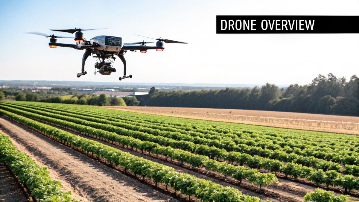
To really get how precision agriculture with drones works, you need to look past the drone itself. What you’re actually dealing with is a complete ecosystem—a combination of hardware, sophisticated sensors, and smart software all working in concert. It’s less like buying a single tool and more like getting a complete diagnostic kit for your entire farm.
The drone is the foundation, of course. In agriculture, two main types get the job done, and each has its own strengths. Picking the right hardware is a critical first step, and a good look at the best agriculture drones for precision farming is a great place to start your research.
- Multi-Rotor Drones: Think of these as the agile workhorses. With four, six, or even eight propellers, they can hover in place, take off and land straight up and down, and fly low to the ground. This makes them perfect for detailed inspections, spot-spraying a specific problem area, or getting super high-resolution images of smaller or awkwardly shaped fields.
- Fixed-Wing Drones: These are the marathon runners of the sky. They look more like small airplanes and give up the ability to hover for incredible speed and endurance. A single flight can easily cover hundreds—sometimes thousands—of acres, making them the go-to choice for mapping massive properties quickly.
The Drone’s Superpowered Senses
What really makes an agricultural drone special are the sensors it carries. These are the “eyes” that see the world in ways we can’t, picking up on subtle signs of crop stress, irrigation problems, or changes in soil that are invisible to the naked eye. Each sensor gives you a different layer of information, like looking at your field through a set of superpower goggles.
Here are the most common types:
- Multispectral Sensors: This is your on-demand plant health doctor. It captures light from specific bands that we can’t see, like near-infrared (NIR) and red-edge. Healthy plants are great at reflecting NIR light. By analyzing these reflections, the sensor creates detailed health maps that can show you stressed vegetation long before the leaves ever start to turn yellow.
- Thermal Sensors: Just like a thermometer, these sensors measure temperature differences across your field. They can instantly spot irrigation issues by showing where the ground is too hot (a sign of dryness) or unusually cool (often meaning it’s waterlogged). This helps you fine-tune your watering schedules for maximum efficiency.
- LiDAR Sensors: LiDAR stands for Light Detection and Ranging, and it’s all about building a hyper-accurate 3D map of your land. It works by shooting out laser pulses and measuring how long they take to bounce back. The result is a precise model of the terrain, plant height, and even canopy density—invaluable data for planning drainage, tracking growth, and estimating biomass.
The Brains of the Operation
The final piece of the puzzle is the software. It’s the central nervous system that connects the drone and its sensors, translating all that raw data into a simple, readable map that actually helps you make decisions. Without it, you’d just have thousands of pictures and a spreadsheet full of numbers.
The real value isn’t in the thousands of pictures a drone takes; it’s in the single, clear map that tells you exactly where to act. This is where flight planning, data processing, and analysis come together.
First, flight planning software lets you automate the drone’s flight path. This ensures you get consistent, repeatable data every single time you fly. Once the drone lands, photogrammetry software takes over, stitching the thousands of individual images into a single, high-resolution map of your field.
To get the most precise maps possible, it’s crucial to understand positioning technology; learning more about https://evolutionflight.com/ppk-ppp-solutions/ can show you how centimeter-level accuracy is achieved. Finally, analytics platforms interpret this map, generating the color-coded health reports and prescription files that empower you to act with total confidence.
Turning Drone Data into Actionable Field Strategy
Raw data from a drone is a bit like a pile of puzzle pieces. You have thousands of individual images, but the real value only emerges when you put them together to see the big picture. The genius of precision agriculture with drones is in this very process: transforming aerial snapshots into a clear, farm-level strategy that saves money and boosts crop health.
The journey from a drone flight to an in-field action isn’t instantaneous, but it follows a logical path. It all starts with planning on the ground and ends with a precise “prescription” that guides your farm equipment. Think of it as translating the drone’s bird’s-eye view into instructions your machinery can understand.
This workflow shows how a planned flight turns into analysis and, ultimately, actionable insights.
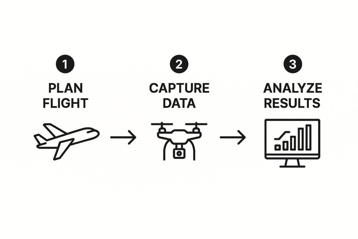
Each stage builds on the one before it, ensuring the final output is both accurate and genuinely useful for making management decisions on the ground.
Step 1: Mission Planning and Data Capture
A successful drone survey starts long before takeoff. Using specialized software, you map out an automated flight path for the drone, much like plugging a destination into your car’s GPS. This plan guarantees the drone captures the entire field with consistent image overlap—often 70% or more—which is critical for the next step.
Once launched, the drone flies this pre-programmed “lawnmower” pattern, snapping thousands of high-resolution images. Every photo is geotagged with precise GPS coordinates, creating a detailed digital record of your field at that exact moment. For very large operations, the technology behind long-range commercial UAV surveying shows how this is accomplished over massive areas.
Step 2: Image Stitching and Orthomosaic Creation
With the drone back on the ground, the real work begins. The next task is to make sense of all those individual photos. This is where photogrammetry software comes into play. It acts like a digital quilter, stitching the thousands of overlapping images into one seamless, high-resolution map of your field.
This finished product is called an orthomosaic. Unlike a standard satellite photo, it’s geometrically corrected, which means any distance or area you measure on the map is accurate. It’s essentially a true-to-scale digital twin of your field, giving you the perfect canvas for analysis.
The orthomosaic is the foundation upon which all other insights are built. It transforms a chaotic collection of pictures into a coherent and measurable digital asset.
This single, unified map lets you zoom in on tiny details, measure problem spots, and get a clear, top-down view of your entire operation.
Step 3: Analysis and Insight Generation
This is where the magic really happens. With the orthomosaic complete, specialized software goes to work analyzing the data, especially from multispectral sensors that see light invisible to the human eye. This process generates color-coded health maps that make problem areas jump right off the screen.
The most common of these is the Normalized Difference Vegetation Index (NDVI) map, but it’s not the only tool in the box. Different indices reveal different stories about your crop’s health:
- NDVI: This is the workhorse. It compares near-infrared light (which healthy plants reflect) with red light (which they absorb) to give a general assessment of plant vigor. Green zones mean healthy growth, while yellow and red highlight plant stress.
- NDRE: This index uses the “red-edge” light spectrum, which is highly sensitive to chlorophyll content. It’s fantastic for spotting subtle nitrogen deficiencies in crops with a dense canopy, often catching issues earlier than NDVI.
- OSAVI: This one is optimized to ignore the “noise” from bare soil. That makes it incredibly useful for analyzing fields with sparse vegetation or during the early growth stages of a crop.
These maps translate complex sensor readings into a simple visual language. At a glance, you can see exactly where your attention and resources are needed most.
From Data to Decisions
The table below breaks down how raw data is systematically processed into a usable format. Each stage takes the output from the previous one and adds another layer of refinement, culminating in a practical tool for the farmer.
Drone Data Processing Stages and Outputs
| Workflow Stage | Primary Activity | Key Output |
|---|---|---|
| Data Capture | The drone flies an automated mission, capturing thousands of geotagged images with specific sensor types (RGB, multispectral). | A large collection of individual, high-resolution images with GPS data. |
| Image Stitching | Photogrammetry software aligns and stitches the images together, correcting for lens distortion and terrain. | A single, high-resolution orthomosaic map of the entire field. |
| Analysis | Agricultural software processes the orthomosaic to calculate vegetation indices like NDVI, NDRE, or OSAVI. | Color-coded health maps that visually represent crop vigor and stress. |
| Prescription | A user defines zones on the health map and assigns specific application rates for inputs like fertilizer or pesticides. | A digital prescription map (e.g., shapefile) ready for farm machinery. |
This structured process ensures that the insights are not just interesting but are directly transferable to the equipment working in the field.
Step 4: Creating and Executing Prescription Maps
The final, and most impactful, step is turning these insights into action. Using the health maps as a guide, you can create a prescription map. This is a digital file that tells your smart farm equipment exactly how much fertilizer, pesticide, or water to apply, and precisely where.
For instance, the map might instruct a variable-rate spreader to deliver a higher dose of nitrogen to the yellow, stressed zones and a much lower dose—or none at all—to the healthy green zones. This file is loaded directly into the tractor’s GPS. As the machine moves, it automatically adjusts its application rates on the fly. This targeted approach is the heart of precision agriculture, slashing waste and making every dollar you spend on inputs count.
Real-World Wins with Agricultural Drones
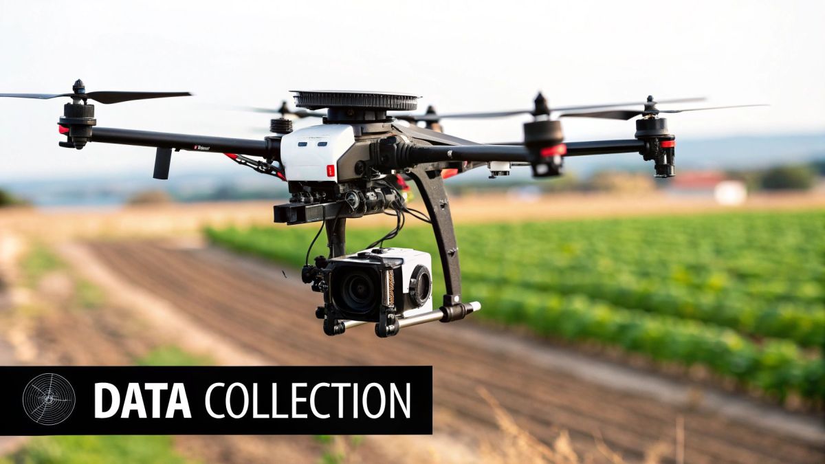
It’s one thing to talk about data and workflows, but it’s another to see how precision agriculture with drones is solving real problems on the ground. This isn’t about fancy maps for the sake of technology; it’s about giving farmers tangible solutions that boost their bottom line, reduce waste, and keep their crops healthy.
These aren’t far-off concepts. We’re talking about practical tools being used right now to spot nutrient issues, dial in irrigation, and get a reliable headcount on crops. Drones give farmers a bird’s-eye view with a level of detail that lets them act fast and with incredible accuracy.
Pinpointing Problems Before They’re Visible
One of the most powerful things a drone can do is spot plant stress weeks before it shows up to the naked eye. By flying a field with a multispectral sensor, a drone creates an NDVI map that acts as an early warning system.
Think of it like a health X-ray for your crops. The map highlights subtle changes in how plants reflect light—a direct signal that something is wrong, whether it’s a nutrient deficiency, a pest problem, or the start of a disease. You might look out and see a uniform sea of green, but the NDVI map can show a specific patch that’s already in trouble.
Catching problems this early is a total game-changer. Instead of reacting to a widespread issue, you can make a targeted strike, like applying a specific nutrient mix only to the struggling area. This keeps a small problem from blowing up and protects your final yield.
Intelligent Irrigation and Water Management
Water is gold for any farmer, and managing it well is non-negotiable, especially in dry regions. When you put a thermal camera on a drone, you get an incredibly detailed picture of how water is actually behaving across your fields.
Thermal imagery shows temperature differences on the ground. Hot spots are a dead giveaway for dry, underwatered soil, while cool spots can point to a leak or waterlogging.
Armed with this data, a farmer can:
- Find Blockages: Instantly see where clogged nozzles or busted sprinklers are leaving crops thirsty.
- Fine-Tune Schedules: Water based on real soil moisture data instead of just running a fixed schedule.
- Stop Overwatering: Cut back on water waste and prevent crop damage from soaked soil, which saves both water and money.
By turning irrigation from a blunt, field-wide task into a precise, zone-by-zone strategy, drones make sure every drop of water counts.
This kind of detail makes irrigation vastly more efficient. It’s a win for the farm’s bank account and a win for the environment.
Creating Precision Prescription Maps
All the insights from these drone-generated health maps lead to one of the most valuable tools in modern farming: the prescription map. This is basically a digital set of instructions for your smart farm equipment, telling it exactly how much fertilizer, pesticide, or other input to apply, and precisely where.
Let’s say an NDVI map shows one part of your field is thriving, but another section has a clear nitrogen deficiency. A prescription map is created to guide a variable-rate spreader. As the tractor drives, it automatically ramps up the nitrogen application over the weak zone and dials it way back—or shuts it off completely—over the healthy areas.
This targeted method, known as Variable Rate Technology (VRT), makes sure every bit of input is used where it’s needed most. It cuts out the massive waste that comes with blanket spraying, where you over-fertilize healthy plants and still don’t give struggling ones enough support. Not only does this slash your input costs, but it also drastically reduces chemical runoff into the environment.
Accurate Plant Counting and Yield Estimation
For anyone growing high-value crops, knowing your exact plant count is crucial for forecasting yield and managing logistics. Trying to count plants by hand across hundreds of acres is a nightmare, but a drone with the right AI software can knock it out with stunning accuracy.
The process is simple: a drone flies a low, slow mission, capturing high-resolution photos. These images are then fed into an analysis platform where machine learning algorithms get to work identifying and counting each individual plant. You get a precise population count in a tiny fraction of the time it would take a crew on foot.
This data is incredibly useful for a few reasons:
- Check Germination: Quickly see how well your planting went and spot areas that need to be reseeded.
- Inform Thinning: Make smart decisions about thinning crops based on actual plant density, not guesswork.
- Forecast Your Yield: A reliable plant count is a cornerstone of an accurate yield estimate, helping you plan for harvest, storage, and sales.
And the technology keeps getting better. For instance, drones using machine learning can now spot crop diseases with up to 95% accuracy. It’s advancements like these that are pushing the agriculture drone market toward a projected $23.8 billion by 2032. You can read more about the trends in the agriculture drone market and its projected growth. These applications show that drones in agriculture aren’t just a novelty; they are a practical, powerful tool for the modern farmer.
The Financial and Environmental Payoff of Drone Farming
Any new piece of farm technology faces a simple but crucial test: does it actually pay for itself? With precision agriculture with drones, the answer is a clear and convincing “yes.” The benefits show up in your bank account and in the health of your land. This isn’t about fancy gadgets; it’s about real savings and measurable results that directly improve a farm’s bottom line.
One of the most immediate gains comes from using resources more intelligently. Instead of blanketing an entire field with expensive inputs, a drone-generated prescription map lets you apply fertilizer or pesticide exactly where it’s needed—and nowhere else. This surgical approach cuts waste dramatically, often leading to cost reductions of up to 30% on these crucial supplies.
Boosting Yields and Reducing Risk
Beyond simply saving money on inputs, drones help you make more money by protecting and improving your final yield. Think of it as an early warning system. A drone equipped with a multispectral camera can spot a nutrient deficiency or a budding pest infestation weeks before you could ever see it with the naked eye.
Catching these problems early allows for a quick, targeted response before a small issue can wipe out an entire section of a field. By keeping crops healthier throughout the season, you end up with higher, more consistent yields come harvest time. It’s about turning a potential risk into a manageable task, which translates directly to more revenue.
A Lighter Footprint on the Land
The advantages of precision agriculture don’t stop at the bank. Applying inputs with such accuracy has a profoundly positive effect on the environment. By slashing the total volume of chemicals used, you drastically reduce the chances of harmful runoff contaminating nearby streams, rivers, and groundwater.
This targeted approach offers several key environmental wins:
- Reduced Chemical Runoff: Applying fewer chemicals directly protects local water ecosystems from pollution.
- Optimized Water Usage: Thermal drone imagery can pinpoint thirsty spots in a field, leading to smarter irrigation plans that conserve water.
- Improved Soil Health: Less chemical saturation helps maintain a robust soil microbiome, which is vital for long-term productivity.
The real payoff of drone farming is twofold: it makes operations more profitable while simultaneously making them more sustainable. This creates a resilient farming model that is good for business and the planet.
This dual benefit is a huge reason why drone technology is catching on so fast. For farmers curious about the equipment that makes this happen, our partners at LiDAR USA offer some of the most advanced systems available. You can find more on their high-precision LiDAR drone solutions.
Operational Gains and New Service Models
The improvements also extend to day-to-day farm operations. Drones can easily survey hard-to-reach or even hazardous areas, keeping workers safe. They also create an automatic digital record of your fields, simplifying the paperwork and compliance tasks that used to eat up so much time.
Not long ago, the upfront cost was a major hurdle, especially for smaller farms. That’s changing. The emergence of Drone-as-a-Service (DaaS) models means you can hire a professional drone crew for specific jobs, like field mapping or spraying, without needing to buy and maintain the equipment yourself.
This newfound accessibility is fueling explosive growth. The agriculture drone market is expected to jump from USD 2.55 billion to USD 9.36 billion by 2029, and flexible service models are a big part of that story. For farmers interested in making the leap, a great starting point is exploring strategies for maximizing agricultural grant opportunities. When you combine a clear ROI with better environmental practices and easier access, investing in drone farming just makes sense.
Getting Started with Drones on Your Farm
Bringing drone technology onto your farm can feel like a massive undertaking, but it doesn’t have to be. The best way to start is by forgetting about the drones for a moment and focusing on your fields. What problems are you trying to solve?
Before you even look at a single piece of equipment, walk through your biggest headaches. Is there a stubborn section of a field that always seems to have irrigation problems? Are you trying to get a better handle on pest pressure or simply want a more accurate stand count after planting? Defining these challenges first will make every other decision down the line much clearer.
Buy or Hire a Drone Service
With your goals defined, you’ll hit your first major decision: should you buy your own drone setup or hire a professional service to do the flying for you? There’s no single right answer here; it really comes down to your farm’s specific needs, budget, and how hands-on you want to be.
- Buying Your Own Drone: This path gives you ultimate control and flexibility. You can fly whenever and wherever you need to, collecting data on your own schedule. The trade-off is the upfront cost for the drone, sensors, and software, not to mention the time you’ll need to invest in learning to fly safely and manage the data.
- Hiring a Drone Service Provider: For a lot of growers, this is the perfect way to dip a toe in the water. You get the benefit of high-end equipment and professional data analysis without the steep learning curve or capital investment. The downside is that you’re on their schedule, and the per-service costs can add up over a season.
Many farmers find that starting with a service provider is a great trial run. It lets you see the real-world value on your own land, which makes it much easier to justify buying your own gear later on.
Navigating the Regulatory Landscape
Once you start flying a drone for your farm, you’re no longer just a hobbyist. This is a commercial operation, and that means following the rules. In the United States, the Federal Aviation Administration (FAA) is in charge. To fly legally, you’ll generally need to register your drone and get a Part 107 certificate—the FAA’s remote pilot license.
Understanding and following aviation rules isn’t optional—it’s the law. These regulations exist to keep everyone safe, both in the air and on the ground.
These rules cover the basics of safe flying, like staying below a certain altitude, only flying during the day, and always keeping the drone within your line of sight. It might sound like a lot of red tape, but the certification process is straightforward and ensures you know how to operate your equipment responsibly.
Choosing the Right Hardware and Software
If you’ve decided to buy your own drone, the problems you identified at the very beginning will be your guide. For instance, if your goal is to monitor crop health and create variable-rate fertilizer maps, you’ll absolutely need a multispectral sensor. If spotting irrigation leaks is the top priority, then a thermal camera is the tool for the job.
The software you choose is just as important as the drone itself. You’ll need an app for planning your automated flights, a program to stitch the thousands of images into a coherent map (like an NDVI map), and finally, software that can analyze that map and create a prescription file your tractor’s controller can understand. The good news is that many platforms, like DroneDeploy or Pix4D, now bundle these functions together, making the entire process much more connected.
Common Questions About Drones in Agriculture
When farmers first start exploring precision agriculture, they usually have a lot of practical questions. Let’s walk through some of the most common ones that come up.
How Much Ground Can a Drone Actually Cover?
That really comes down to the type of drone you’re flying. For smaller, more detailed jobs, a multi-rotor drone is your go-to tool. Think of it as your field scout—it can comfortably cover 50 to 100 acres in one flight, perfect for getting a close look at specific problem areas or smaller fields.
But if you’re working with massive properties, you’ll want a fixed-wing drone. These are the long-distance runners, built for endurance. They can map several hundred, and sometimes even over a thousand, acres in a single mission.
When Is the Best Time of Day to Fly?
For the most reliable data, you want consistent lighting. The best time is right around solar noon when the sun is directly overhead. This gets rid of long shadows that can skew your imagery and make it harder to analyze crop health accurately.
Another great option is flying on a day with uniform cloud cover. The overcast sky acts like a giant softbox, diffusing the sunlight and giving you even, shadow-free illumination across the entire field.
The key is consistency. You want to capture data you can compare week after week, season after season. Sticking to similar lighting conditions—either bright and direct or fully overcast—is what allows you to build trustworthy crop health maps over time.
Do I Need an Internet Connection Out in the Field?
Surprisingly, no. You don’t need to be online to get the work done. Many of the best data processing platforms, like Pix4Dfields, are built to work completely offline.
This means you can fly your drone, then plug the SD card into a laptop right there in your truck and process the images into a usable health map. The only time you’ll need an internet connection is later, when you’re ready to upload that finished prescription map to a cloud platform like the John Deere Operations Center.
Ready to see how a drone solution built for your farm can make a real difference? The experts at Innoflight Technology design and build advanced unmanned aerial systems to meet the precise needs of modern agriculture. Explore our custom agricultural drone platforms and request a quote today.