Imagine having a tireless expert who can survey every corner of your property daily, spotting problems the human eye would simply miss. That’s the new reality with Unmanned Aerial Vehicles (UAVs), which are quickly becoming as essential as tractors for modern Australian farms. They’re the key to unlocking data-driven, precision farming.
How UAVs Are Reshaping Australian Farming
The classic image of Australian farming—vast paddocks managed by hard yakka and a good dose of intuition—is getting a serious update. These days, a farmer's most powerful tool might not be a tractor, but a sophisticated drone flying hundreds of feet overhead.
These "eyes in the sky" are the heart of precision agriculture. This is a whole philosophy that shifts away from broad, one-size-fits-all treatments and towards targeted, evidence-based actions.
Instead of treating an entire paddock the same way, UAVs give you the detailed intelligence needed to act with almost surgical precision. This is a massive advantage in Australia's diverse and often challenging environment, where every drop of water counts and input costs are always on your mind. By gathering granular data on crop health, soil conditions, and water levels, farmers can make smarter decisions that boost yields and save money.
From Broad Strokes to Fine Details
Think of old-school farming like painting a wall with a big roller. You cover the whole surface, even the bits that don't need it. A UAV, on the other hand, is like a fine-tipped brush, letting you apply resources exactly where they’re needed most.
This targeted approach means you're not just farming better; you're farming smarter. By identifying specific areas of a paddock that are under stress, you can apply fertiliser, water, or pesticides only to those zones, drastically cutting waste and environmental impact.
This level of detail was once unimaginable. Now, farmers can use drone data to create variable-rate application maps for their machinery, making sure every square metre of their property is managed for maximum productivity. It turns guesswork into a science.
The Core Benefits for Australian Farms
Bringing UAVs onto the farm delivers a clear set of advantages that tackle the real-world challenges of modern agriculture head-on. The benefits go well beyond simple cost savings and touch every part of the operation.
Here's where you'll really see the difference:
- Enhanced Crop Monitoring: Drones with multispectral sensors can spot plant stress, disease, or nutrient deficiencies long before you could see them with your own eyes. This early warning lets you act fast, saving crops that might otherwise be lost.
- Optimised Input Use: By pinpointing exactly where water, fertilisers, and pesticides are needed, you can slash your input costs. In fact, some studies have shown that targeted drone spraying can reduce chemical use by up to 90%.
- Improved Yields and Quality: It's simple, really. Healthier, more consistently managed crops lead to higher yields and better-quality produce. Data-driven decisions ensure your plants get what they need, right when they need it.
- Increased Operational Efficiency: A drone can scout hundreds of hectares in the time it would take you to cover a fraction of that on a quad bike. This frees up your time—and your team's time—for other critical jobs around the farm.
Navigating Drone Rules for Australian Farms
Putting a drone to work on your farm isn’t as simple as just getting it in the air. You're operating in Australian airspace, which means you need to fly safely and legally. The Civil Aviation Safety Authority (CASA) sets the rules, and for any farmer looking into uav agriculture australia, getting your head around them is the first, most important job.
These rules aren't a one-size-fits-all deal. They shift depending on how heavy your drone is and what you plan to do with it. This is a critical distinction, as it dictates everything from registration and licensing to your day-to-day operational duties. Nail this from the start, and you’ll save yourself a world of trouble later on.
Before you even think about your first flight, remember that your farm is a workplace. That means all the usual Work Health and Safety (WHS) obligations apply. Getting a handle on understanding the Australian WHS framework ensures your drone program is not just compliant with aviation law, but fits neatly into your farm's existing safety systems.
Understanding Drone Weight Categories
CASA groups drones by their take-off weight, and this directly shapes the rules you need to follow. For ag work, this matters a lot. A drone used for simple crop scouting is a featherweight compared to the heavy-lifters needed for spraying.
Here’s a quick rundown of how it works:
- Sub-250g (Very Small): These little guys have the most relaxed rules. You still need to register them, but you generally won't need a pilot's licence for basic jobs on your own land.
- 250g to 2kg (Small): This is the sweet spot for many popular mapping and scouting drones. Registration is a must, and while some commercial work can be done without a full licence, specific operational rules kick in.
- 2kg to 25kg (Medium): Now we're talking. Most agricultural spraying drones fall right into this category. To fly these, you'll almost certainly need a Remote Pilot Licence (RePL).
- Over 25kg (Large): For the big jobs like large-scale spraying or seeding, you'll be using one of these. They require the highest level of certification, including a Remote Pilot Licence (RePL) and often an RPA Operator’s Certificate (ReOC) for the business itself.
This flowchart shows how drones fit into the broader farm data picture, helping you gather crucial intel from crop health to water and soil conditions.
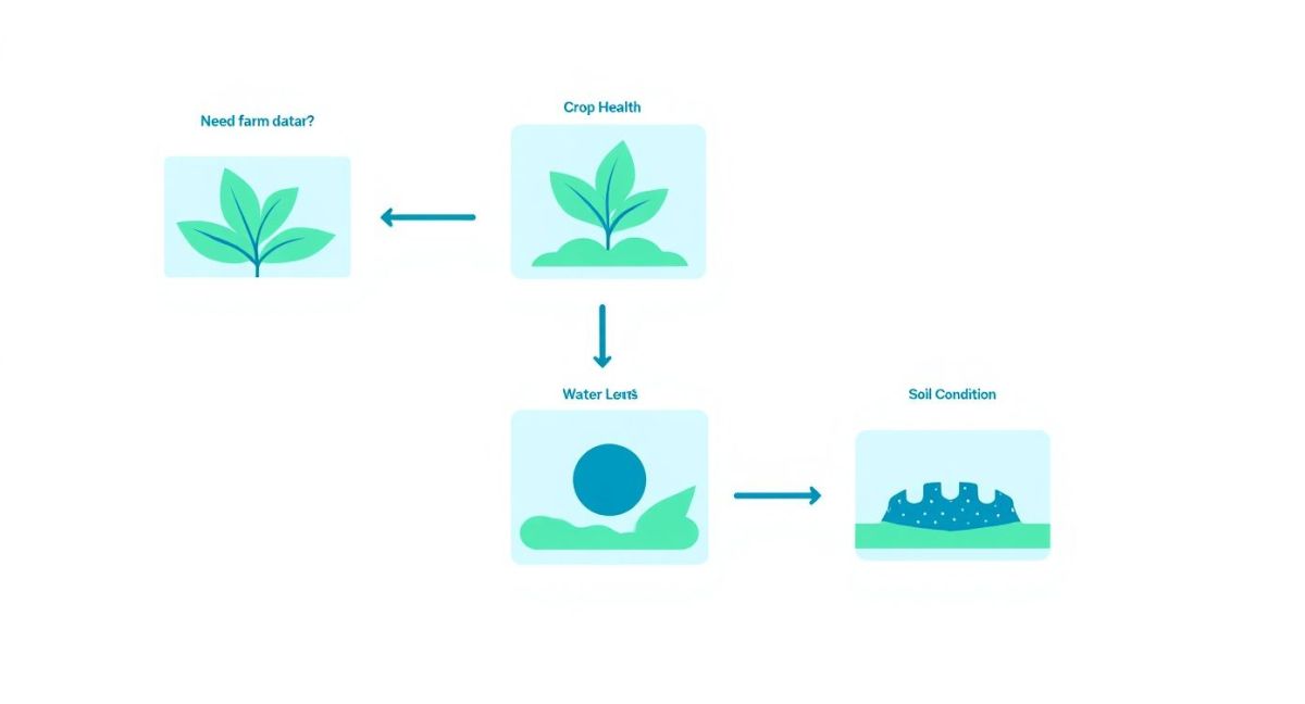
As you can see, the kind of data you need to collect really drives the type of monitoring you'll do, which in turn influences your choice of drone, sensors, and flight plans.
Licence to Fly: Registration vs RePL and ReOC
It's easy to get registration and licensing mixed up, but they're two different things. A good way to think about it is like your farm ute: registration is the number plate, while the RePL is your driver's licence.
Registration: Every single drone flown for business purposes in Australia, no matter its size, must be registered with CASA. It's a fairly simple online process that officially links the drone to you or your business.
Licensing, on the other hand, is all about proving you have the skills and knowledge to fly safely.
- Remote Pilot Licence (RePL): This is your personal ticket to fly. If you want to operate drones over 2kg for commercial gain, you need one. It involves both theory and hands-on training to make sure you know the rules of the sky, how to read the weather, and what to do when things go wrong.
- RPA Operator’s Certificate (ReOC): This is a certification for your business, not you as an individual. If you're running a more complex operation—think multiple pilots, drones over 25kg, or flying in restricted areas—you'll likely need a ReOC. It’s an organisational approval that documents all your safety procedures and operational plans.
For any serious agricultural work, like using a DJI Agras sprayer, a RePL is the absolute minimum. It’s a worthwhile investment that proves you're a professional who's serious about operating within the law—protecting your farm, your people, and your neighbours. And remember, these regulations can and do change, so always check the latest guidelines on the CASA website.
Choosing the Right Drone Tools for the Job
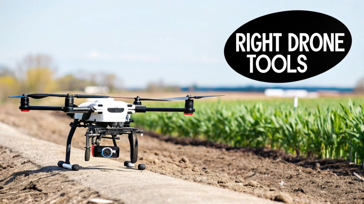
A drone on its own is just a fancy flying machine. It’s the payload—the specialised sensor or tool it carries—that turns it into a genuine agricultural asset. This is where the real work gets done, transforming your drone from a simple vehicle into something that can see, measure, and even act on your behalf.
Choosing the right payload is all about matching the tool to the task. You don't need the most expensive or complicated gadget; you need the one that delivers the exact information required to make smarter decisions on the farm. For anyone looking into uav agriculture in Australia, getting your head around these tools is the first critical step.
Think of it like picking from a toolbox. You wouldn't use a sledgehammer to tighten a tiny bolt. The same logic applies here. The payload defines what your drone can actually do, whether that's scouting crops, checking on livestock, or mapping your terrain with mind-boggling precision.
Seeing Beyond What the Eye Can See
The human eye is incredible, but it's blind to a massive chunk of the light spectrum. The problem is, many early signs of crop stress—like a nutrient deficiency or the start of a fungal outbreak—show up in that invisible spectrum long before we can see them. This is where specialised sensors give you a kind of agricultural superpower.
Common sensor types include:
- RGB Cameras (Standard Visual): These are essentially high-quality digital cameras, just like the one in your phone, but better. They’re perfect for getting a clear bird's-eye view, assessing storm damage, doing plant counts, or creating detailed visual maps of your property.
- Multispectral Sensors: This is where the magic really starts. These sensors capture light in specific, narrow bands, especially in the near-infrared (NIR) range that we can’t see. Healthy, thriving plants reflect a huge amount of NIR light, while stressed or unhealthy plants absorb it.
- Thermal Sensors: These gadgets measure heat signatures. They’re brilliant for checking livestock body temperatures from a distance, spotting irrigation leaks (where the ground is suddenly cooler), or even seeing if a piece of machinery is overheating.
By processing the information from a multispectral sensor, you can generate powerful health maps like the Normalised Difference Vegetation Index (NDVI). An NDVI map uses simple colour-coding—often red for stressed areas and green for healthy growth—to turn complicated data into a visual map you can act on immediately.
Matching Drone Payloads to Common Farming Tasks
To make sense of it all, here's a quick guide to help you match the right drone payload to specific jobs around the farm.
| Farming Task | Recommended Payload | Primary Benefit |
|---|---|---|
| Crop Health Monitoring | Multispectral Sensor | Detects early signs of stress, disease, or nutrient issues before they're visible to the naked eye. |
| Variable Rate Application | Multispectral Sensor | Creates precise prescription maps (e.g., NDVI) to guide targeted fertiliser or pesticide application. |
| Livestock Mustering & Health | Thermal Sensor & RGB Camera | Quickly locates stock in large paddocks and can identify animals with elevated body temperatures. |
| Weed Mapping | High-Resolution RGB Camera | Identifies and maps weed infestations with high accuracy for targeted spot-spraying. |
| Irrigation & Water Management | Thermal Sensor | Pinpoints leaks in irrigation lines and identifies areas of water stress or waterlogging. |
| Land Surveying & Earthworks | LiDAR Sensor | Generates highly accurate 3D elevation models for planning drainage, dams, or land levelling. |
| Targeted Spraying | Spraying Drone Payload | Applies chemicals directly to problem areas, drastically reducing input costs and environmental impact. |
| Pasture Seeding | Spreading Drone Payload | Broadcasts seeds over difficult-to-access terrain or for regenerating specific pasture zones. |
This table is a starting point. The real value comes from thinking about your biggest challenges and finding the tool that provides the best solution.
Creating a 'Digital Twin' of Your Farm
Beyond just looking at crops, some payloads are built to measure the physical world with incredible accuracy. They let you build a perfect three-dimensional model of your property—a "digital twin"—which is a massive help for planning and managing farm infrastructure.
LiDAR, which stands for Light Detection and Ranging, is a game-changer for this. It works by shooting thousands of laser pulses at the ground every second and measuring how long they take to bounce back. The result is a hyper-detailed 3D point cloud of your terrain, buildings, and even individual trees.
This technology is perfect for:
- Topographic Mapping: Creating precise elevation maps to plan out irrigation channels, drainage systems, and land-levelling projects.
- Canopy Penetration: Unlike a camera, LiDAR can "see" through vegetation to map the ground beneath it, which is ideal for assessing erosion risk or planning earthworks in timbered country.
- Volumetric Calculations: Need to know exactly how much grain is in a stockpile or how much water your dam can hold? LiDAR can measure volumes with stunning accuracy.
From Collecting Data to Taking Direct Action
The most recent agricultural drones don't just gather information—they do something with it. These heavy-lifters are designed to turn the insights you get from sensor data into immediate, practical action out in the paddock.
The two main types are:
- Spraying Drones: Kitted out with large tanks and sophisticated nozzle systems, these drones can apply pesticides, herbicides, or liquid fertilisers with surgical precision. This targeted approach can slash chemical use, in some cases by up to 90%, saving money and reducing environmental impact.
- Spreading Drones: These are fitted with hoppers designed to distribute granular products like seeds or solid fertiliser. They're perfect for reseeding pastures in steep or hard-to-reach gullies or for applying specific nutrients exactly where your soil maps say they're needed.
Ultimately, a successful drone program comes down to matching the right tool to your farm’s unique challenges. Whether you're managing broadacre crops in WA or a vineyard in the Barossa, the right payload will deliver the intelligence and capability you need to move forward.
Turning Drone Data Into Actionable Farm Insights
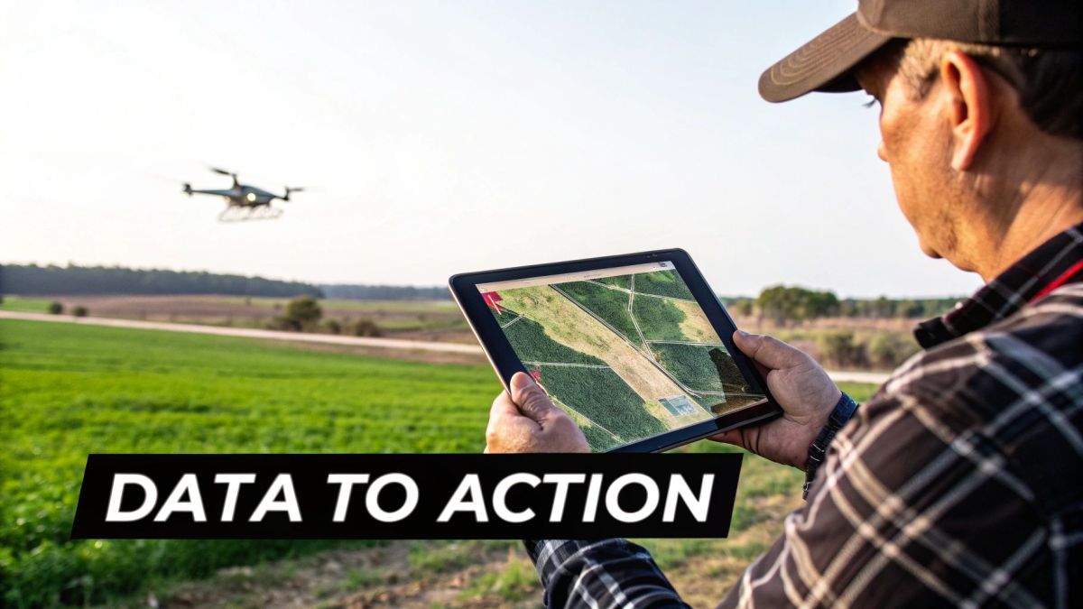
Collecting thousands of high-resolution images is just the beginning. The real value of using a drone in agriculture isn't in the data itself, but in how you turn that raw information into profitable decisions out in the paddock. A folder full of unprocessed images is like a pile of bricks without a blueprint—the potential is there, but you can’t build a house with it yet.
This entire process, from launching the UAV to making a real change in your management plan, is what we call the data workflow. A smooth, efficient workflow is what separates a novel piece of tech from a truly indispensable farm management tool.
The workflow follows a logical path: planning the mission, capturing the data, processing it into usable maps, and finally, analysing the results to find insights that can drive action. Each step builds on the last, creating a powerful feedback loop that helps refine your farming practices over time.
Step 1: Automating Data Capture with Flight Planning
Consistency is everything when you're gathering agricultural data. You need to be able to compare apples with apples, season after season. This is where flight planning software becomes essential, as it takes human error out of the equation and ensures every survey is repeatable and reliable.
Think of it like setting up a centre pivot irrigator. You don't drive it by hand each time; you program a path, and it executes it perfectly. Flight planning software does the exact same thing for your drone.
You simply outline the paddock you want to survey on a map, set parameters like flight altitude and image overlap, and the software automatically generates an optimal flight path. The drone then flies this mission autonomously, snapping photos at precise intervals to guarantee complete coverage. This automated approach ensures the data is captured the same way, every single time, which is critical for accurate year-on-year analysis.
Step 2: Processing Images into a Usable Map
Once the drone lands, you'll have a memory card loaded with hundreds or even thousands of individual photos. The next step is to use specialised software to stitch these images together into a single, seamless, high-resolution map of your farm. This process, called photogrammetry, is a bit heavy on computer processing power but it's where the real magic happens.
The software analyses each photo, identifies common points between them, and pieces them together like a highly detailed digital jigsaw puzzle. The final output is an orthomosaic map—a geographically accurate, top-down view of your property that you can zoom into and analyse with incredible detail.
An orthomosaic map is more than just a pretty picture; it's a foundational data layer. From this single map, you can create elevation models, measure distances and areas, and, most importantly, generate specialised vegetation health indices.
Step 3: Analysing the Data and Creating Prescriptions
This is where all that data gets turned into actual intelligence. By analysing the orthomosaic map, particularly one created from multispectral imagery, you can generate powerful analytical tools like an NDVI (Normalised Difference Vegetation Index) map. These maps use simple colour coding to give you an instant, intuitive snapshot of crop health across an entire paddock.
- Green areas usually point to healthy, vigorous plant growth.
- Yellow and orange areas show moderate stress, flagging potential problems that need a closer look.
- Red areas highlight significant stress, disease, or bare patches requiring immediate attention.
From these visualisations, you can take direct action. For example, if a certain section of a field shows up red on an NDVI map, you can head straight to that spot to conduct targeted soil tests rather than taking random samples across the whole paddock.
The most powerful outcome, though, is creating variable-rate prescription maps. These maps translate the health data from your drone survey into a language your tractor's GPS controller can understand. The map tells your spreader or sprayer to apply more fertiliser in the underperforming red zones and less—or none at all—in the healthy green zones. This targeted approach is the essence of precision agriculture, saving a huge amount on inputs and reducing your environmental footprint.
Agricultural drones are genuinely changing how we farm in Australia, boosting both productivity and sustainability. For example, some wheat farms in New South Wales have reported a 15% increase in yield while also seeing a 20% reduction in operational costs thanks to drone-assisted crop monitoring and fertiliser application. To see more examples, you can explore the benefits of agricultural drones in Australia. This really shows how a well-executed data workflow for UAV agriculture in Australia leads to tangible, bottom-line results.
Does a Drone Really Pay for Itself? Working Out the ROI
Let’s be honest, any new bit of gear on the farm has to earn its keep. The technology is impressive, but the real question is simple: will a drone make or save you more money than it costs? Figuring out the return on investment (ROI) for a drone program isn't about guesswork; it's about sitting down and doing the sums to build a solid business case.
This means taking a hard look at both sides of the coin. You need to account for all the upfront and ongoing costs, then stack them up against the real-world financial benefits you can expect. For many Aussie farms, the numbers are compelling, proving that a drone is much more than a gadget—it's a serious production tool.
The market growth tells a powerful story. The Australian agriculture drone market hit an estimated USD 54.1 million in 2024 and is expected to climb to nearly USD 499 million by 2033. That kind of rapid growth doesn't happen by accident; it's fuelled by genuine financial returns as more farms embrace precision agriculture. Discover more about the Australian ag-drone market trends.
Tallying Up the Initial and Ongoing Costs
Before you can see the returns, you need a clear picture of what you're spending. The price tag on the drone itself is just the beginning. A proper cost breakdown needs to include everything required to get your program up and running—and keep it that way.
Be sure to factor in these key costs:
- Hardware: This is the drone itself, plus all the necessary batteries, controllers, and specialised payloads like multispectral sensors or LiDAR scanners.
- Software: You’ll likely have ongoing subscriptions for flight planning, data processing (photogrammetry), and platforms that help you make sense of the data.
- Training and Licensing: Don't forget the cost of getting a Remote Pilot Licence (RePL) for yourself or your team.
- Maintenance and Insurance: Like any piece of machinery, drones need upkeep, eventual repairs, and proper public liability insurance.
By listing every potential expense from the get-go, you create a realistic baseline for your investment. This simple step helps avoid nasty surprises down the track and ensures your ROI calculation is built on facts, not just hope.
Pinpointing Where Drones Actually Save You Money
Once you have your costs sorted, it’s time for the exciting part: identifying and putting a number on the financial benefits. This is where a drone program stops being an expense and starts becoming a profit driver. The savings usually come from doing more with less and making smarter, data-backed decisions.
The financial gains typically fall into three main buckets:
- Slashing Input Costs: This is often the most immediate and easy-to-measure return. Using drone data to create variable-rate maps means you're putting fertiliser, pesticides, and herbicides exactly where they’re needed, and nowhere else. For some Australian farms, this precision has led to chemical savings of up to 90%.
- Boosting Yield and Crop Quality: Spotting problems early is the name of the game. Drones can pick up on issues like nutrient deficiencies, irrigation leaks, or pest hotspots weeks before they're visible to the naked eye. Tackling these issues sooner prevents yield loss and improves the quality and consistency of your crop at harvest.
- Cutting Labour and Operational Costs: A single drone can scout hundreds of hectares in a morning, a job that could take a person days on a quad bike or in a ute. This saves a huge amount of time and wages, not to mention fuel and vehicle wear-and-tear, freeing up your team to focus on other critical tasks.
By putting real figures against these benefits—like calculating fertiliser savings per hectare or estimating the dollar value of a 5-10% yield bump—you can build a powerful financial argument for the investment. When the tangible gains clearly outweigh the total costs, bringing drone technology onto your farm becomes a smart, profitable business move.
Your Practical Checklist for Buying a Farm UAV
Jumping into the world of agricultural drones is a big step. To make sure you’re sinking your money into a tool that will actually deliver value, it pays to have a plan. A good checklist helps you see past the sales pitch and focus on what your operation genuinely needs.
Think of these points as a guide to your decision-making process. The right drone should feel like a natural extension of your farm, not a complicated piece of tech that sits in the shed gathering dust.
Core Operational Requirements
First things first: what do you actually need this drone to do? Nailing down the core jobs is the most important step. Get this right, and the rest tends to fall into line.
-
Farm Size and Flight Time: How much ground do you need to cover in a day? This simple question dictates the drone's required flight time and how many spare batteries you’ll need on hand. A drone with a 30-minute flight time might be a champion for a small vineyard but will barely make a dent in a large broadacre operation.
-
Crop Type and Payload: The job defines the tool. If you’re mapping wheat paddocks to generate an NDVI map, a multispectral sensor is non-negotiable. On the other hand, if you’re looking at spot spraying in a dense orchard, you’ll need a heavy-lift drone with top-notch obstacle avoidance.
Compliance and Integration
Next, you need to make sure the drone and its software play by Australia’s rules and work with the systems you already have. The last thing you want is an expensive paperweight because of a simple compatibility oversight.
A key financial decision is whether to lease or purchase the drone outright. Taking the time to understand the differences between leasing vs. buying equipment can have a big impact on your cash flow and overall farm budget.
Make sure any drone you're considering is fully compliant with CASA regulations for its weight and how you plan to use it. Don't be shy about asking suppliers to spell out the specific licensing (like a RePL or ReOC) and registration needed for the model.
You also need to check if the software talks to your other systems. The drone's data needs to slide effortlessly into your existing farm management software (FMS). If it doesn't, you’re just signing yourself up for a whole lot of data-wrangling headaches.
Supplier Support and Training
Finally, remember that you’re not just buying a piece of hardware; you’re starting a relationship with the supplier. For any serious ag operation, having solid local support is absolutely essential.
Before you sign on the dotted line, ask some direct questions:
- Where is your support team actually based?
- What, exactly, does your warranty cover?
- Do you provide proper hands-on training for our team?
- How do we get local repairs and spare parts when we need them?
Choosing a supplier with a strong, Australia-based support and training network is the best way to minimise downtime and ensure you’re getting the most from your investment for years to come.
Got Questions About Ag Drones? Here Are Some Straight Answers
Getting into agricultural drones can feel like a big leap, and it's natural to have a few questions before you dive in. We get asked a lot about the practical side of using drones on Australian farms, so we've put together some clear answers to the most common queries.
What Kind of CASA Licence Do I Actually Need?
This is a big one. The licence you'll need really boils down to the weight of your drone and what you plan to do with it.
Let's break it down simply:
- Scouting & Mapping (under 2kg): If you're just doing some basic crop scouting on your own land with a smaller drone, you might not need a full pilot licence. However, you absolutely must register the drone with CASA. No exceptions.
- Spraying & Spreading (over 2kg): The moment you start talking about heavier ag drones—the ones designed for spraying or spreading—you're in licenced territory. You will personally need a Remote Pilot Licence (RePL). Think of it as your drone driver's licence; it proves you've got the skills to fly safely.
- Bigger Operations: If you're looking at running a team, flying multiple drones, or using the really big UAVs (over 25kg), your business will likely need an RPA Operator’s Certificate (ReOC) on top of the individual pilot licences.
How Long Can an Ag Drone Realistically Stay in the Air?
This is where expectations meet reality. Flight time isn't a single number; it's a constant balancing act between the drone's size, battery, and what it's carrying.
A lightweight mapping drone can often stay up for 30 to 45 minutes on a single battery, which is great for covering decent ground. But a heavy-lift spraying drone lugging a full 40-litre tank is a different beast altogether—you'll be lucky to get 10 to 15 minutes out of it.
That might not sound like much, but professional operators have this down to a fine art. They always have a stack of charged batteries and a fast-charging station on the back of the ute, letting them "hot-swap" batteries and keep the drone working with minimal downtime.
Can I Fly My Drone if the Weather Turns Nasty?
Modern ag drones are tough, but they're not invincible. Pushing your luck with bad weather is a surefire way to risk your gear, your data, and your safety.
- Wind: Every drone has a wind speed limit. Fly beyond it, and you're fighting a losing battle. The drone will struggle to hold its position, burn through the battery in no time, and could easily crash. For spraying, high winds also mean one thing: drift. It’s ineffective and dangerous.
- Rain: Most drones and water don't mix. Unless your drone has a specific IP (Ingress Protection) rating for water resistance, flying in the rain is asking for a catastrophic electrical failure. Always check the specs.
- Extreme Heat: That blistering Aussie sun can be just as bad as rain. On a scorching day, batteries and motors can overheat, which kills performance and can cause lasting damage. Smart operators get their flying done in the cooler parts of the day, like the early morning.
Bottom line: always check the forecast and stick to what the manufacturer recommends. It’s the best way to protect your investment.
Ready to integrate high-performance UAV solutions into your agricultural operations? Innoflight International designs and manufactures advanced drone systems tailored for Australian conditions. Discover our heavy-lift platforms and precision sensors. Get a customised quote from Evolution Flight today.