The connection between drones and business isn't some far-off idea anymore. It’s happening right now, delivering real, measurable returns for companies that are looking for a smarter way to work. Drones have become a powerful tool for gathering better data, making job sites safer, and cutting down on operational costs that were once just accepted as part of doing business.
They've officially moved beyond hobbyist toys and are now essential equipment.
How Drones Are Reshaping Business in 2026
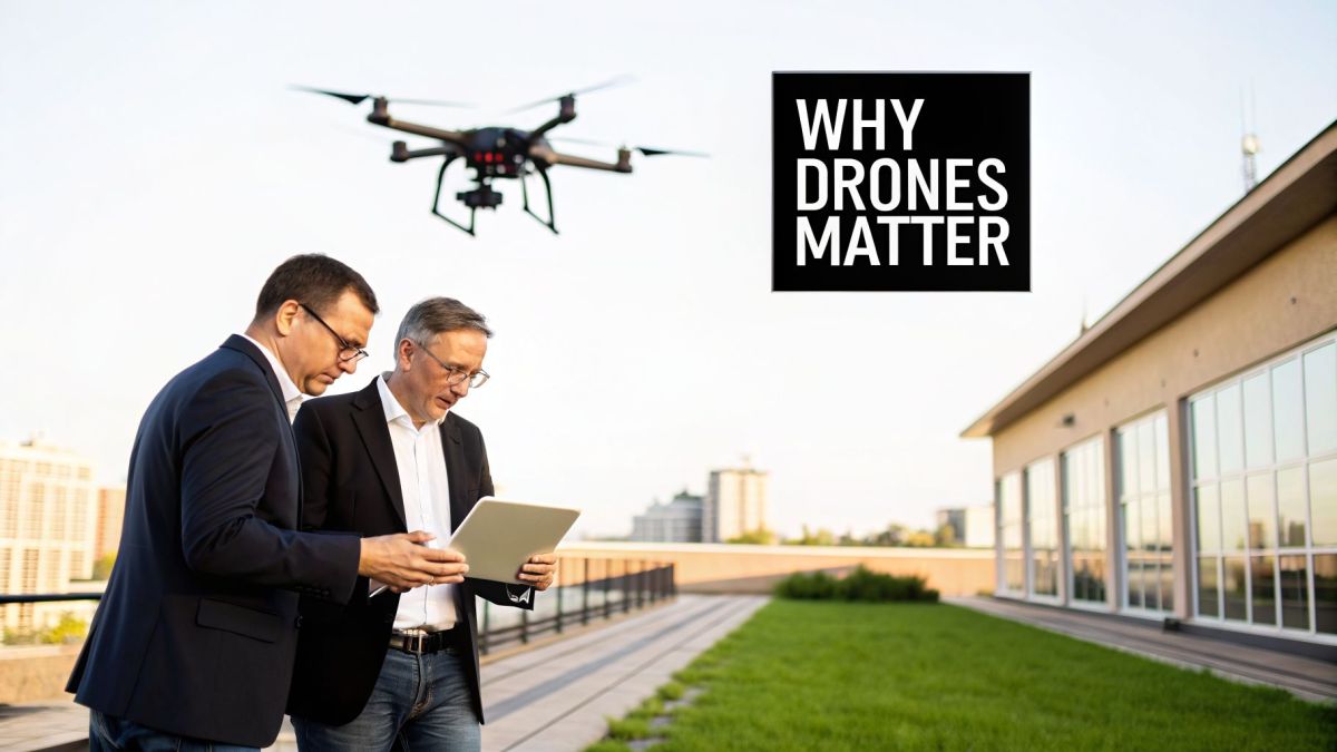
The best way to think about a drone is as a flying, intelligent sensor. For decades, major industries like energy, construction, and agriculture have had to rely on methods that were expensive, incredibly slow, and often dangerous. Think about sending crews to climb massive cell towers, walk hundreds of miles of pipeline, or manually survey sprawling mining sites. It's inefficient, and it puts people in harm's way.
This is exactly where drones come in. By putting the right sensor on a drone—whether it's a high-resolution camera, a thermal imager, or a LiDAR scanner—a company can get those same jobs done faster, more safely, and with a level of accuracy that was unimaginable before. The real value isn't just getting a picture from the sky; it's getting actionable data that leads to better, more informed decisions on the ground.
It all comes down to identifying a specific, recurring problem—a pain point—and using a drone to solve it directly. The table below shows just a few examples of how this works in practice.
Key Industrial Problems Solved by Drones
| Industry Pain Point | Drone-Enabled Solution | Business Outcome |
|---|---|---|
| Dangerous and slow cell tower inspections. | A drone with a high-resolution zoom camera inspects the tower in minutes from a safe distance. | Reduced risk to personnel, faster inspection cycles, and more accurate defect detection. |
| Inefficient stockpile volume measurement in mining. | A drone flies a pre-planned route and uses photogrammetry or LiDAR to create a 3D model. | 99% accurate volume calculations completed in hours, not days, improving inventory management. |
| Spotty and inaccurate crop health monitoring. | A drone with a multispectral sensor identifies stressed plants before they are visible to the human eye. | Increased crop yields through targeted application of water or fertilizer and reduced waste. |
As you can see, the drone isn't just a gadget; it’s a targeted solution that delivers a clear business benefit by changing how data is collected.
From Costly Problems to Data-Driven Solutions
Let's look at a common headache for any electric utility: vegetation management. An overgrown tree branch getting too close to a power line is a huge risk for fires and outages. Traditionally, utilities used ground patrols or expensive helicopter flights, both of which are slow and can easily miss developing problems. It's a constant operational drain on budgets and staff.
An industrial pain point is a specific, recurring problem that costs your business time, money, or creates safety risks. Drones excel at solving these issues by providing a new, more efficient way to collect the data needed to make better operational decisions.
This is where a heavy-lift drone like the Evolution Flight Patriot Quadcopter comes in. Its ability to carry advanced LiDAR sensors is the key. That technical capability directly translates to a business solution. The drone flies the power line corridor and builds a 3D map with millimeter accuracy, pinpointing every single spot where a tree is encroaching on the lines.
Suddenly, the utility can shift from a reactive "find-and-fix" model to a predictive, data-driven strategy. They can send crews exactly where they're needed most and prevent outages before they ever happen.
This move from manual work to aerial intelligence is catching on everywhere, fueling incredible growth. The global drone market is expected to jump from roughly US$69 billion in 2026 to US$147.8 billion by 2036. This growth isn't just hype; it shows that the link between drones and business is becoming a fundamental part of modern operations. You can find more detail on these trends in market reports from industry analysts like the Edge AI and Vision Alliance.
Solving Critical Infrastructure Challenges with Drones
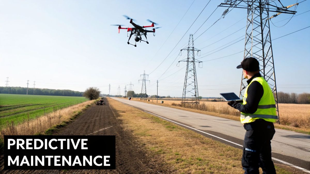
The real story of drones and business isn't about futuristic gadgets; it's about solving gritty, real-world problems. For industries that manage thousands of kilometers of infrastructure, like electric utilities, certain challenges are a constant drain on money, manpower, and peace of mind.
Take vegetation management, a never-ending headache for power companies. A single tree branch creeping too close to a high-voltage line isn't just a maintenance chore. It's a genuine threat that can spark devastating wildfires, trigger mass outages, and result in massive regulatory fines.
For decades, the tools for finding these ticking time bombs have been clumsy at best. Sending ground crews to walk or drive endless corridors is painfully slow and puts workers in treacherous terrain. Helicopter patrols are faster, sure, but they’re incredibly expensive, noisy, and from their high altitude, it’s easy to miss the smaller branches that pose a critical risk.
From Reactive Repairs to Predictive Maintenance
This is exactly where a purpose-built unmanned aerial system (UAS) changes the game. The challenge isn't merely about getting an eye in the sky; it's about collecting incredibly precise, three-dimensional data over vast distances without breaking the bank.
A platform like the Evolution Flight Patriot Quadcopter was engineered to do just that. It’s not just a drone, but a solution built around key specifications that directly address the needs of utility operators.
Heavy-Lift Capacity (Up to 10kg): This isn't for carrying parcels. This industrial pain point of needing precise 3D data is solved by this spec, which allows the drone to carry a survey-grade LiDAR (Light Detection and Ranging) scanner. The business outcome is a hyper-accurate 3D point cloud of the entire corridor, mapping the exact location of every wire, pole, and branch down to the millimeter.
Extended Flight Endurance (Up to 45 minutes): The pain point of slow, inefficient corridor inspections is solved by this long endurance. This technical spec delivers the business outcome of covering huge sections of the grid in a single flight, slashing the time and cost it takes to inspect the whole network and resulting in a much lower cost-per-kilometer.
With this combination, a utility company can completely overhaul its vegetation management strategy. Instead of reacting to outages, they can now predict risks. The LiDAR data is used to build a "digital twin" of the grid, where software automatically flags every spot where vegetation is—or soon will be—too close. This means crews are sent only where they're needed, outage risks plummet, and the entire grid becomes safer and more resilient.
This kind of tangible value is what’s fueling the industry’s explosive growth. The commercial drone market is on track to grow from USD 83.81 billion in 2025 to USD 182.45 billion by 2033, a surge driven by exactly these high-impact jobs. For power companies, LiDAR-equipped drones aren't a novelty; they’re becoming a core operational tool, with some reporting they've cut manual survey times by up to 70%. You can dig into more statistics by checking out a recent market report on the drone industry from Grand View Research.
Increasing Safety and Efficiency in Mining
The same principle—using the right tool for a dangerous and difficult job—applies perfectly to another heavy industry: mining. The biggest pain points in an open-pit mine often revolve around safely and accurately surveying the site. Measuring stockpiles, checking pit walls for signs of instability, and mapping haul roads are all vital for planning, inventory, and most importantly, safety.
Traditionally, this meant sending surveyors to walk around an active mine. They had to navigate around massive machinery and unstable ground, a slow and high-risk process that could still produce inconsistent data.
Once again, a heavy-lift drone like the Evolution Flight Patriot Quadcopter offers a clear path forward. Outfitted with a high-resolution LiDAR or photogrammetry payload, it delivers several immediate advantages for a mining operation:
Enhanced Worker Safety: The most obvious win. Surveyors stay out of the open pit, running the entire mission from a safe location. This single change dramatically reduces the risk of accidents.
Unmatched Accuracy: Instead of taking sample measurements, the drone captures a complete, high-density 3D model of the site. This allows for stockpile volume calculations with over 99% accuracy, which translates to better inventory management and more reliable financial forecasting.
Operational Speed: What once took a survey team days can now be done in a few hours. This speed allows for more frequent surveys, giving mine planners near-real-time data to make smarter, faster decisions.
Whether it’s for a utility line or a mine pit, the formula is the same. The right drone platform directly solves a costly and dangerous problem, creating a clear and measurable return on investment.
How Drones Reshape Large-Scale Mapping and Surveying
If you run a geospatial firm or work for a transportation agency, you know the drill. Big projects, like mapping a highway corridor or modeling a floodplain, always feel like a juggling act. You’re constantly forced to choose between speed, accuracy, and cost, and something always has to give.
Putting boots on the ground to survey hundreds of kilometers is painstakingly slow and incredibly expensive. We’re talking about months of work that can drag out project timelines and eat into your budget. It’s a frustrating model that limits the number of jobs you can take on and puts a tight squeeze on profit margins. This is where a serious aerial platform isn't just a nice-to-have; it completely rewrites the rules of the game.
Getting Past the Old Way of Surveying
The real challenge has always been capturing highly accurate data over huge areas without it taking forever. Drones with professional sensors are the obvious answer, but let's be honest—most off-the-shelf drones just can't handle the demands of true survey-grade mapping. You need a machine built specifically for endurance and heavy lifting.
This is exactly the gap the Evolution Flight Patriot Octocopter was built to fill. It's not about bells and whistles; its features are designed to solve the real-world headaches of large-scale surveying.
Serious Flight Time (over 60 minutes): This specification directly addresses the pain point of slow, expensive ground surveys. For your business, the outcome is the ability to cover a long stretch of highway or an entire river basin in a single flight, slashing your data collection time from weeks to just a few days.
Real Heavy-Lift Power: To solve the pain point of needing engineering-grade precision, this drone is built to carry what matters: professional, survey-grade LiDAR sensors. These heavy, high-end sensors are needed to capture millions of data points with centimeter-level precision. This delivers the business outcome of providing the high-quality data your clients demand for complex digital twins and engineering models.
When you combine that kind of flight time with true heavy-lift strength, you can start confidently bidding on bigger, more profitable projects that were simply out of reach before.
Finding New Ways to Grow Your Business
With a workhorse like the Patriot, you can do more than just complete jobs faster. You can fundamentally change what you offer your clients. When you can deliver incredibly accurate models of infrastructure and terrain in days instead of months, you're no longer just another service provider—you become an essential partner.
The real win here is the ability to open up entirely new lines of business. By providing better data, faster, you can become the go-to expert for creating the detailed digital twins and environmental models that everyone is clamoring for.
This isn't a niche market, either. The global drone industry is expected to rocket past US$90 billion by 2036, and the commercial side is where the action is. Market reports from firms like Future Markets Inc. show a huge spike in demand for LiDAR in geospatial mapping, pointing to where the industry is headed.
On top of that, a drone’s stability has a direct impact on your bottom line. The Evolution Flight Patriot Octocopter is engineered for incredible stability, even in challenging conditions. This technical spec solves the business pain point of costly re-work by ensuring its LiDAR sensor captures clean, consistent data on the first go. The business outcome is a dramatic reduction in the need for expensive re-flights, which protects your profits and keeps your projects on schedule. The link between drones and business success here is crystal clear: better tech lets you deliver a better, more profitable service.
Enhancing Public Safety and Emergency Response
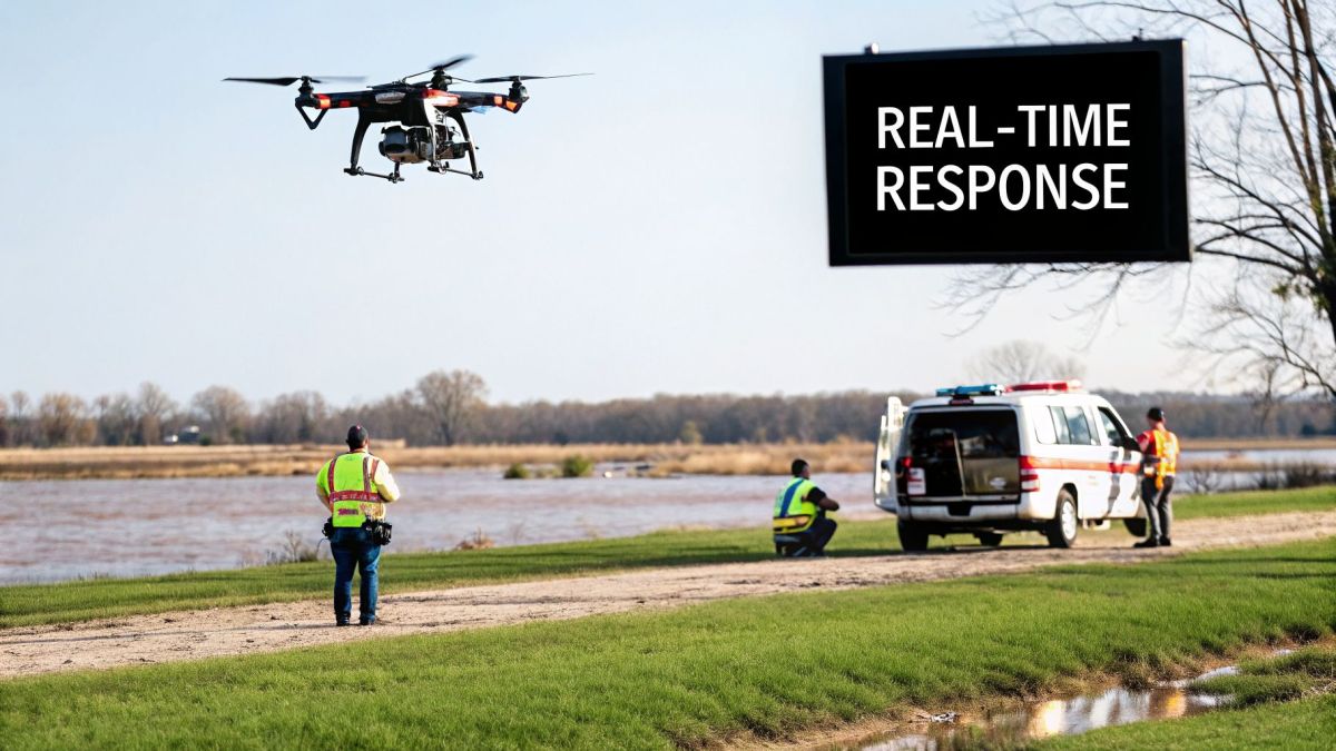
When a crisis hits, first responders are almost always working against the clock with incomplete information. Think about a fast-moving wildfire, a search for a missing person in the wilderness, or the chaotic aftermath of a flood. Ground teams are often navigating this "fog of war," putting themselves at risk and slowing down the response simply because they can't see the whole picture.
This information gap can be the difference between life and death. That’s where specialized drones step in, not as a gadget, but as a critical tool for giving commanders real-time intelligence. The goal is simple: get an accurate, live picture to decision-makers on the ground, instantly.
The Evolution Flight Patriot Quadcopter was built from the ground up for these high-stakes, chaotic environments. Its features aren't just technical specs on a data sheet; they're designed to deliver life-saving outcomes for emergency agencies.
Rapid Deployment in Critical Moments
In an emergency, every second counts. Fire crews can’t afford to wait for a helicopter to be cleared for takeoff, and search teams can't operate blind as a situation worsens. The Patriot is built for immediate action.
It can be airborne in just minutes, a direct answer to the problem of delayed intelligence. This is backed by its exceptional wind tolerance, which means the drone can fly and stay stable even when the weather is turning—a common reality in fires and storms. The result is profound: agencies get eyes in the sky immediately, not when the weather finally decides to cooperate.
This rapid, all-weather capability gives command centers the power to:
- Track the live movement of a wildfire's front.
- Instantly identify safe evacuation routes for people in danger.
- Get a fast, initial overview of damage just moments after an event.
Seeing Through Smoke and Darkness
But what about when visibility is zero? The industrial pain point of operating in smoke, darkness, and dense terrain can make it impossible to find stranded people or understand the full scale of a disaster. Just putting a standard camera in the air isn't enough.
The Evolution Flight Patriot Quadcopter is designed to carry a high-resolution thermal and EO/IR (Electro-Optical/Infra-Red) sensor payload. This technical capability translates directly into a game-changing business outcome: the ability to see what the human eye can't. A thermal camera can easily spot a person's heat signature through thick smoke or find a lost hiker in the dead of night.
For a search and rescue team, this changes everything. Instead of burning precious hours searching a huge area on foot, a drone pilot can scan that same terrain in minutes, pinpointing the person's exact location and guiding ground crews right to them. This dramatically increases the odds of a successful rescue.
A Secure Solution for Government and Defense
For government, defense, and law enforcement agencies, the conversation around drones has another critical layer: security. Using a commercial drone for sensitive surveillance or intelligence gathering can open the door to data interception or reliance on a compromised supply chain. This isn't just a technical problem; it's a major operational and national security risk.
This is where a drone's origin and compliance become a crucial factor. Evolution Flight platforms are fully NDAA-compliant. This technical specification directly addresses the industrial pain point of data vulnerability and supply chain risk. For a defense or law enforcement user, the business outcome is trust and data integrity. It means they can fly sensitive missions with total confidence, knowing their surveillance feed and hardware are secure from foreign interference. This compliance is a non-negotiable for any government body looking to use drones without creating new security holes.
Getting to Grips with Regulations and Data Security
Getting a drone program off the ground involves more than just learning to fly. You have to navigate a maze of legal and security rules that come with operating aircraft, and for most serious commercial work, the real goal is flying Beyond Visual Line of Sight (BVLOS).
Think of it this way: inspecting a 200-kilometer gas pipeline or a sprawling power grid by keeping the drone in your sight is barely practical. Your crew would spend all their time driving to new launch points instead of actually collecting data. It’s this exact limitation that holds back the true financial return of using drones for large-scale work.
Why BVLOS is the Real Game-Changer
Getting the green light for BVLOS operations from an authority like Australia’s CASA is tough, but it's worth the effort. It’s what separates a hobby from a professional, industrial-grade operation.
With BVLOS approval, a single flight can cover huge distances, slashing inspection times and operational costs. Suddenly, monitoring hundreds of kilometers of railway lines or pipelines isn't just possible; it's incredibly efficient. This is how you get the maximum return on your investment, especially if you're managing long, linear assets.
But as your drones fly further and gather more valuable data, another critical issue comes into play: data security. When a drone is creating a digital map of your power grid or filming sensitive locations, the information it carries becomes a high-stakes asset.
A data leak that exposes a "digital twin" of your critical infrastructure isn't just an IT headache. It's a fundamental business failure, which is why rock-solid data security has to be a non-negotiable part of any serious drone program.
Keeping Your Mission-Critical Data Safe
For many government and enterprise users, the fear of data being intercepted or of using hardware with a compromised supply chain is a major roadblock. This isn't just a vague worry; it's a specific operational risk that needs a solution built right into the drone's hardware and software.
This is exactly why Evolution Flight platforms are designed to be fully NDAA-compliant. The National Defense Authorization Act (NDAA) is a U.S. law that puts strict controls on the supply chain, banning components from certain foreign sources known to pose a security risk.
What this technical compliance means for your business is simple: you can have absolute trust in your equipment. By choosing an NDAA-compliant drone, you’re solving the industrial pain point of data insecurity. The business outcome is ensuring your hardware is secure from the chip level up, with no hidden backdoors that could expose your data. For anyone in defense, public safety, or critical infrastructure, this compliance is the bedrock of a trustworthy aerial intelligence program. It gives you the confidence you need to truly scale your operations.
Your Roadmap to Successful Drone Integration
Getting a drone program off the ground is about so much more than just buying a new piece of kit. Think of it as building a whole new operational capability from the ground up. It’s a journey that begins with a real-world problem and ends with a return on your investment you can actually measure.
To get there, it helps to follow a proven framework. We can break this journey into four clear phases, with each one setting the stage for the next. This approach helps you sidestep the common mistakes that happen with a rushed or poorly planned rollout and makes sure your investment is tied to concrete business goals.
Phase 1: Assessment and Procurement
The first phase is all about assessment. Before you even think about drones, you have to identify a specific, costly pain point in your operations. What's a process that is currently too slow, too dangerous, or just too expensive? For a mining company, that might be the slow, and often inaccurate, task of measuring stockpile volumes, which throws off everything from inventory to financial reporting.
Once you’ve clearly defined the problem, procurement becomes a much more focused, strategic task. For that mining company, the goal isn't just to get an eye in the sky; it's to capture precise volumetric data safely and efficiently. This immediately shows that a basic camera drone won't cut it. Instead, the real need is for a heavy-lift platform that can carry a high-resolution LiDAR sensor, like the Evolution Flight Patriot Quadcopter.
Success starts when you match the right tool to the right job. The Evolution Flight Patriot Quadcopter's heavy-lift capacity isn't just a cool feature—it’s what allows the drone to carry a LiDAR payload. That technical spec solves the pain point of inaccurate measurements, generating the business outcome of 99%+ accurate stockpile data that the company needs for truly reliable inventory control.
Phase 2: Integration and Scaling
With the right gear in hand, you can move into the integration phase. This is where the drone becomes a true part of your day-to-day work, not just a side project. It involves creating new workflows, writing down standard operating procedures (SOPs), and getting your pilots and data analysts trained up. A big part of this is setting up the right data pipelines to turn raw sensor data, like point clouds, into actionable reports, like those stockpile volumes.
As you build out your program, you’ll find that getting airborne is more than just a technical challenge. The process involves some key approval steps.
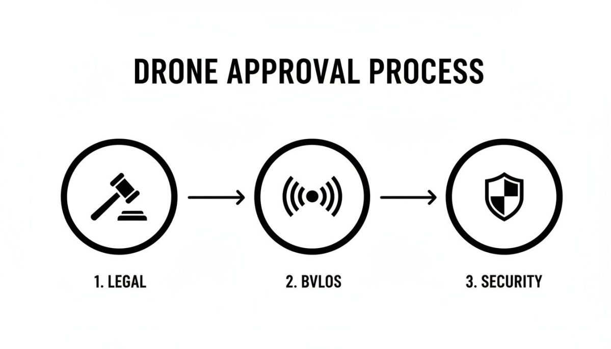
As you can see, professional drone operations are built on a foundation of legal compliance, approvals for advanced flights (like BVLOS), and solid data security.
Finally, after you've proven the drone's value in one area, you're ready for scaling. That mining company, now confident in its stockpile management, can start looking for other opportunities. They might expand the program to handle pit wall monitoring, haul road analysis, or environmental compliance surveys. Each new application uses the same assess-procure-integrate model, building on earlier successes and expanding the total ROI of their drones and business program.
Your Top Questions About Business Drones, Answered
When you're thinking about bringing drones into your business, a few key questions always come up. It's only natural. You want to know about the real-world value, the rules you have to follow, and whether your data will be safe. Let's get you some straight answers.
What's the Real ROI of Using Drones?
The return on a drone program isn't just one thing; it's a combination of benefits that add up quickly.
First, there are the obvious financial wins. You're immediately cutting costs for things like scaffolding, helicopter charters, and the sheer number of labour hours needed for manual inspections. Those expenses shrink, and the savings go straight to your bottom line.
Then you have the operational gains. A drone can inspect a huge asset or a large area far faster than a person on the ground. We've seen inspection times cut by as much as 70%. This means your expert technicians spend less time gathering data and more time actually analyzing it and making critical repairs.
But honestly, the most significant return is in safety. Every time you send a drone up instead of a person, you're taking someone out of a dangerous situation—whether that's working at height, near live power lines, or in a confined space. You can't put a price on reducing accident risk and the massive liability that comes with it.
How Hard Is It to Get Licensed?
Getting into the regulatory side of things can seem intimidating, but it's a clear, step-by-step process. Here in Australia, the Civil Aviation Safety Authority (CASA) sets the rules. For most commercial operations, your company will need a Remote Operator's Certificate (ReOC), and your pilots will each need a Remote Pilot Licence (RePL).
This is where having the right partner makes all the difference. You need someone who doesn't just know the drones, but also knows the ins and outs of CASA regulations. They can make sure your program is compliant from day one and help you get approvals for more complex flights, like Beyond Visual Line of Sight (BVLOS), which is where you'll find the biggest operational advantages.
How Secure Are Your Drone Solutions?
This is a big one, especially for our clients in government and critical infrastructure. When you're inspecting sensitive assets, the last thing you want is for that data to be compromised by an insecure drone. The industrial pain point is the risk of data leaks or reliance on a compromised supply chain.
That’s why our platforms, including the Evolution Flight Patriot Quadcopter, are fully NDAA-compliant. This technical specification solves the pain point directly. The business outcome is a guarantee that the drone’s entire supply chain is secure and free from components made by prohibited foreign companies. It means your data stays your data, giving you the confidence to fly any mission, no matter how sensitive.
Ready to see how a secure, high-performance drone can solve your biggest operational challenges? Contact Evolution Flight today to discuss your specific needs and get a custom quote.