Think of LiDAR as giving a drone a superpower: the ability to feel the world in three dimensions, not just see it. While a camera captures a flat image, a LiDAR system uses rapid-fire laser pulses to measure distances, building a hyper-accurate 3D map of whatever is below. This is a game-changer for any job that demands precision, from mapping dense forests to inspecting critical infrastructure like power lines.
Understanding Lidar for Drone Technology
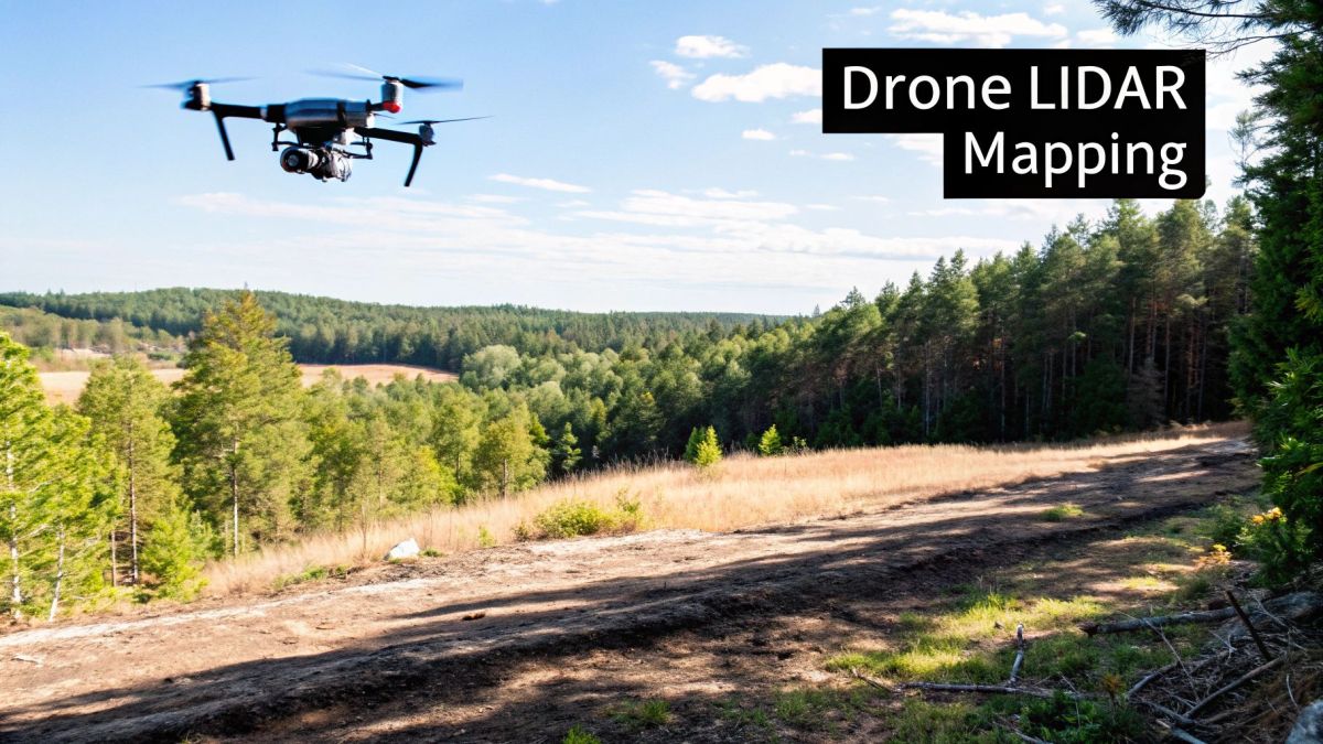
At its heart, LiDAR operates a bit like a bat navigating in the dark. A bat sends out sound waves and uses the returning echoes to understand its surroundings—the location, size, and shape of every object. A drone LiDAR system does something similar, but with light.
It fires thousands of laser pulses towards the ground every single second. These pulses bounce off everything they hit—the top of a tree canopy, the side of a building, or the bare earth—and return to a sensor on the drone. The system measures the exact time it takes for each pulse to make this round trip, and from that, it calculates the precise distance to that point.
When you collect millions of these individual measurements together, you get what’s known as a point cloud. It’s a dense and incredibly detailed 3D digital model of the area you just scanned.
The Three Pillars of Precision
Getting centimetre-level accuracy from a drone that’s constantly moving and tilting is no small feat. It’s not just about the laser; it’s a technological trio, with three core components working in perfect harmony to make sure every single point is placed exactly where it should be.
Let's break down the essential hardware that makes up a drone LiDAR payload. Think of these as the brains, the heart, and the inner ear of the whole operation.
Core Components of a Drone LiDAR System
| Component | Primary Function | Analogy |
|---|---|---|
| Laser Scanner | Emits and receives the laser pulses. Its pulse rate dictates the point cloud's density. | The system's heart, pumping out light. |
| Global Positioning System (GPS) | Tracks the drone's exact latitude, longitude, and altitude in real-time. | The system's compass, giving it a location on the map. |
| Inertial Measurement Unit (IMU) | Measures the drone's orientation—its roll, pitch, and yaw—at all times. | The system's inner ear, keeping it balanced. |
Each part plays a crucial role. Without the GPS, you'd have a detailed 3D shape with no idea where it is in the world. Without the IMU, the drone's tilt would throw off every measurement, resulting in a warped and useless map.
By combining data from the laser scanner, GPS, and IMU, the system produces a georeferenced point cloud. This means every single point in your 3D model has a real-world coordinate, turning raw data into an actionable, measurable map.
This fusion of technologies is what makes lidar for drone setups so powerful. It's a leap beyond simple aerial photography, giving us the ability to measure and analyse the physical world with a level of detail that, until recently, was only possible with slow, expensive, and often difficult ground-based methods.
How Drone LiDAR Creates a Digital Twin of Reality
So, how do we get from millions of invisible laser pulses to a precise, measurable digital copy of the real world? It's a fascinating process that blends careful planning in the office with autonomous data capture in the field and some serious number-crunching back at the computer. This is how a single drone flight can produce a powerful digital twin, accurate right down to the centimetre.
The whole thing starts well before the drone's propellers even begin to spin. It all kicks off with mission planning. Using specialised software, an operator maps out the survey area, setting crucial details like flight altitude, speed, and how much the flight paths should overlap to make sure no gaps are left in the data. This automated plan becomes the drone's instructions for the entire job.
Once on-site, the drone follows this pre-programmed flight path on its own. As it zips across the sky, the integrated LiDAR for drone system is firing off hundreds of thousands of laser pulses every single second. At the same time, the drone's onboard GPS and IMU are constantly logging its exact position and orientation.
The Art of Data Fusion
The raw data captured during the flight is a messy jumble of laser return times, GPS coordinates, and IMU orientation readings. This is where the real magic happens in post-processing. Specialised software takes all these different data streams and weaves them together, correcting for every tiny movement and tilt of the drone.
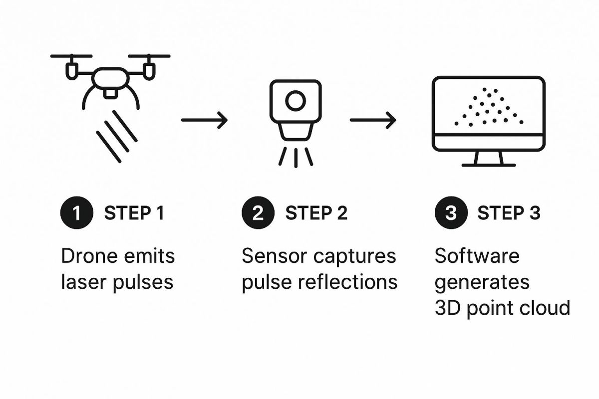
This fusion process turns millions of individual measurements into a single, cohesive, and georeferenced point cloud. This is the fundamental building block of any LiDAR survey.
While this digital raw material is incredibly detailed, it needs a bit more work to be truly useful. The next critical step is point cloud classification. Here, intelligent algorithms sift through the data, automatically sorting the points into different categories. For instance, the software can tell the difference between points that hit the ground and those that bounced off buildings, vegetation, or power lines.
This classification is the secret sauce that lets LiDAR "see" through a forest. By filtering out every point that isn't the ground, surveyors can generate a 'bare-earth' model, revealing the true shape of the land hidden beneath a dense tree canopy.
From Raw Points to Actionable Models
Once you have a classified point cloud, creating the final products is relatively straightforward. Engineers and surveyors can then generate highly accurate models designed for specific project needs. These aren't just pretty pictures; they are precise, measurable datasets that drive critical decisions.
Common outputs, or 'deliverables', include:
- Digital Elevation Models (DEMs): These are 3D representations of the bare-earth terrain, absolutely vital for things like floodplain analysis, infrastructure planning, and site grading.
- Digital Surface Models (DSMs): These models show the elevation of everything on the surface, including buildings and trees, giving you a complete picture of the landscape.
- 3D Mesh Models: By connecting the dots in the point cloud, the software can create solid, realistic 3D models of structures or even entire sites for visualisation and inspection.
This level of detail is fuelling significant growth across multiple Australian sectors. The broader Aussie drone market is currently valued at USD 0.28 billion and is tipped to hit USD 2.76 billion by 2034. This boom is heavily influenced by industries like agriculture, mining, and construction, which rely on the kind of precise 3D data that LiDAR drones deliver.
The ability to create such detailed outputs is what makes this technology so incredibly useful, especially in fields like agriculture where understanding the lay of the land is everything. For a deeper dive into this, check out our guide on how precision agriculture with drones is reshaping modern farming.
Choosing the Right LiDAR Drone for Your Project
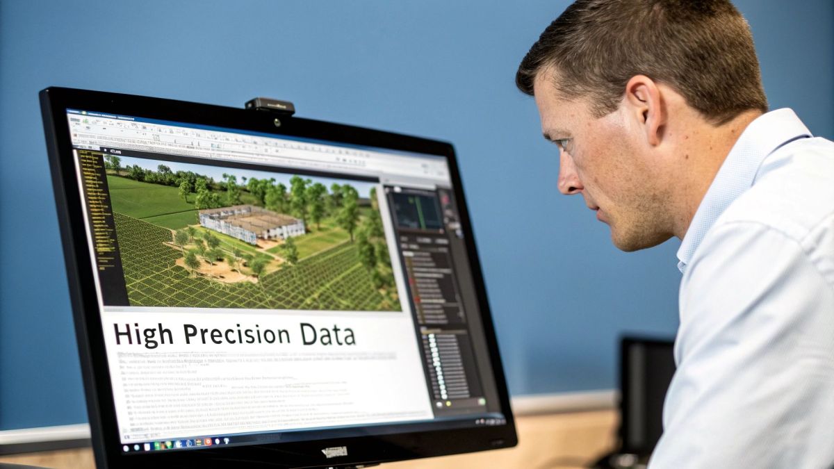
Picking the right combination of drone and LiDAR sensor is probably the most important decision you'll make. It’s not about grabbing the most expensive gear off the shelf; it's about finding the perfect tool for the job you need to do. Get this wrong, and you could end up with dodgy data or a very expensive paperweight.
Think of it like choosing a camera. A wildlife photographer needs a powerful zoom lens to catch a lion from a safe distance, while a portrait photographer wants a lens that creates that soft, blurry background. In the same way, the right LiDAR for drone setup depends entirely on what you’re trying to map.
Decoding Key LiDAR Sensor Specifications
When you first glance at a LiDAR sensor’s spec sheet, you’ll see a bunch of numbers. These aren’t just technical jargon; they have a direct impact on the quality and type of data you can collect. Let's break down the most important ones so you know what you’re looking at.
Pulse Rate (Points Per Second)
This is simply how many laser pulses the sensor fires every second. A higher pulse rate means a denser point cloud, which translates to more detail in your final model. For complex environments like a thick forest, a high pulse rate (think 2 million points per second) is non-negotiable if you want to capture every last branch and leaf. For wide-open areas like a mine site, a lower rate will often do the trick.
Number of Returns
When a laser pulse heads towards the ground, it can hit several things on its way down. Imagine a single pulse hitting the top of a tree, then a lower branch, and finally reaching the forest floor. A sensor that can record multiple returns captures each of these impacts from that single pulse. This is absolutely critical in forestry because it lets you map both the canopy and the true ground hidden beneath it.
Sensor Accuracy
This tells you how close the LiDAR points are to their actual, real-world coordinates. For survey-grade work like construction verification, you'll need pinpoint accuracy, often within 1–5 centimetres. For less demanding jobs, like general environmental monitoring, you can get away with a bit less precision.
The interplay between these specifications is key. A sensor with a high pulse rate and multiple returns is the go-to choice for penetrating dense vegetation, whereas a sensor prioritising absolute accuracy is better for mapping hard surfaces and infrastructure.
Matching the Drone Platform to the Mission
The LiDAR sensor is only half the story. The drone carrying it is just as crucial. The platform’s capabilities dictate where you can fly, how long you can stay in the air, and what kind of weather you can handle.
Here are the critical drone factors to consider:
-
Payload Capacity: The drone has to be able to safely carry your LiDAR sensor. These can weigh anything from under 1 kg to over 5 kg, so always check the drone’s maximum payload limit.
-
Flight Endurance: This determines how much ground you can cover in a single flight. A typical multirotor drone might give you 30–40 minutes in the air. For mapping long corridors or massive areas, a fixed-wing or VTOL (Vertical Take-Off and Landing) drone that can fly for over an hour is a much better fit.
-
Weather Resistance: Let's be honest, projects rarely happen on perfectly calm, sunny days. A drone with a decent IP (Ingress Protection) rating can handle a bit of rain and stronger winds, meaning you get more flying days and keep your project on schedule.
A Practical Comparison for Different Industries
To really bring this home, let’s look at how the ideal setup changes for a few common applications. Understanding how the mission drives the hardware choice is the key to getting it right.
Comparing LiDAR Sensor Specifications for Different Use Cases
The table below shows how project goals in different sectors directly influence the kind of LiDAR specs you’ll need. You'll quickly see there's no "one-size-fits-all" solution.
| Specification | High-Density Forestry | Open-Pit Mining | Urban Mapping |
|---|---|---|---|
| Primary Goal | Penetrate canopy, map bare earth | Calculate volumes, monitor slopes | Model complex buildings, map assets |
| Pulse Rate | Very High (1,000,000+ PPS) | Moderate to High | High |
| Number of Returns | High (5+ returns) | Low (1–2 returns) | Moderate (2–3 returns) |
| Sensor Accuracy | Moderate | High (for volume accuracy) | Very High (survey-grade) |
| Drone Type | Multirotor for manoeuvrability | Fixed-Wing/VTOL for large areas | Multirotor for complex environments |
As you can see, a forester’s dream setup would be overkill for a miner, and a city mapper needs a completely different balance of specs.
By carefully analysing your project's needs against these technical specifications, you can build a LiDAR for drone system that is perfectly suited to the task. This ensures you not only collect the right data but also get the best possible return on your investment.
Real-World LiDAR Drone Applications
With the theory covered, let's jump into where the rubber meets the road. The real magic of a lidar for drone setup isn't in the tech itself, but in how it solves complex, real-world problems. Across countless industries, it's delivering measurable gains in safety, efficiency, and data-backed decision-making.
This isn't just about making cool 3D models. It's about generating actionable intelligence that changes how businesses operate. From calculating massive stockpiles of material with incredible accuracy to mapping dense bushland in stunning detail, drone LiDAR is proving its worth in the field every single day.
This rapid uptake is fuelling serious market growth. In Australia, LiDAR market revenue is expected to reach around USD 160.2 million by 2030. While ground-based systems still hold a big slice of the pie, the UAV segment is catching up fast, largely thanks to its flexibility and cost-effectiveness in sectors like mining, forestry, and urban planning.
Revolutionising Mining and Quarrying
The mining industry works on a scale where tiny inaccuracies can snowball into huge financial losses or serious safety hazards. LiDAR-equipped drones give operators a way to manage massive earthmoving operations and monitor site stability that's faster, safer, and far more precise than traditional methods.
One of the most common jobs is stockpile volume calculation. What used to be a time-consuming and often dangerous task for ground surveyors can now be done in minutes. A drone can fly an autonomous mission over a stockpile, capturing a dense point cloud that delivers volume calculations with an accuracy of over 99%.
This kind of data empowers site managers to run more frequent inventory checks, tighten up logistics, and make their financial forecasting much more reliable. But it goes beyond just measuring what's already there; LiDAR is a vital tool for staying ahead of safety issues.
- Pit Wall Stability Monitoring: By running regular scans of pit walls, geologists can spot subtle ground movement or deformation over time. This helps them predict potential failures and put stabilisation measures in place before a collapse happens, protecting workers and expensive machinery.
- Haul Road Optimisation: The data from a LiDAR scan can be used to analyse haul road gradients and conditions, making sure they’re designed for peak efficiency and safety for all that heavy equipment.
Forestry and Environmental Management
In forestry and environmental science, getting a true picture of the terrain and vegetation is everything. LiDAR’s unique ability to punch through tree canopies makes it an absolute game-changer for mapping what’s hidden underneath—something a standard aerial photo just can't do.
LiDAR works its magic by capturing multiple laser returns from a single pulse. This lets it differentiate between the top of the tree canopy and the actual ground, allowing us to create a 'bare-earth' digital elevation model that reveals the true topography of the forest floor.
This single capability opens up a whole world of applications for managing our natural resources. Forest managers can now collect incredibly detailed data without ever needing to trek into remote or inaccessible areas.
A few key uses include:
- Forest Health and Biomass Assessment: LiDAR data gives us precise measurements of tree height, canopy density, and overall forest structure. This is crucial for calculating carbon stock, assessing bushfire risk, and monitoring the impact of disease or illegal logging.
- Floodplain Mapping: By generating accurate bare-earth models of river systems, authorities can run much more precise flood simulations. This leads to smarter planning for infrastructure and better emergency response strategies.
- Coastal Erosion Monitoring: Flying regular LiDAR surveys along coastlines allows us to measure change with pinpoint accuracy, helping track erosion patterns and see if coastal defence work is actually effective.
Construction and Infrastructure Verification
On any modern construction site, good data is gold. Drone LiDAR gives project managers an accurate digital snapshot of the site at every stage, from the first day of earthworks to the final handover. This is key to keeping projects on time, on budget, and in line with design specs.
A primary use case here is progress tracking and as-built verification. A quick weekly flight produces a 3D model that can be laid directly over the original Building Information Modelling (BIM) designs. This means managers can instantly see any differences between the plan and what’s actually happening on the ground, catching expensive mistakes before they become big problems.
This level of detail is also critical for large-scale projects, and you can learn more about how this technology supports long-range commercial UAV surveying in our detailed guide. These examples show that a lidar for drone system is much more than a simple mapping tool—it's a powerful project management asset that delivers a clear return on investment.
Lidar vs Photogrammetry: What You Need to Know
When it comes to mapping the world in 3D from a drone, two names always pop up: LiDAR and photogrammetry. On the surface, they seem to do the same thing, but how they get there is completely different. Picking the right one for your job is critical—get it wrong, and you could end up with useless data and a blown budget.
Let's start with photogrammetry. At its core, it's the art of creating 3D models from photos. A drone flies over an area, snapping hundreds or even thousands of overlapping, high-resolution pictures. Specialised software then gets to work, stitching all those images together to build a detailed 3D model. Think of it like a high-tech, digital version of papier-mâché, using photos instead of paper strips.
The big drawcard for photogrammetry is its accessibility. It uses standard camera technology, which keeps the equipment costs down. This makes it a fantastic option when your main goal is a visually stunning, full-colour model, like for real estate showcases or mapping open-pit mines.
Where Photogrammetry Hits a Wall
But photogrammetry isn't without its problems. It's a "passive" technology, meaning it relies on ambient light—the sun—to see anything. This means it struggles on overcast days, in the early morning, or late evening.
The biggest stumbling block, however, is vegetation. Photogrammetry can only map what the camera can see. So, while it can create a beautiful model of a forest canopy, it has absolutely no idea what the ground looks like underneath. The trees essentially form a solid "roof," hiding the true terrain below.
LiDAR's Clear Advantage
This is exactly where a LiDAR for drone system comes into its own. LiDAR is an "active" sensor; it generates its own light by firing out laser pulses. This makes it completely independent of the sun. You can fly a LiDAR mission at dawn, midday, or even in the middle of the night and get the same high-quality data.
But LiDAR’s real superpower is its ability to see through vegetation. The laser pulses are tiny enough to find gaps between leaves and branches. Some pulses bounce off the top of the canopy, while others make it all the way to the forest floor and back. This gives you two distinct data sets: the top of the trees and the true, bare-earth ground level.
This single capability makes it indispensable for any project needing accurate ground data in vegetated areas. Think forestry management, flood plain mapping, or surveying a new construction site that’s covered in scrub. If this sounds like your project, looking into professional LiDAR service work can give you a much clearer picture of what's possible.
Making the Right Call for Your Project
So, which one should you choose? It really boils down to your end goal and the environment you’re working in.
Here’s a quick guide to help you decide.
-
Choose Photogrammetry when:
- Your main goal is a photorealistic, full-colour 3D model.
- The area is wide open with minimal trees or scrub.
- Your budget is tight, and you don’t need survey-grade vertical accuracy.
- You're mapping vertical surfaces like building walls, where it often performs very well.
-
Choose LiDAR when:
- You absolutely need an accurate bare-earth model (a Digital Elevation Model).
- The site is covered in dense vegetation or forest.
- The project requires centimetre-level vertical accuracy.
- You need to capture fine details like power lines, fences, or communication towers.
At the end of the day, LiDAR is the gold standard for accuracy and reliability, especially when the conditions get tough. Photogrammetry is still a brilliant and cost-effective tool, but only for the right kind of job.
Where is Drone LiDAR Heading?
Aerial mapping is moving forward at an incredible pace, and drone LiDAR technology is leading the charge. A few key trends are making this powerful tool even easier to use, smarter, and faster, completely changing how we capture and work with geospatial data.
One of the biggest game-changers is sensor miniaturisation. As LiDAR sensors get smaller, lighter, and use less power, they can be fitted onto a much wider range of compact, nimble drones. This really opens up the playing field, making high-precision mapping a realistic option for more organisations than ever before.
From Raw Data to Instant Answers
It’s not just the hardware that’s getting better; the software behind LiDAR is also taking a massive leap forward. The introduction of artificial intelligence (AI) and machine learning is automating tasks that used to be incredibly time-consuming and manual.
For example, AI algorithms can now perform automated point cloud classification. They’re getting incredibly good at identifying and labelling features like ground, trees, buildings, and power lines with very little human help. This slashes data processing time, letting teams get from a raw scan to real, usable insights much, much faster.
The future of drone LiDAR isn't just about collecting better data. It's about getting answers from that data almost instantly. Real-time processing, which once seemed like a distant dream, is now becoming a reality for urgent missions like disaster response, where knowing what's happening on the ground can save lives.
This rapid uptake is mirrored in the market numbers. The global LiDAR drone market was valued at USD 210.4 million in 2024 and is expected to rocket to nearly USD 700 million by 2033. Here in Australia, that growth is especially strong, fuelled by the huge demands of our mining, agriculture, and land management industries. You can dive deeper into the global trends shaping the LiDAR drone market to see what’s behind this boom.
As these developments continue, drone LiDAR is set to become the backbone of modern geospatial data collection. It’s providing the precise digital foundation we need to build smarter, safer, and more efficient industries.
Got Questions About LiDAR Drones? We’ve Got Answers.
When you're looking at bringing high-end surveying gear into your toolkit, it’s only natural to have a few questions. The big ones usually revolve around cost, when and where you can actually fly, and what it takes to become a pro. Getting your head around these practicalities is the first step before you even think about investing in a professional LiDAR drone system.
Here are some of the most common questions we get from people just like you, with straight-up, practical answers.
What's the Real Cost of a LiDAR Drone Setup?
There’s no single price tag on a LiDAR drone, because the cost really depends on what you need it to do. The investment can swing wildly based on the system's power and precision, but we can break it down into a few general tiers.
-
Getting Started: For those dipping their toes in or tackling smaller jobs, an entry-level system will set you back somewhere between AUD $20,000 and $50,000. This usually gets you the drone, a capable LiDAR sensor, and the software to get you off the ground.
-
The Professional Workhorse: This is where most commercial surveying and mapping outfits land. You're looking at an investment of AUD $50,000 to $150,000. For that, you get a solid, reliable system that hits the sweet spot between accuracy, range, and performance for day-to-day work.
-
Top-Tier Survey Grade: When you need the absolute best—think major infrastructure projects where every millimetre counts—the sky's the limit, but expect to pay upwards of AUD $200,000. These are the elite systems with incredible range and accuracy that can get down to the centimetre level, or even better.
Remember, these figures aren't just for the sensor. They typically cover the full package: the drone itself, the complete LiDAR payload (sensor, IMU, GPS), and the crucial post-processing software licenses.
Can You Fly a LiDAR Drone at Night or in Bad Weather?
One of LiDAR's biggest selling points is its ability to work in total darkness. It’s an 'active' sensor, meaning it creates its own light with a laser, so it couldn't care less if the sun is up. This is a huge advantage over photogrammetry, opening up your operational window to a full 24 hours.
But what about weather? That's a different kettle of fish.
LiDAR doesn't need sunlight, but it's not immune to the elements. Heavy rain, thick fog, or snow will interfere with the laser pulses, scattering and absorbing them. This will seriously mess with your data quality and accuracy.
While you might get away with a bit of light drizzle, you'll always get the best results in clear conditions. And don't forget, the drone’s own IP rating (its weather resistance) is the ultimate gatekeeper for whether you should be flying at all.
What Sort of Training Do I Need to Fly a LiDAR Drone?
Flying a LiDAR drone properly isn't a single skill; it’s two. First and foremost, you have to be a certified and licensed drone pilot, playing by all the rules set out by Australia's Civil Aviation Safety Authority (CASA). There are no shortcuts here.
On top of that, you need specialised training for the LiDAR system itself, and this is non-negotiable. It’s about so much more than just keeping the drone in the air. You need to get your head around the mission planning software, learn how to configure the sensor perfectly for different jobs, and master the art of post-processing the massive point cloud datasets to produce the clean, accurate models your clients expect. Any good vendor will include a comprehensive training package that walks you through the entire workflow, from planning the flight to delivering the final product.
At Innoflight Technology, we don't just sell drones; we provide complete solutions and the expert support you need to get them flying with confidence. To find the right system for your project, take a look at our advanced aerial platforms.
Article created using Outrank