
Magnetic field sensing is really just the art of measuring invisible magnetic forces to make sense of the world around us. Think about the simple needle of a compass always pointing north, or the complex sensors that guide a drone. In both cases, the technology is translating an unseen energy into practical, usable data. It’s what allows us to navigate with incredible accuracy, find hidden geological formations, and even check that our electronic devices are working properly.
Understanding the Invisible Forces Around Us
At its heart, magnetic field sensing makes the invisible, visible. Picture yourself standing in an open field. You can't see or feel it, but you're standing within an immense force field generated by the Earth's molten iron core. A simple compass works because its magnetised needle naturally wants to align with these invisible field lines, giving us a reliable sense of direction.
The same idea works on a much smaller scale. Every time electricity runs through a wire, whether it's in a drone's motor or your kitchen toaster, it creates its own tiny magnetic field. Specialised sensors can pick up on these small disturbances, which lets us understand what’s happening inside a system without ever having to physically touch it. The possibilities are huge, all because we can measure these forces with such precision.
The Earth as a Giant Magnet
The biggest magnetic field we deal with is the one produced by the Earth itself. This global field isn't static, though; it shifts, wanders, and its strength changes over time. Keeping track of these changes is vital for everything from navigation to geological science, especially across a massive landmass like Australia. That's why various organisations are dedicated to monitoring our planet’s magnetic behaviour.
A great example is Geoscience Australia, which looks after the Australian Geomagnetic Reference Field (AGRF) model. This model essentially maps the Earth's magnetic field across our region and gets updated every five years. Using data from observatories, aircraft, and satellites, they track the shifts that can affect everything from navigation to our communication networks. You can learn more about how Australia's magnetic field is monitored and its impact on the country.
The ability to sense magnetic fields gives us a kind of sixth sense. It lets our technology perceive a fundamental force of nature, turning it into a powerful tool for exploration, navigation, and discovery.
From Navigation to Exploration
While navigation is the most obvious use, magnetic field sensing is also a fantastic tool for discovery. Geologists and resource exploration companies rely on it to see what’s going on deep beneath the ground. Different rocks and minerals have their own magnetic signatures, creating tiny variations—or 'anomalies'—in the local magnetic field. By flying highly sensitive instruments over an area, surveyors can build a magnetic map that reveals a lot.
- Hidden Geological Structures: It can help identify underground fault lines, different rock formations, and basins.
- Potential Mineral Deposits: It's great for locating iron ore and other valuable magnetic minerals.
- Buried Infrastructure: You can find things like pipelines, cables, or even unexploded ordnance without needing to dig.
It's almost like giving the Earth an MRI, using magnetic data to paint a picture of what’s hidden just out of sight. This capability is absolutely fundamental to modern surveying and a major driver of Australia's resource industry.
How Different Magnetic Sensors Actually Work
To make sense of an invisible magnetic field, we need a special kind of translator—a device that can convert that unseen force into a measurable electrical signal. These translators are called magnetometers, and they come in several different flavours, each with its own clever method for detecting magnetic fields. Understanding the differences is key to appreciating why your phone's digital compass is a world away from the high-precision sensor on a geological survey drone.
This infographic breaks down the core areas where magnetic field sensing is applied, from understanding our planet to guiding advanced technology.
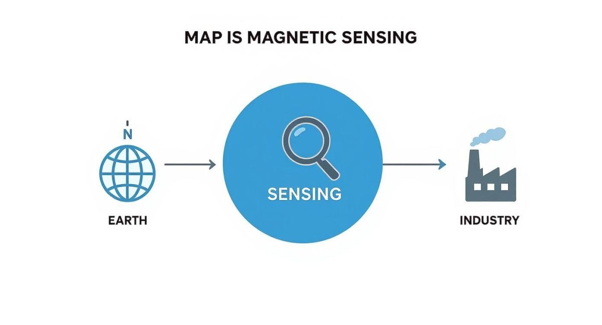
As the image shows, whether we’re mapping the Earth’s core, navigating a vehicle, or inspecting industrial pipes, the fundamental principle of detecting magnetic fields is the common thread tying it all together.
The Hall Effect Sensor: A River Diverted
One of the most common types is the Hall effect sensor, which you’ll find in countless devices, from car engines to computer keyboards. Imagine a steady river of electrical current flowing through a thin, conductive strip. When you bring a magnet nearby, its field acts like an invisible barrier, pushing the flowing current over to one side of the strip.
This "push" creates a tiny build-up of electrical charge on that side, resulting in a voltage we can measure. The stronger the magnetic field, the greater the push and the higher the voltage. It’s a beautifully simple and direct way to measure magnetic strength, which makes these sensors cheap and durable enough for everyday applications.
The Magnetoresistive Sensor: A Crowded Hallway
Next up are magnetoresistive (MR) sensors, which take a slightly different approach. Think of an electrical current as a group of people trying to walk down a crowded hallway. The material inside an MR sensor is engineered so its electrical resistance—basically, how difficult it is for the current to get through—changes when a magnetic field is present.
Applying a magnetic field is like organising the crowd in the hallway. It can either make it much easier for people (the current) to flow, or it can make it much harder. By measuring this change in resistance, the sensor can precisely figure out the strength and direction of the magnetic field. This is why you’ll often find them in hard drives and high-sensitivity compasses.
The core idea behind all magnetometers is converting a magnetic influence into a different, more easily measured physical property—like voltage, resistance, or frequency. The specific method used determines the sensor's sensitivity, cost, and suitability for a particular job.
The Fluxgate Magnetometer: A Bucket Overflowing
For more demanding scientific and geological survey work, fluxgate magnetometers offer a much higher level of sensitivity. Picture a small bucket made from a special magnetic material. We pour magnetic energy into this bucket at a steady rate until it becomes completely full, or 'saturated'.
An external magnetic field, like the one from the Earth, either helps fill the bucket faster or works against it, making it fill slower. The sensor measures precisely how much energy it takes to make the bucket overflow in each cycle. By comparing these cycles, it can detect incredibly small variations in the surrounding magnetic field, making it ideal for mapping geological anomalies from a drone.
Each of these sensor types really shines in different scenarios, which is why a single approach to magnetic field sensing just doesn’t fit all needs. Here’s a quick comparison to make things clearer.
Comparing Common Magnetometer Technologies
The table below offers a side-by-side look at the three main types of magnetic sensors, highlighting how they work and where they're best used.
| Sensor Type | Working Principle Analogy | Key Strengths | Common Applications |
|---|---|---|---|
| Hall Effect | A magnetic field diverts a river of current, creating voltage. | Low cost, durable, wide measurement range. | Consumer electronics, automotive sensors, industrial switches. |
| Magnetoresistive | A magnetic field changes the difficulty of current flow. | Good sensitivity, compact size, low power. | Digital compasses, position sensing, hard drives. |
| Fluxgate | Measuring energy needed to 'overflow' a magnetic core. | Very high sensitivity, stable, detects field direction. | Geological surveys, space exploration, laboratory instruments. |
Ultimately, choosing the right sensor always involves balancing the need for precision against practical factors like cost, size, and power consumption. For a simple directional reading in a phone, a low-cost Hall effect or MR sensor is perfect. But for mapping Australia's hidden geology, only the extreme sensitivity of a fluxgate magnetometer will get the job done right.
Mapping Australia's Hidden Geology from the Sky
Forget the simple compass in your hand. Magnetic field sensing can operate on an incredible, continent-spanning scale. Here in Australia, it’s the key to unlocking a hidden world right beneath our feet, showing us geological secrets and valuable resources that are totally invisible from the surface.
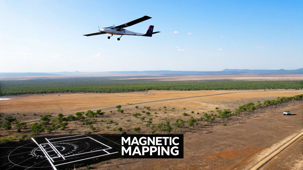
Picture a specialised aircraft or an advanced drone flying a perfectly straight grid pattern over a vast, remote landscape. These aren't just scenic joyrides; they're high-tech data collection missions. Tucked inside, highly sensitive magnetometers are constantly measuring tiny variations in the Earth's magnetic field with stunning precision.
Every single measurement is a tiny clue. As the aircraft flies its course, the sensor picks up subtle magnetic shifts caused by different types of rock buried deep underground. Formations rich in iron, ancient volcanic dykes, and deep sedimentary basins all leave their own unique magnetic fingerprint.
From Raw Data to a Magnetic Map
What comes back from these aerial surveys is a massive stream of raw data points, each one tagged with a precise GPS coordinate. A single reading on its own doesn’t tell you much. But when you collect and process millions of these points, you can stitch them together to create a detailed ‘magnetic map’ of what lies beneath.
Think of this map as a geological MRI. Areas with stronger magnetic intensity pop out as vibrant 'highs', while weaker spots show up as cool 'lows'. These patterns are a direct reflection of the underlying geology, revealing features that would otherwise be completely hidden.
- Ancient Fault Lines: Geologists can trace the paths of massive fault systems that have been dormant for eons.
- Mineralised Zones: The maps can pinpoint areas with a high potential for valuable ore bodies.
- Underground Water: They help identify certain geological structures often associated with groundwater resources.
- Continental Structure: The data helps scientists piece together how the Australian continent formed over billions of years.
Being able to ‘see’ underground without ever drilling a single hole is absolutely fundamental to Australia’s resources sector and our scientific knowledge of the continent.
These aerial magnetic surveys aren’t just about finding what's valuable. They're about building a complete picture of our continent's geological architecture, from the surface right down to the deep crust.
The AusLAMP Project A Continental Endeavour
One of the most ambitious efforts in this field is the Australian Lithospheric Architecture Magnetotelluric Project, or AusLAMP. Kicked off in November 2013, this collaborative project is a massive undertaking to map the magnetic and electrical properties of the entire Australian landmass.
So far, AusLAMP has collected data from around 1,500 stations, covering roughly 50% of the country. Best of all, every bit of information, from raw field data to the final processed models, is made publicly available. This open access helps fuel both new scientific discoveries and commercial innovation.
Drones Are Changing the Game
For decades, traditional crewed aircraft have been the workhorses for these large-scale surveys. Now, Uncrewed Aerial Systems (UAS) are stepping in to play a crucial role. Drones fitted with high-precision magnetometers can fly lower, slower, and get into spots that are too tricky or dangerous for a conventional plane.
This allows for incredibly high-resolution surveys over specific target areas. For a mining company trying to map out a mineral deposit, or an environmental team tracking buried contaminants, the detail from a drone survey is second to none. This combination of magnetic field sensing and advanced drone technology is the next big step in our quest to map Australia's hidden geology from above.
Solving Geological Mysteries with Magnetic Data
Magnetic field sensing does more than just map resources; it’s a powerful tool for piecing together our planet’s ancient history. Think of it as a form of geological detective work. By studying anomalies—places where the Earth’s magnetic field is stronger or weaker than expected—scientists can uncover evidence of dramatic events from millions of years ago.
A fantastic real-world example is the Coompana Anomaly, a massive magnetic puzzle buried deep beneath the Nullarbor Plain in South Australia. This huge, circular feature has a significant dip in magnetic intensity, which is a clear sign that the rocks deep underground are fundamentally different from their surroundings. But what caused it?
Unravelling the Coompana Anomaly
For a long time, this anomaly was a complete enigma. Early aerial surveys picked up its unusual signature, but the true cause was hidden far below the surface. This is where magnetic field sensing became the key, giving researchers the clues they needed to build and test theories about its origin.
One popular theory was that the anomaly is a scar from a colossal meteorite impact from hundreds of millions of years ago. An event like that would generate immense heat and pressure, changing the magnetic properties of the rock in a distinct circular pattern. Another idea suggested the rocks were once part of a different continent that collided with ancient Australia, bringing its unique magnetic signature along for the ride. You can explore our guide on how UAS aerial surveying contributes to modern geological mapping.
A Tale of Drifting Continents
As more magnetic data was gathered, the evidence began to tell a fascinating story of tectonic movement. The Coompana Anomaly, first spotted during airborne magnetometer surveys in the 1970s, showed a region where the Earth's magnetic field was much weaker than in surrounding areas. This unique signal is now believed to come from rocks that either formed in the Northern Hemisphere and travelled south with plate tectonics, or from deep crustal rocks that were magnetised when the Earth's poles were reversed.
"Magnetic anomalies are like geological fingerprints left behind by ancient events. By analysing their shape, size, and intensity, we can reconstruct the Earth's past, revealing everything from asteroid impacts to the slow dance of continents."
Why Magnetic Data Is the Key
Without this data, mysteries like the Coompana Anomaly would stay hidden forever, buried under kilometres of younger rock. It's the ability to 'see' through this cover that makes magnetic field sensing so indispensable for geologists. Each theory about how the anomaly formed predicts a very specific magnetic pattern.
- Impact Event: This would likely create a circular pattern with a clear magnetic low in the middle, surrounded by a ring of higher magnetism.
- Continental Collision: This would probably show a more linear or irregularly shaped boundary where the different crustal blocks smashed together.
Scientists can take the real-world data collected from aerial surveys and compare it directly to these predicted models. The data from the Coompana Anomaly aligns much more closely with the continental collision model, providing strong evidence for that theory and helping rewrite our understanding of how the Australian continent was built. It’s a perfect illustration of how magnetic sensing is a fundamental tool not just for finding what's valuable, but for understanding where we came from.
Integrating Magnetic Sensors into Drones
When you add magnetic field sensing technology to a drone, you're not just adding a new part; you're giving it a whole new sense. It allows the Uncrewed Aerial System (UAS) to perceive the invisible magnetic world around it, turning a simple flying machine into a sophisticated tool for both navigation and discovery.
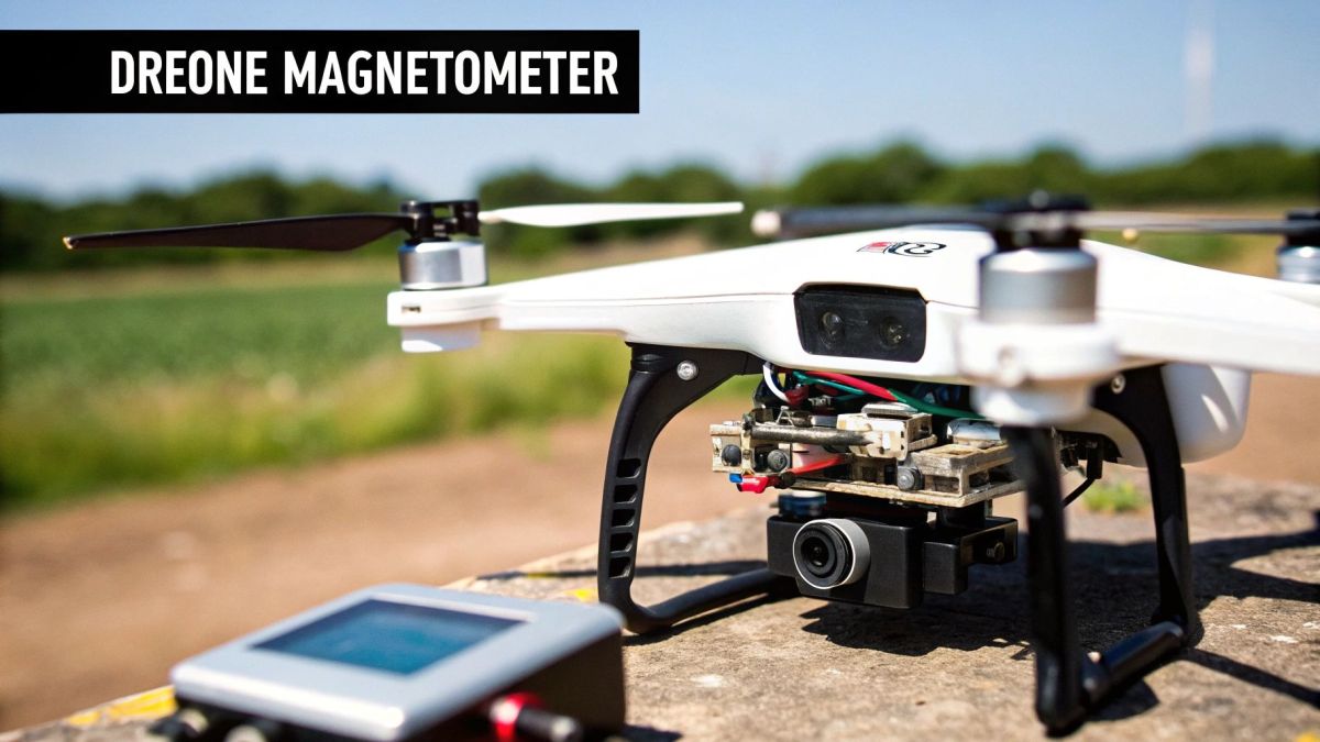
One of the most important jobs for a magnetic sensor, often called a magnetometer, is navigation. Think of it as the drone's digital compass. By constantly measuring the Earth's magnetic field, it provides a stable and reliable sense of direction, or heading, which is absolutely vital for steady flight and precise manoeuvres.
While GPS tells the drone where it is in the world, the magnetometer tells it which way it's facing. This teamwork between GPS and magnetic sensing forms the backbone of modern drone navigation, paving the way for accurate, autonomous flight paths.
A Digital Compass for Reliable Navigation
You can't overstate the importance of the magnetometer as a navigational backup. GPS signals are generally dependable, but they can be blocked or disrupted in what we call "GPS-denied" environments. Think of deep urban canyons, dense forests, or even just periods of high solar activity.
If the GPS signal drops out, a drone can get disoriented fast. Without a heading reference, it has no idea which way to turn to get home or carry on with its mission. The magnetometer steps in, providing that crucial, independent sense of direction. It’s the steady hand that guides the drone when other systems go offline, keeping the aircraft stable and controllable until GPS is restored.
Turning Drones into Powerful Surveying Tools
Beyond just keeping the drone oriented, fitting a high-precision magnetometer unlocks its potential as a powerful surveying instrument. This is where magnetic field sensing goes from a simple navigation aid to a tool for discovering what lies beneath the ground. A drone equipped with a sensitive magnetometer can carry out detailed magnetic surveys with a level of detail and efficiency that was once unthinkable.
These aerial surveys have become game-changers across many Australian industries:
- Mineral Exploration: Drones can fly low and slow over rugged terrain to map magnetic anomalies, which often point to valuable ore bodies like iron or nickel.
- Environmental Monitoring: They’re used to locate buried steel drums filled with hazardous waste or to map contaminated soil without ever needing to disturb the site.
- Infrastructure Inspection: Operators can quickly find and map the exact location of buried pipelines, cables, and other metallic utilities.
By turning a drone into a flying magnetometer, we can generate incredibly detailed magnetic maps of targeted areas. You can dive deeper into this process in our guide to aerial surveying with a UAV.
The Challenge of Magnetic Noise
Now, integrating these sensors isn't as simple as just bolting one onto the drone's frame. A drone is an electrically noisy place. Its powerful motors, high-current wiring, and power distribution boards all create their own magnetic fields. This electronic "noise" can easily drown out the faint magnetic signals the sensor is trying to pick up from the Earth.
Overcoming the drone's own magnetic interference is the single biggest engineering challenge in UAS magnetometry. The goal is to isolate the subtle geological signal from the overwhelming noise of the aircraft itself.
Engineers have developed some clever strategies to tackle this. Often, the magnetometer is mounted on a long boom or suspended on a cable far below the drone's body. This physically separates the sensitive instrument from the main sources of interference, dramatically improving the signal-to-noise ratio and leading to cleaner, more accurate data.
On top of that, sophisticated calibration routines are essential. Before a survey flight, the drone performs a series of specific manoeuvres—pitching, rolling, and yawing—while the magnetometer records the interference from every angle. This data creates a magnetic "noise profile" of the drone, which is then mathematically subtracted from the survey data, leaving behind just the pure geological signal.
Best Practices for UAS Magnetic Surveys
Getting great results from a drone-based magnetic survey is about more than just strapping on a good sensor. To get it right, you need a solid plan, a steady hand during the flight, and a careful approach to handling the data. Sticking to proven best practices is what turns a stream of raw numbers into a clear and accurate magnetic map.
Think of it this way: you’re trying to hear a faint whisper in a noisy room. These practices help you filter out all the background noise—both from the environment and the drone itself—so you can clearly hear the subtle signals coming from the ground. Every step, from planning the mission to processing the data, is critical.
Plan Your Flight for Optimal Data Capture
The first job is to design a flight plan that squeezes the most value out of every minute in the air. This isn't just about flying over an area; it's about flying over it in the smartest way possible to get high-quality, dense data. The two big things to nail down are your flight altitude and line spacing.
Flying lower to the ground usually gets you a higher-resolution picture because the sensor is closer to what it's trying to measure. But you have to weigh that against safety and the drone's ability to follow the terrain. The distance between your parallel flight lines is just as important. Tighter lines give you a more detailed map, but it also means more flight time.
The real aim of mission planning is to build a consistent dataset with plenty of overlap. This prevents any gaps in your final map and makes sure you capture the features you’re hunting for with enough detail.
Calibrate to Eliminate Drone Interference
Before any survey flight, there’s a non-negotiable step: the compensation flight. As we've touched on, the drone itself creates a lot of magnetic noise. This pre-flight calibration is all about measuring that interference so you can mathematically erase it from your survey data later on.
The drone will fly a specific set of patterns—think rolls, pitches, and yaws—at a high altitude where the Earth’s magnetic field is nice and stable. This lets the system map out the complete magnetic signature of the aircraft. If you skip this, your data will be so contaminated by the drone’s own noise that spotting genuine geological anomalies becomes a guessing game. To get a better handle on this, check out our article explaining what electromagnetic interference is.
Use a Ground-Based Base Station
The Earth’s magnetic field isn’t static. It naturally ebbs and flows throughout the day, mostly due to solar activity. These daily (or diurnal) variations are often strong enough to be mistaken for the very geological signals you’re looking for. That’s where a ground-based magnetometer, often called a base station, becomes essential.
This stationary sensor sits quietly near your survey area, recording the natural magnetic field fluctuations while your drone is in the air. The process is simple but absolutely vital:
- Set Up: Find a magnetically "clean" spot for the base station, well away from cars, buildings, or power lines.
- Record: Start logging data before the drone takes off and keep it running until after it lands.
- Correct: During post-processing, you simply subtract the base station's readings from the drone's data.
This removes the diurnal drift, leaving you with a dataset that shows true subsurface anomalies, not the effects of a distant solar flare. Without this correction, you can't be confident in what your magnetic map is actually telling you.
Frequently Asked Questions
Getting into magnetic field sensing can feel a bit like learning a new language, especially when you start attaching these sensitive instruments to drones. Let's break down some of the most common questions people have when they're navigating this fascinating technology.
What Is the Biggest Challenge When Using Magnetometers on Drones?
Without a doubt, the single biggest headache is magnetic interference—what we often call ‘noise’—coming from the drone itself. Think about it: high-current wires, spinning electric motors, and power distribution boards all generate their own magnetic fields. These fields can easily swamp the subtle geological signals you’re trying to pick up from the ground.
Tackling this problem really comes down to a two-part strategy. First, you need smart physical placement, like mounting the sensor on a long boom to get it as far away from the drone's electronic heart as possible. Second, you lean on sophisticated calibration and filtering software that can intelligently separate the drone’s own magnetic signature from the Earth's natural field you want to measure.
Can Magnetic Field Sensing Find Things Other Than Minerals?
Absolutely. While it’s a go-to for mineral exploration, the ability to detect anything containing iron (ferrous objects) makes magnetic field sensing incredibly useful in a whole host of other areas.
Here are just a few real-world examples:
- Unexploded Ordnance (UXO) Detection: A crucial application for safety, helping locate buried mines, old bombs, and other explosive hazards.
- Archaeology: Archaeologists can map out buried foundations, ancient fire pits, and other historical features without ever turning a shovelful of soil.
- Environmental Surveys: It's a fantastic tool for finding buried steel drums, which might be leaking hazardous waste.
- Infrastructure Management: It helps build precise maps of underground utilities like steel pipes or cables buried in reinforced concrete.
How Does Weather Affect Magnetic Field Sensing Surveys?
This is a great question. While a bit of rain or wind won't mess with your magnetic readings, solar weather is a completely different story. Big events like geomagnetic storms and solar flares can cause the Earth’s magnetic field to fluctuate wildly and unpredictably across the globe.
Flying a survey during a geomagnetic storm is a recipe for disaster. The natural magnetic chaos caused by the storm will completely overwhelm the faint geological anomalies you’re looking for, rendering your data pretty much useless.
This is exactly why checking space weather forecasts is a non-negotiable part of professional survey planning. It's also why a ground-based magnetometer, or ‘base station’, is essential. This stationary sensor records the natural daily variations, which you can then subtract from the drone's data. This vital correction step ensures you’re left with only the true geological signals you set out to find.
For robust, Australian-designed UAS platforms ready for high-precision surveying, explore the advanced solutions offered by Innoflight International. Discover the right system for your next project at https://evolutionflight.com.