Think back to the old way of surveying a large property. It meant weeks of trudging through the bush with a tripod, taking one painstaking measurement after another. Now, imagine an aerial surveying UAV mapping that same site in just a few hours, and with even better accuracy. This isn't science fiction; it's the new reality that drones have brought to surveying across Australia.
A Fresh Perspective: Surveying From the Sky
What was once a niche, expensive service has quickly become a go-to tool for countless industries. Drones have completely changed the game for planning, managing, and finishing projects. Instead of sending ground teams into rough terrain or bad weather, professionals can now gather huge amounts of high-quality data from a safe distance. This isn't just a small step up in convenience—it's a massive leap forward in efficiency, safety, and the quality of data we can work with.
You could compare traditional surveying to writing a book by hand, letter by letter. It gets the job done, but it’s slow, detailed work. An aerial surveying UAV is more like a high-speed digital scanner, capturing the whole page in a single pass. This speed means you can survey a site more often, giving you a near real-time view of how a project is progressing.
Why This Matters for Australian Industries
The shift to an airborne approach brings some serious, game-changing benefits. For Australian businesses, particularly those dealing with large or remote sites, these advantages lead to smarter decisions and healthier profits. The ability to get a drone in the air with very little notice offers a level of flexibility that was simply impossible before.
Here’s where it really makes a difference:
- Massive Cost Savings: Fewer people on the ground means fewer labour hours. Less equipment to haul around and less time on-site all add up. A job that used to tie up a team for weeks can now often be knocked over by one operator in a single day.
- Keeping People Safe: Surveying dangerous spots—think unstable mine walls, steep embankments, or active construction sites—no longer means putting your crew at risk. Drones do the work from a safe distance, removing many of the physical dangers of old-school methods.
- Incredible Speed and Scale: A single drone flight can map hundreds of hectares far quicker than a ground crew ever could. This rapid data turnaround helps get projects off the ground faster and keeps them moving from start to finish.
When a survey that took days now takes minutes, a business can suddenly handle more work with the same team. This newfound capacity helps companies grow their operations safely and efficiently.
This guide is your complete roadmap to getting started with aerial surveying UAVs. We’ll dive into the core technologies that drive it, like photogrammetry and LiDAR, and cover the essentials of planning a flight and processing the data. We'll also look at real-world examples that are reshaping industries right here in Australia, giving you the insights to put this powerful tool to work for you.
Understanding Photogrammetry and LiDAR
When a survey drone takes to the sky, it's essentially a high-tech eye, capturing the world below in stunning detail. This whole process is powered by two core technologies: photogrammetry and LiDAR. They're the engines that turn raw flight data into maps and models you can actually measure and use.
Think of them like a camera versus a sonar system. Both give you a picture of what's there, but they go about it in completely different ways. Let's break down how each one works.
The Art of Building Worlds with Photos
Photogrammetry is exactly what it sounds like: creating 3D models from a whole lot of 2D pictures. A drone flies a precise grid pattern, snapping hundreds or even thousands of overlapping photos of a site. Specialised software then gets to work, finding common points in those images and stitching them all together to create a geometrically perfect 3D replica.
It's like assembling a giant, incredibly detailed jigsaw puzzle where all the pieces overlap. The software is the expert puzzle solver, meticulously lining up every photo to build a seamless final product that's not just visually impressive but packed with useful data.
The main things you get out of a photogrammetry survey are rich, photo-realistic models that give you both context and precision.
- Orthomosaic Maps: These are high-resolution, distortion-free aerial maps. Unlike a single satellite photo, an orthomosaic is corrected for perspective and scale, which means you can take accurate distance and area measurements right off the map.
- 3D Point Clouds: The software generates a massive collection of data points from the overlapping images, each with its own X, Y, and Z coordinate. This cloud perfectly outlines the shape of the terrain and features like buildings or stockpiles.
- Digital Surface Models (DSMs): This is a 3D map that shows the elevation of everything on the ground—trees, buildings, and all. It’s a fantastic tool for getting a true sense of the site's layout.
As this graphic shows, one of the biggest wins with photogrammetry is pure speed.
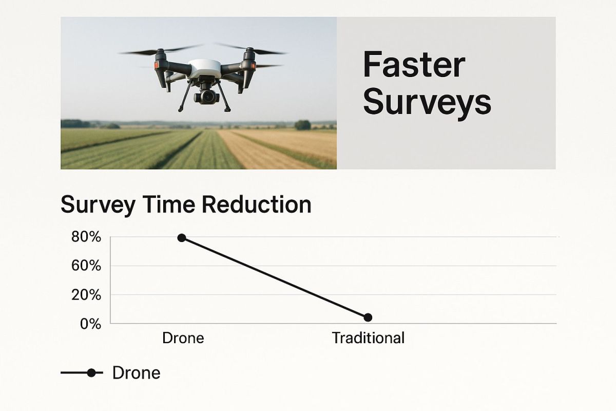
You can cover huge areas in a fraction of the time it would take a ground crew, which is a game-changer for project timelines.
LiDAR: The Power of Laser Precision
While photogrammetry uses existing light to take photos, LiDAR (Light Detection and Ranging) is an active system. The best analogy is a bat using echolocation. A LiDAR sensor on a drone fires out thousands of laser pulses every single second. These pulses hit the ground and everything on it, bouncing back to the sensor.
The system measures the tiny amount of time it takes for each pulse to return. By calculating this "time-of-flight," it figures out the exact distance to millions of individual points, creating an incredibly dense and accurate 3D point cloud. This method is brilliant at picking up fine details and, crucially, can penetrate through vegetation.
LiDAR’s real superpower is its ability to ‘see’ through gaps in a forest canopy or dense scrub to map the true ground surface underneath. This is something photogrammetry just can’t do, making LiDAR the go-to for forestry and terrain modelling in vegetated areas.
Because it brings its own light source, LiDAR isn't bothered by cloudy days or low light, giving you a much wider operational window than photogrammetry, which needs good light to work well. If you're keen to go deeper, you can find out more about what makes LiDAR for drone surveys so effective for these kinds of complex jobs.
Choosing the Right Tool for the Job
So, which one should you use? The answer really comes down to what you need to achieve, your budget, and what the site is like.
To make it simple, here’s a quick comparison of the two technologies.
Photogrammetry vs LiDAR at a Glance
| Feature | Photogrammetry | LiDAR |
|---|---|---|
| Technology | Passive; uses reflected light (photos) to create 3D models. | Active; uses emitted laser pulses to measure distances. |
| Primary Output | Colourised point clouds, photo-realistic orthomosaics, and 3D mesh models. | Highly accurate, dense point clouds and bare-earth terrain models. |
| Accuracy | Very good, but can be affected by shadows, uniform surfaces, and light. | Extremely high, especially for vertical measurements. Unaffected by lighting. |
| Vegetation Penetration | Poor. Maps the top of the canopy or vegetation. | Excellent. Can penetrate through gaps to map the ground beneath. |
| Cost | Generally lower cost for hardware and software. | Higher initial investment for sensor and processing software. |
| Best For | Visual inspections, construction site monitoring, agriculture, open-pit mines. | Forestry, corridor mapping (powerlines, railways), flood modelling. |
Ultimately, there's no single "best" tool—only the right tool for your specific project.
Photogrammetry is your best bet when you need:
- High-resolution, photo-realistic maps for visual checks.
- A more budget-friendly survey for open areas like construction sites or farms.
- Colourised 3D models where visual context is key.
LiDAR is the clear winner for:
- Surveying heavily vegetated or forested land to map the bare earth.
- Projects that demand the highest level of vertical accuracy, like mapping powerline corridors.
- Mapping long, linear infrastructure where capturing fine details is critical.
Sometimes, the best approach is to combine them. Using photogrammetry to provide the rich visual context and LiDAR to deliver that unbeatable terrain accuracy can give you the most complete picture of your site.
Planning Your UAV Survey Mission
Great data is never an accident. It’s always the result of a great plan. This is where the theory behind the tech meets the real world, and where the success of your aerial surveying uav mission is decided. Think of it like a pilot’s pre-flight checklist—every step is deliberate, methodical, and non-negotiable for a safe flight and high-quality data.
This isn't just about getting a drone in the air. It’s a strategic process of defining your goals, setting the right flight parameters, and thinking through every variable that could throw a spanner in the works. A solid plan means you capture the right data the first time, saving you a world of headaches, time, and money down the track.
Defining Your Survey Area and Objectives
First things first: what are you actually trying to achieve? Are you mapping a construction site to check on progress, figuring out stockpile volumes for a mine, or checking in on crop health for a farmer? Your end goal shapes every single decision you make from this point on.
Once the objective is crystal clear, you need to map out the survey area with precision. This usually involves drawing a digital boundary over satellite imagery inside your flight planning software. This boundary tells the drone exactly where to fly, making sure you get full coverage of the target zone without chewing through battery life on areas that don't matter.
Establishing Critical Flight Parameters
With your survey area locked in, it’s time to dial in the flight parameters. These technical settings are the nuts and bolts of your mission and directly influence the quality and accuracy of your final data. Nailing these is absolutely critical for a successful aerial surveying uav operation.
A few key parameters you’ll need to configure are:
- Altitude: Flying lower gets you super high-resolution images, but it takes more time (and battery swaps) to cover the same ground. Flying higher is much more efficient but gives you a lower ground sampling distance (GSD), meaning less detail.
- Image Overlap: This is one of the big ones. You need a high degree of overlap—typically 70-80% both in front of and to the side of the drone's path. This is essential for the photogrammetry software to properly stitch the images together into a seamless, accurate 3D model.
- Flight Speed: You have to find the sweet spot between the drone's speed and the camera's shutter speed. Go too fast, and you’ll end up with motion blur, which can make your data completely useless.
Think of these parameters as the recipe for your survey. If you get the ingredients or measurements wrong—too little overlap or too much speed—the final dish simply won't turn out right. Meticulous setup here prevents major headaches later.
Modern software takes a lot of the guesswork out of this. You can see how new flight planning software like I-GCS helps automate these complex calculations to get the best results.
The Role of Ground Control Points
If your survey demands serious, survey-grade accuracy, then Ground Control Points (GCPs) are non-negotiable. GCPs are physical markers you place on the ground across your site. You then measure their exact geographic coordinates with high-precision GPS gear.
Imagine trying to pin a giant, wobbly map to a wall. Without any pins, the map would sag, warp, and be in the wrong spot. GCPs are your pins. They anchor your digital drone map to its precise, real-world coordinates. By tagging these points in your processing software, you correct any tiny errors and ensure your final model is centimetre-perfect.
Navigating Australian Airspace Regulations
Finally, no mission plan is complete until you’ve sorted out the legal side of things. In Australia, the Civil Aviation Safety Authority (CASA) sets the rules for all drone operations. Before you even think about taking off, you have to check airspace restrictions, be aware of any local council rules, and make sure your flight follows CASA's standard operating conditions.
This means things like keeping the drone within your visual line-of-sight, staying below height limits, and not flying over people without the right approvals. Planning for compliance isn't just about ticking boxes to avoid a fine; it’s about operating safely and professionally.
Turning Raw Data into Actionable Insights
The mission doesn’t end when the drone lands. In fact, that’s where the real work of an aerial surveying uav begins. Capturing thousands of images or millions of laser points is just step one. The next, and most crucial, phase is transforming all that raw data into clear, measurable intelligence you can actually use.
Think of it like being a chef with a basket of fresh ingredients. The produce is high-quality, but it isn't a meal yet. It takes skill, the right tools, and a solid recipe to turn it into something valuable. In the world of drone surveying, specialised software is your kitchen, and your raw data is waiting to be prepped.
This process involves feeding the collected data into powerful photogrammetry or LiDAR software. The software then meticulously analyses, aligns, and stitches everything together to create sophisticated final products.
From Raw Files to Tangible Deliverables
The output of data processing isn't just a pretty picture; it’s a collection of highly accurate, data-rich deliverables that professionals rely on to make critical decisions. After data collection, the raw information needs to be transformed into usable insights. Companies offering specialized data processing services can help extract the most value from your UAV survey data, turning complex datasets into clear reports.
The three primary outputs you’ll work with are:
- 3D Point Clouds: This is often the first major output. It's a massive collection of individual points, each with its own X, Y, and Z coordinate in space. The result is a stunningly detailed 3D digital replica of your entire survey area, forming the foundation for all other models.
- Digital Surface Models (DSMs): A DSM is a 3D map showing the elevation of every feature on the site—from buildings and vegetation to machinery and stockpiles. It gives you a complete topographical view of the surface, just as the drone saw it from above.
- Orthomosaic Maps: An orthomosaic is a giant, high-resolution aerial map stitched together from hundreds of individual photos. Unlike a standard aerial image, it’s geometrically corrected for distortion, meaning every pixel is in its true geographic location. This allows you to take precise distance and area measurements directly from the map itself.
The Software Powering the Process
Turning raw data into these polished deliverables requires robust processing software. The industry relies on several key platforms, each with its own strengths. Professional surveyors often use software like Pix4D, Agisoft Metashape, or Trimble Inpho.
These programs are the workhorses of the aerial surveying uav industry. They handle the immense computational load of aligning thousands of images, generating dense point clouds, and creating seamless orthomosaics. Cloud-based platforms like DroneDeploy also offer a streamlined workflow, allowing for processing and collaboration directly online.
The choice of software often depends on the project's complexity and the specific outputs required. For rapid, in-field assessments, a tool like Pix4Dreact can generate maps quickly offline, while more detailed engineering projects might require the advanced features of Pix4Dmapper or Matic for centimetre-level accuracy.
Ensuring Your Data Is Reliable
Creating a model is one thing; ensuring it's accurate is another. Quality control is a non-negotiable step in the data processing workflow. It's how you verify that your final models are reliable enough for making important financial or safety-related decisions.
A thorough quality check involves a few key steps:
- Checking the Processing Report: All professional software generates a detailed quality report. This document provides key metrics on camera calibration, image alignment, and the accuracy of your Ground Control Points (GCPs).
- Visual Inspection: You have to get your eyes on it. Carefully examine the 3D model and orthomosaic for any distortions, gaps, or blurry areas. These can indicate issues with image overlap, poor lighting during the flight, or processing errors.
- Verifying with Checkpoints: Use independent, known survey points (checkpoints) that weren't used in the initial processing to validate the model's absolute accuracy. Comparing the model's coordinates to the known checkpoint coordinates gives you a true measure of its reliability.
By following this diligent process, you can confidently turn raw drone data into actionable insights that drive smarter, faster, and safer project outcomes.
How Australian Industries Use UAV Surveying
All the theory is great, but the real magic of an aerial surveying UAV is seeing it solve real-world problems. Across Australia, industries are swapping old-school methods for drone technology to work faster, safer, and with a level of detail that just wasn't possible before. Every use case tells a story of a challenge overcome and a clear return on investment.
This isn't just a fleeting trend—it's a massive economic shift. The market for aerial surveying UAVs in Australia is booming, with both commercial companies and government bodies getting on board. The Australian drone market was valued at around USD 614 million in 2024 and is expected to climb to USD 1.5 billion by 2033. This growth is fuelled by how brilliantly drones can map our vast, remote landscapes where traditional surveying just can't keep up. You can read more about the Australian drone market's growth on imarcgroup.com.
Agriculture Is Seeing Big Results
On the farm, UAVs have become the ultimate high-tech farmhand. Farmers are sending up drones with multispectral sensors to get a complete picture of crop health. These sensors pick up on subtle signs of stress in plants that you’d never see with the naked eye, pointing out exactly where to apply water, fertiliser, or pesticides.
This targeted strategy is the heart of precision agriculture. It means farmers use fewer resources and get better yields. Instead of blanket-treating an entire field, they can focus on the specific patches that need attention, saving money and running a more sustainable operation. For a closer look, have a read of our guide on how precision agriculture with drones is changing the game.
Mining and Resource Management
Australia’s mining sector is enormous, and even a tiny inefficiency can cost a fortune. UAVs have completely changed how companies manage these huge sites, especially when it comes to calculating stockpile volumes.
What used to take a ground crew several days can now be done by an aerial surveying UAV in a few hours. The drone flies over, captures the data for a precise 3D model of the stockpile, and from that, you get an exact volume measurement.
This quick turnaround means mine operators can do inventory checks more often, which is fantastic for logistics, planning, and keeping the accountants happy.
Construction and Infrastructure
Keeping a busy construction project on track is all about knowing what’s happening on the ground. Project managers are now using aerial surveys to create 3D models of their sites every week, or sometimes even daily.
These models give them a perfect bird's-eye view to check on progress, spot potential hold-ups, and make sure everything is being built to spec. It smooths out communication between everyone involved—from the architects to the clients—and helps teams catch problems early.
Environmental and Disaster Management
It’s not just about business, either. UAVs have become critical tools for looking after our environment and responding to emergencies. Conservationists use them to monitor coastal erosion, check the health of fragile ecosystems, or assess the damage after a bushfire with incredible speed.
When a natural disaster hits, that speed is everything. Drones can quickly map out an affected area, helping emergency services figure out where to send help first. They're also being used to prepare for future events, with applications like UAVs for flood zone mapping helping to model risks and protect communities before disaster strikes.
Getting It Right: Accuracy and Compliance in Aerial Surveying
Flying a survey drone is one thing, but getting results you can actually rely on is a whole different ball game. It’s not just about having the latest tech or a slick flight plan. The real secret sauce for any professional UAV operation comes down to two things: an obsession with accuracy and a non-negotiable commitment to the rules.
This is what separates the pros from the amateurs. It’s how you deliver survey-grade data that clients can trust to make critical decisions, time and time again.
Think of it this way: accuracy is the concrete slab your entire project is built on. Without it, that stunning 3D model you’ve just created is nothing more than a pretty picture. It's useless for any real-world engineering, planning, or analysis. Nailing that precision starts well before the drone's props even start spinning.
Best Practices for Pinpoint Accuracy
Getting your data right isn't about luck; it's about process. Building a few key habits into your workflow will make a world of difference in minimising errors and getting consistently clean results.
- Pick Your Weather Wisely: The perfect day for flying isn't necessarily a bright, sunny one. Overcast skies are your best friend, giving you soft, even light. Harsh sunlight creates deep shadows that can really throw off photogrammetry software. And it goes without saying, high winds are a no-go—they’ll cause drift, which leads to blurry, unusable photos.
- Lock Down Your Camera Settings: Before you even think about taking off, manually set and lock your camera’s focus, exposure, and white balance. If you leave these on auto, the camera will make tiny adjustments mid-flight, creating subtle inconsistencies between photos that become a major headache during processing.
- Be Smart with Your GCPs: Don't just scatter your Ground Control Points around and hope for the best. You need to place them strategically. Spread them evenly across your entire survey area, making sure to hit the highest and lowest spots. This is what properly anchors your digital model to the real world.
Staying on the Right Side of the Law
Technical skill gets you halfway there, but operating as a professional means doing things by the book. In Australia, that means playing by the rules set out by the Civil Aviation Safety Authority (CASA) and showing a healthy respect for people's privacy.
The best way to bake accuracy and compliance into every job is to know how to create effective Standard Operating Procedures. This gives you a repeatable, safe, and professional framework for every single mission.
Keeping detailed flight logs, running pre-flight risk assessments, and respecting no-fly zones aren't just good ideas—they are core duties for any commercial operator. This isn't bureaucracy; it's what protects your business, your clients, and the public.
This discipline is more important than ever. Drones have completely changed the game for jobs like infrastructure inspection and public safety here in Australia. In fact, the Australian UAV market is expected to grow at a CAGR of 12% over the next ten years, potentially hitting AUD 2,988 million by 2034.
As drones become a common sight for inspecting critical infrastructure or helping law enforcement, a professional, rule-abiding approach is what will keep the industry strong and trusted. Following these guidelines ensures your work is not only technically brilliant but also legally and ethically sound.
Got Questions? We've Got Answers
Stepping into the world of drone surveying can feel a bit like learning a new language. There are always practical questions that pop up, especially when you're just starting out in Australia. Let's tackle some of the most common ones to help you get your bearings.
How Much Ground Can a Drone Actually Cover in a Day?
This is a classic "it depends" question, but the answer really hinges on your drone and how detailed you need the data to be.
If you're using a fixed-wing drone—the kind that looks more like a small plane—you're built for endurance. These workhorses can easily map over 500 hectares in a day. On the other hand, a multi-rotor drone (the more common quadcopter style) is better for tricky, smaller sites. Because of their shorter battery life, you're looking at a range of 50 to 150 hectares per day.
How Much Does Bad Weather Mess Things Up?
Honestly, bad weather is the biggest roadblock to getting clean, reliable data.
High winds are a nightmare; they push the drone off its flight path, leading to blurry photos and wonky 3D models. Heavy cloud cover isn't much better, as it casts dark, moving shadows that can completely throw off photogrammetry software. And rain? That's a hard stop. It's not just bad for the electronics, it also messes with the sensor readings.
The golden rule for a successful survey mission? Fly on a calm, overcast day. This gives you soft, even light without any harsh shadows, which is the perfect recipe for crisp, consistent images across your entire project area.
Do I Really Need a Special Licence to Do This in Australia?
For any commercial work, the answer is a firm yes.
To fly a survey drone legally for business in Australia, you can't just take it out of the box and go. You'll need to be a certified pilot with a Remote Pilot Licence (RePL). On top of that, the business itself needs a Remotely Piloted Aircraft Operator's Certificate (ReOC) from the Civil Aviation Safety Authority (CASA). It's all about ensuring safety and professionalism.
Ready to see what professional drone technology can do for your surveying projects? Innoflight Technology provides a full suite of advanced UAV systems built for accuracy and reliability. Explore our drone solutions and discover the right tool for your work.