Ever wondered how your phone magically finds the quickest way home, dodging traffic you can't even see yet? Or how a farmer knows, down to the square metre, which part of their crop needs a bit more water? The secret sauce behind all of this is geomatics.
It’s a field that has quietly woven itself into the fabric of our modern world, going far beyond simple map-making.
Understanding Geomatics and Why It Matters

Think of geomatics as the discipline that connects our physical world to its digital counterpart. It takes the centuries-old practice of land surveying and supercharges it with an arsenal of modern tech to capture, manage, and interpret spatial information.
The whole point is to answer the question of where things are and, more importantly, why that location matters. It's not just about putting a pin on a map; it's about creating rich, layered digital models that help us make smarter decisions about our environment.
The Building Blocks of Geomatics
At its heart, geomatics is a structured process. It’s a systematic way of making sure the geographic data we collect is accurate, reliable, and actually useful for solving real problems.
The workflow breaks down into a few key stages:
- Data Acquisition: This is where it all begins. Information about the Earth's surface is gathered using tools like satellites, drones, LiDAR scanners, and GPS receivers.
- Data Processing: Raw data from the field can be a bit of a mess. This step involves cleaning it up, making corrections, and getting it organised into a structured format.
- Data Analysis: Once the data is clean, specialists use powerful software to dig in and find patterns, connections, and trends that aren't obvious at first glance.
- Data Visualisation: Finally, all those complex findings are turned into something we can easily understand—like interactive maps, detailed 3D models, or insightful charts.
The real magic of geomatics is its ability to transform millions of disconnected geographic data points into a clear, coherent story. A story that guides crucial decisions everywhere from city planning to emergency management.
To get a clearer picture of how these pieces fit together, here's a quick summary.
Geomatics at a Glance
| Component | Simple Explanation | Example in Daily Life |
|---|---|---|
| Data Acquisition | Gathering location-based information about the world around us. | Your phone's GPS tracking your location for a ride-share app. |
| Data Processing | Cleaning and organising raw spatial data to make it accurate and usable. | A mapping app correcting GPS drift to place you on the right road. |
| Data Analysis | Finding meaningful patterns and insights within the geographic data. | A weather app analysing atmospheric data to predict rain in your area. |
| Data Visualisation | Presenting the spatial information in a visual, easy-to-understand way. | Seeing a real-time traffic map with red, yellow, and green routes. |
This table shows how the technical steps of geomatics translate directly into the convenient tools we rely on every day.
Take a drone flying over a construction site, for instance. It isn’t just snapping photos. It’s capturing thousands of images, each tagged with precise geographic coordinates. Through the geomatics workflow, these images are stitched together into an incredibly accurate 3D model.
Project managers can then use this "digital twin" to track progress, calculate the volume of materials on-site, and check that safety protocols are being followed. As the technology has matured, the powerful combination of drones and GIS has made this kind of detailed oversight easier and more affordable than ever.
This ability to create a digital replica of a physical space is what makes geomatics so indispensable today. It gives us the power to see, measure, and understand our world in ways we never could before.
Exploring the Core Technologies of Geomatics
Geomatics isn't just one thing; it's a powerful combination of tools that work together to capture and make sense of our world. Think of it like an orchestra—each instrument plays a distinct part, but the real magic happens when they all play in harmony. These technologies are the building blocks that transform raw spatial data into actionable intelligence.
At its heart, geomatics brings together several key disciplines. The infographic below shows the main pillars that hold up the entire field.
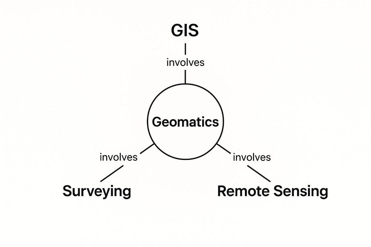
As you can see, GIS, surveying, and remote sensing are the central components. Each one contributes specialised data and analysis techniques to the geomatics toolkit.
Geographic Information Systems as Smart Maps
Geographic Information Systems, or GIS, are the brains behind the operation. Don't think of a GIS as just a flat, static map. Instead, picture it as an intelligent, dynamic map built from many transparent layers stacked on top of each other.
Each layer holds a different type of information for the same geographic area. A city planner, for example, could use GIS to:
- Start with a base layer of satellite imagery.
- Overlay a second layer showing property boundaries.
- Add a third layer that maps out underground water pipes.
- Finally, pop on a fourth layer detailing zoning regulations.
By toggling these layers on and off, they can see complex relationships in a way that just wasn't possible before. They could instantly find all residential properties within 50 metres of a major water main. This ability to query and visualise data is what makes GIS such a vital tool for decision-making.
Remote Sensing for a Bird’s-Eye View
Remote sensing is the science of gathering information about the Earth’s surface without ever physically touching it. It’s like taking the planet's pulse from a distance. This is usually done with sensors mounted on satellites, aeroplanes, and—more and more these days—Unmanned Aerial Systems (UAS).
These sensors capture data from across the electromagnetic spectrum, seeing much more than the human eye can. This allows specialists to do things like monitor deforestation, track urban growth, or assess the health of crops over huge areas.
Remote sensing gives us the large-scale context. It provides a comprehensive picture of environmental patterns and changes over time that would be impossible to see from the ground.
GNSS and LiDAR for Pinpoint Accuracy
While remote sensing gives us the big picture, other technologies provide the fine details. Global Navigation Satellite Systems (GNSS)—which includes the GPS we all know—is the technology that gives us precise location information. High-end receivers can pinpoint a spot on Earth with centimetre-level accuracy, which is fundamental for modern surveying. For a closer look at this technology, you can explore more about how RTK GPS achieves such incredible precision.
Meanwhile, Light Detection and Ranging (LiDAR) essentially "paints" the world with lasers. A LiDAR scanner fires out millions of light pulses every second, measuring the time it takes for them to bounce back. This process generates a dense "point cloud"—a stunningly detailed 3D digital model of the terrain, buildings, and even individual trees. This is critical for creating accurate digital twins of infrastructure or highly detailed topographic maps. For those interested in advanced applications, learning about commercial aerial photogrammetry offers deeper insights into building precise 3D models.
A New Era for Surveying and Mapping
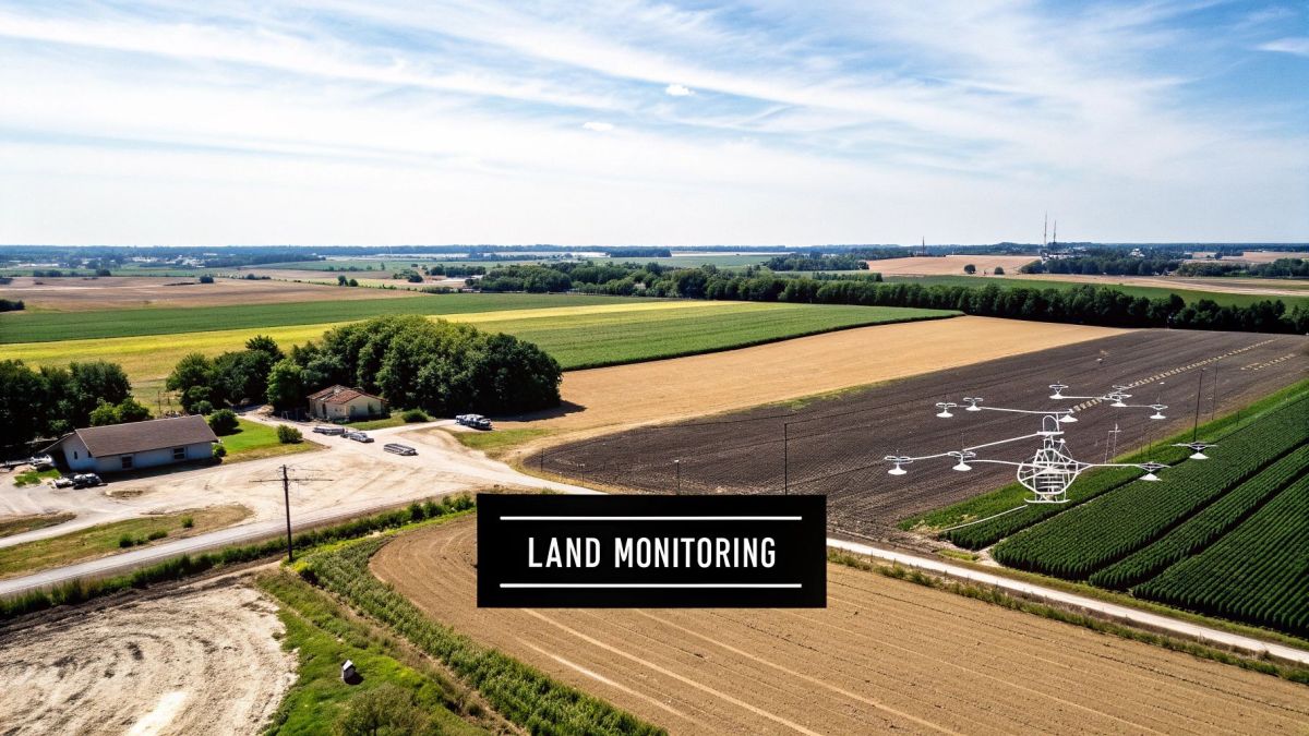
Geomatics has completely changed the game for the ancient practice of surveying. It’s taken what was once a slow, manual grind and turned it into a fast-paced digital discipline. Not long ago, surveying teams would spend weeks out in the field with their basic tools. Now, a modern surveyor can get more done in a single day than their predecessors could in a whole month.
This incredible leap forward is all thanks to a new toolkit. Today's surveyors use drones, high-precision GNSS receivers, and LiDAR scanners to gather huge amounts of spatial data with astonishing speed and accuracy. These tools all work together to build detailed 3D models of land, buildings, and essential infrastructure, giving us a complete digital picture of a site.
But these changes aren't just about doing things faster; they're about fundamentally changing how we plan and manage projects from the ground up.
The Modern Digital Mapping Workflow
The way we create digital maps today is a perfect example of geomatics in action. It's a process that turns the physical world into a digital asset we can measure, analyse, and update whenever we need to. This workflow generally breaks down into a few key steps.
- Flight Planning: Before a drone even leaves the ground, a surveyor uses special software to map out an automated flight path. This planning makes sure the drone captures images with the right amount of overlap and at the perfect altitude needed to create a precise model.
- Data Capture: The drone then follows this pre-set route, snapping hundreds or even thousands of high-resolution pictures. Every single image is geotagged with exact GNSS coordinates, creating the raw data for the final map.
- Data Processing: Back at the computer, photogrammetry software gets to work. It finds common points across all the photos and uses them to stitch everything together into a seamless, measurable 3D model or a flat orthomosaic map.
This digital workflow brings massive improvements in efficiency and data quality. Perhaps most importantly, it dramatically boosts safety. Surveyors can now map dangerous or hard-to-reach places—think steep cliff faces or active motorways—without ever putting themselves in harm's way.
The real magic of geomatics in surveying is its ability to create a 'digital twin'—a precise, data-rich virtual copy of a real-world asset. This model acts as the single source of truth for planning, construction, and long-term maintenance.
The history of mapping in Australia really puts this progress into perspective. Captain James Cook’s 1770 charting of over 2,800 kilometres of coastline was an incredible achievement for its time. Today, that legacy is carried on by national bodies like Geoscience Australia, who maintain detailed digital maps of the entire continent—a task only possible because of modern geomatics. You can dive deeper into the fascinating evolution of Australian maps online.
From planning major construction projects and developing land to managing our critical infrastructure, geomatics gives us the detailed spatial intelligence we need to build and maintain our world better than ever before.
How Geomatics Is Used in the Real World
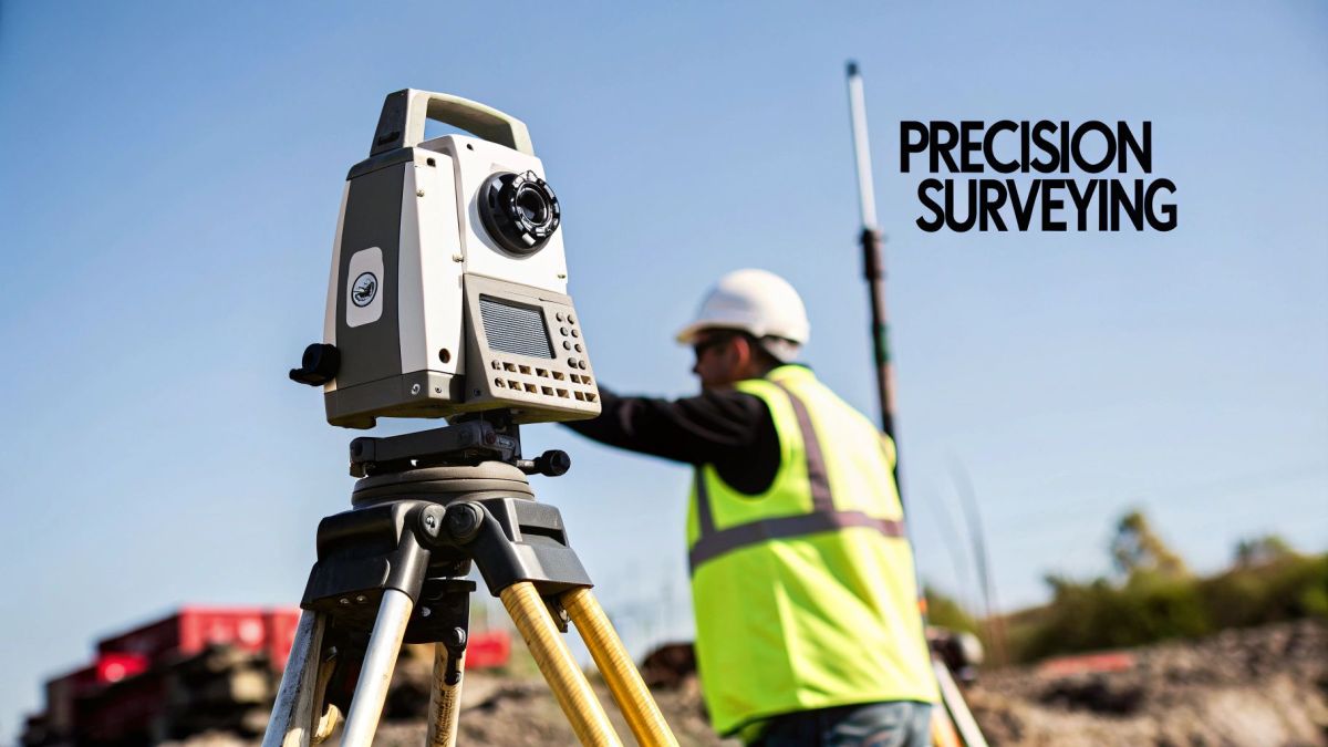
The theory is one thing, but the real power of geomatics shines when you see it solving tangible problems. This isn't some abstract field stuck in a university lab; it’s a practical discipline that gives us the spatial intelligence to manage our world better. Geomatics gives us a powerful lens to understand and interact with our environment, whether that’s protecting fragile ecosystems or building smarter cities.
Its applications are incredibly diverse because almost every industry has a "where" question. Knowing the specific location and context of assets, events, or resources is the key to boosting efficiency, cutting risks, and making smarter calls. Let’s look at a few examples of geomatics in action.
Environmental Management and Conservation
To protect our planet, we first have to understand it. Geomatics gives us the tools to monitor the health of our environment on a massive scale. Conservationists, for example, rely on satellite remote sensing to track landscape changes that are simply impossible to see from the ground.
Think about monitoring deforestation in the Amazon. Analysts can compare satellite images over time to spot illegal logging almost as it happens, allowing authorities to step in. In the same way, multispectral sensors can detect subtle colour changes in coral reefs, flagging coral bleaching events early on.
This kind of large-scale monitoring gives environmental managers the hard data they need to protect biodiversity, manage natural resources sustainably, and actually measure if their conservation efforts are working.
The Rise of Precision Agriculture
Farming has gone high-tech, and geomatics is at the heart of what’s known as precision agriculture. The idea is straightforward: instead of treating a whole field the same, farmers use geomatics to manage it on a micro-level, applying water, fertiliser, or pesticides only where they’re truly needed.
Here’s how it typically works:
- Data Collection: A drone with specialised sensors flies over a crop. It captures data showing tiny variations in plant health, soil moisture, and nutrient levels across the field.
- Analysis and Prescription: This spatial data gets plugged into a GIS platform to create a "prescription map." This map pinpoints zones that need more attention.
- Targeted Application: The prescription map is then loaded into GPS-guided machinery, like tractors and sprayers. This equipment automatically adjusts how much it applies as it moves across the field, following the map’s instructions perfectly.
This data-first approach helps farmers seriously boost their crop yields while cutting back on water and chemical use. The result? A more profitable farm and a more sustainable way of growing our food.
Optimising Urban Planning and Services
Geomatics is also essential for navigating the complexities of modern cities. Urban planners and local governments depend on GIS to analyse spatial patterns and make better decisions about how our communities grow and operate.
Take traffic management. By looking at GPS data from vehicles, planners can find traffic bottlenecks, simulate how a new road might affect congestion, and even optimise traffic light timing to improve flow. This same kind of location analysis helps them figure out the best spots for new parks, schools, and bus routes so they serve the community fairly.
Essentially, geomatics helps create a "digital twin" of a city. This model allows officials to run different scenarios, plan infrastructure more effectively, and deliver public services right where they're needed most. It's all about creating smarter, more liveable cities for everyone.
Using Geomatics for Disaster Response and Climate Resilience
Beyond its commercial and planning applications, geomatics has a profound role in protecting communities and building a more resilient future. When disaster strikes, the ability to see and understand what's happening on the ground in real-time isn't just helpful—it saves lives. Geomatics delivers the critical spatial intelligence that emergency responders need to act fast.
Take a bushfire, for example. Emergency services use a constant stream of satellite imagery and aerial survey data to map the fire's perimeter. This information is plugged straight into GIS platforms, which can then predict the fire's likely path by analysing terrain, fuel load, and weather. This allows authorities to orchestrate targeted evacuations and send crews where they’re needed most.
Proactive Planning for Climate Events
Geomatics is just as powerful when used for planning before a disaster hits. For communities in flood-prone areas, high-resolution LiDAR data is used to create incredibly precise digital elevation models. These models allow hydrologists to simulate different flood scenarios and generate detailed inundation maps.
These maps show exactly which homes, roads, and critical assets are most at risk. Armed with this knowledge, local councils can reinforce defences or develop smarter emergency plans. The same logic applies to managing our coastlines.
- Sea-Level Rise Modelling: Geomatic analysis helps coastal communities visualise the long-term impacts of rising sea levels, pinpointing vulnerable zones.
- Adaptation Strategies: This data informs practical adaptation measures, like building seawalls or restoring natural buffers like mangrove forests.
- Infrastructure Resilience: It guides decisions on where to build new infrastructure, ensuring it’s placed away from projected high-risk areas.
Geomatics in Australian Hazard Management
Australia’s unique environmental challenges make geomatics an essential tool for monitoring natural hazards. The devastating 2019–2020 ‘Black Summer’ bushfires burned over 18.6 million hectares and underscored the urgent need for advanced spatial technology. Geomatics tools were vital for real-time fire mapping and post-disaster assessment, processing countless data points to guide the emergency response.
Similarly, national flood mapping programs rely on high-resolution elevation data to protect communities at risk. You can discover more about how this data is used for landform and hazard analysis on the Geoscience Australia website.
Geomatics shifts disaster management from a reactive posture to a proactive one. It allows us to not only respond more effectively but also to anticipate risks and build resilience into the fabric of our communities.
The data and analytical power of geomatics are also fundamental to developing advanced climate risk assessment tools. Information gathered by UAS platforms is especially valuable here.
In search and rescue missions, drones equipped with thermal sensors can quickly find missing people in tough terrain, day or night. You can learn more about how drones are used for rescue operations in our detailed guide. These real-world examples show just how valuable geomatics is in a world facing more and more environmental challenges.
Got Questions About Geomatics? Let's Clear Things Up
Even after breaking it all down, you might still have a few questions rattling around. That's completely normal. Geomatics is a dynamic field that crosses paths with a few other disciplines, and nailing down the differences is key to really getting it.
Let's walk through some of the most common questions to connect those final dots. By the end, you'll have a much stronger grasp of where geomatics fits into the world of science, tech, and business.
What’s the Difference Between Geomatics and GIS?
This is easily the most common point of confusion, but a simple analogy helps clear it up instantly.
Think of geomatics as the entire kitchen. It’s the whole operation—the raw ingredients, the stove, the knives, the chef, and the final meal plated up and ready to serve. A Geographic Information System, or GIS, is just one crucial appliance in that kitchen, like the oven. You can't cook the meal without it, but it's not the whole kitchen.
Geomatics is the big-picture discipline. It covers all the methods we use to collect, process, and manage geographic data, from traditional land surveying and satellite navigation to advanced remote sensing. GIS, on the other hand, is the specific software tool we use to analyse, interpret, and visualise that data.
In short, GIS is a vital tool within the much larger geomatics process. You use geomatics techniques to gather the data, then you fire up your GIS software to make sense of it all.
What Kind of Career Can I Have in Geomatics?
The career paths in geomatics are incredibly diverse and expanding fast. The demand for professionals who can wrangle location-based data has never been higher. While classic roles like Land Surveyor are still absolutely essential, the field has blown wide open.
Today, you could find yourself working as a:
- GIS Analyst: Building maps and crunching spatial data to help cities with urban planning, logistics companies optimise their delivery routes, or environmental agencies manage conservation efforts.
- Remote Sensing Specialist: Using satellite or aerial imagery to monitor deforestation, check on crop health for farmers, or map out mineral deposits for mining companies.
- Geospatial Data Scientist: Diving deep into huge spatial datasets, using machine learning and advanced analytics to spot trends and build predictive models for everything from real estate to public health.
These experts are in high demand everywhere, from construction and mining firms to the big tech companies building the next generation of mapping apps we'll all be using.
What Skills Do I Need to Work in Geomatics?
To really succeed in this field, you need a solid mix of technical know-how and sharp analytical thinking.
On the technical front, you’ve got to be comfortable with the core tools of the trade. That means getting hands-on experience with GIS software like ArcGIS or the open-source QGIS, along with remote sensing platforms and various data processing applications.
But technology is only half the story. You also need to be a great problem-solver with a keen eye for detail. As the amount of spatial data we're collecting continues to explode, other skills are becoming just as important. Knowing how to code, especially using Python to automate tasks, is a massive advantage. A good handle on database management and data science principles will also put you ahead of the pack.
At Innoflight International, we build the advanced UAS platforms and high-precision sensors that drive modern geomatics. From LiDAR mapping to intricate infrastructure inspections, our drone solutions deliver the pinpoint accuracy and reliability your projects depend on. Explore our systems to see how we can support your spatial data needs.