Picture this: a first responder that can soar over raging floodwaters, peer through thick smoke, and locate a stranded person in mere minutes. That's no longer science fiction; it's the new reality with drones for rescue. This guide isn't about hobbyist gadgets—it's about how these powerful tools are becoming essential for modern emergency services, helping teams act faster, see clearer, and stay safer.
The New Frontline in Emergency Response
In the chaos right after a disaster, every single second counts. For decades, emergency services had to rely on ground crews and helicopters—both of which have their limits. Ground teams often face impassable terrain, while helicopters are expensive and can take a long time to get airborne. Both methods can put responders themselves in harm's way.
The game has changed with the arrival of sophisticated drones for rescue. These aren't your average flying cameras. They are specialised, rugged tools that give first responders an immediate set of eyes in the sky. Think of them as a scout that can be deployed in under two minutes, ready to go into places people simply can’t, or shouldn't.
A New Era of Situational Awareness
This leap forward is supported by critical infrastructure like FirstNet, the dedicated broadband network for first responders, which provides the reliable, high-speed data connection needed to stream live video and sensor data from the field. It’s this seamless connectivity that turns a drone into a life-saving intelligence tool.
So, what are the real-world advantages?
- Rapid Deployment: Drones can be launched from the back of a vehicle, giving teams an aerial perspective long before a helicopter could even get off the ground.
- Enhanced Safety: Responders can now assess chemical spills, check the stability of a collapsed building, or map the edge of a bushfire, all from a safe distance.
- Cost-Effectiveness: A drone is far cheaper to operate than a manned aircraft. This makes advanced aerial capabilities accessible to almost any agency, big or small.
- Superior Data Collection: With high-resolution cameras, thermal sensors, and powerful zoom lenses, drones gather incredibly detailed information that a person on the ground could never see.
Bringing drones into the fold is about more than just a tech upgrade; it’s a whole new way of thinking. It’s about using technology to make smarter, faster, and safer decisions when lives are hanging in the balance. And we're only just scratching the surface of what’s possible.
The numbers tell the story. Drone flights in Australia are expected to skyrocket from 1.5 million annually to over 60 million by 2043. Emergency services will be a massive part of that growth, with frontline police operations tipped to exceed 300,000 drone flights per year and surf lifesaving missions reaching 80,000 annually.
This incredible growth highlights just how valuable drones for rescue have become. Whether it's a thermal drone finding a lost hiker in the bush at night or a UAV dropping a flotation device to a swimmer in distress, these aerial platforms are proving their worth day in and day out. They give our police, firies, and surf lifesavers the power to turn near-impossible situations into successful rescues.
What Makes a Rescue Drone Different?

So, what’s the real difference between a regular camera drone and one that can save a life? It all comes down to the specialised tech packed inside. Drones for rescue aren’t your average off-the-shelf hobby models; they are robust, purpose-built tools designed to perform under the immense pressure of an emergency.
Think of it this way: a standard drone is like a pair of binoculars—it gives you a better view, but that's about it. A true rescue drone, however, is like a complete field toolkit. Each component has a specific, often life-saving, job to do. Let's get into what really gives these machines their power.
H3: Seeing Through Walls and Darkness with Advanced Sensors
Without a doubt, the most important feature of any drone for rescue is its imaging system. We’re talking about technology that goes way beyond a standard camera, allowing operators to see things and gather information in conditions that would leave a human completely blind.
-
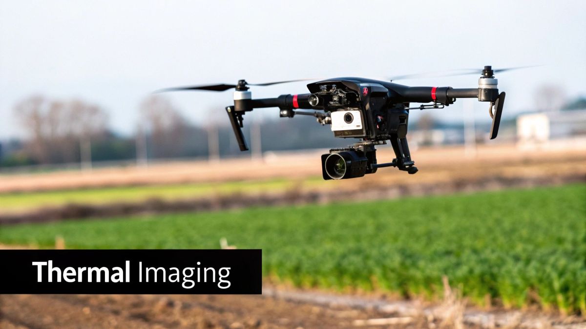
Thermal Imaging Cameras: These are absolute game-changers in the field. A thermal camera doesn’t see visible light; it sees heat. This is what allows a pilot to spot a person's body heat against a cold mountainside in the dead of night, or find someone huddled in thick smoke or fog. To the naked eye, they'd be invisible. On a thermal feed, they stand out as a clear, bright silhouette.
-
High-Zoom Cameras: Getting a detailed look without putting your team in harm's way is critical. High-resolution zoom cameras let operators inspect a structurally compromised building, check a vehicle's registration plate, or assess an injured person's condition from hundreds of metres away. This single capability keeps rescuers out of the immediate danger zone while they gather the intel they need to plan their next move.
These two sensors are often used together, giving crews a much fuller picture of the situation on the ground. A pilot can flick between the thermal and visual feeds in an instant to confirm a heat signature is a person and not just an animal or a warm rock.
The Essential Features of a Lifesaving Drone
To truly understand their impact, it helps to see how each piece of technology directly translates into a real-world rescue function. These aren’t just fancy features; they are practical tools that solve specific problems when time is running out.
Here’s a breakdown of the key technologies and how they're applied in the field.
| Technology Feature | Primary Function | Example Rescue Application |
|---|---|---|
| Thermal Imaging | Detects heat signatures, not visible light. | Finding a lost hiker in pitch-black darkness or locating a person through dense smoke during a bushfire. |
| High-Zoom Camera | Provides detailed visual assessment from a safe distance. | Inspecting a collapsed building for survivors without sending a team into an unstable structure. |
| Payload Delivery System | Carries and remotely drops essential items. | Dropping a flotation device to a swimmer in a rip current, or delivering a radio to a stranded motorist. |
| Loudspeaker | Broadcasts audio messages from the air. | Instructing a lost person to stay put or guiding a crowd away from a hazard zone during an evacuation. |
| RTK/GPS Positioning | Provides centimetre-level location accuracy. | Pinpointing the exact coordinates of a victim in a vast, featureless area for ground team extraction. |
| Extended Flight Time | Allows for prolonged aerial surveillance and search. | Covering a large search grid over a forest or coastline for hours without needing to land and change batteries. |
As you can see, every feature is designed with a life-saving purpose in mind, transforming the drone from a simple eye in the sky into a multi-functional rescue tool.
Delivering Hope with Payload Systems
Sometimes, finding someone is only the first step; you also need to give them immediate assistance. That's where payload delivery systems come in. These are simply mechanisms that let the drone carry and release crucial supplies.
A drone can deliver a flotation device to a swimmer struggling in a rip current or drop a two-way radio to someone stranded by floodwaters, instantly re-establishing communication before ground crews can even get close. This turns the drone from a passive observer into an active rescuer.
These systems are built for precision and reliability. An operator can release the payload with the push of a button, ensuring that help lands exactly where it's needed most. Other common items they might carry include:
- Small first aid kits
- Emergency blankets
- Food and water packs
- Illumination pods to light up a scene at night
H3: The Smart Software Behind the Scenes
The hardware is only one side of the coin. The software powering these drones for rescue is what turns all that raw sensor data into clear, actionable intelligence for the team on the ground.
Modern rescue platforms often use artificial intelligence (AI) to analyse video feeds in real time, automating tasks that are incredibly difficult for a human to do reliably. For instance, AI-powered object detection can scan a huge search area and automatically flag anything that might be a person, like a flash of colour from a jacket or a specific shape against the landscape.
This allows one pilot to cover a massive area far more effectively than a whole team could on foot. The software can automatically drop a pin on a map where it spots something, instantly sharing those coordinates with ground teams. This kind of intelligent support helps fight operator fatigue and makes sure no small detail is missed during a long, stressful mission.
How Drones Are Deployed in Real-World Rescues
It’s one thing to talk about the technology, but seeing how it performs in the field really drives home the life-saving potential of drones for rescue. Right across Australia, emergency services are weaving these aerial tools into their daily operations, completely changing how they tackle everything from natural disasters to searching for missing people. Each time a drone goes up, it’s a story of innovation and keeping people safe.
These aren't just theories or test runs; they're proven strategies that protect the public and the first responders themselves. Having an immediate eye in the sky gives teams a perspective that used to require a costly, slow-to-deploy helicopter. Now, it's available in minutes.
Bushfire and Flood Response
During a bushfire, chaos is the only certainty. Drones fitted with thermal cameras can peer straight through the smoke, giving incident commanders a crystal-clear view of the fire front. They can map the fire's edge, pinpoint hidden hotspots that might flare up later, and check if fire breaks are holding—all without putting a single firefighter in harm's way.
Their role in a flood is just as vital. When roads are impassable and communication is down, a drone can be launched to get instant situational awareness. An operator can quickly see how far the water has spread, spot people stranded on rooftops, and check the structural integrity of bridges or power lines from a safe height.
A single drone can survey huge, inaccessible areas in a matter of minutes. The real-time video it sends back allows rescue teams to set priorities and send resources exactly where they're needed most. This ability slashes response times and makes every decision on the ground a whole lot smarter.
These kinds of deployments are becoming standard practice as the technology gets more affordable and operators gain more experience. You can see this trend in the growing community of nearly 39,000 licensed drone operators in Australia, with emergency services leading the charge. Police forces, for instance, have pioneered advanced uses, getting approvals to fly beyond visual line of sight (BVLOS) to manage dangerous situations like armed sieges, which dramatically lowers the risk to officers.
Surf Lifesaving and Coastal Surveillance
The Aussie coastline comes with its own set of challenges, from treacherous rip currents to sharks. Surf lifesaving clubs have jumped on board, using drones for rescue as a proactive surveillance tool. A drone can patrol a long stretch of beach far more effectively than lifeguards on the sand or in an IRB.
From the air, an operator can easily spot a swimmer getting dragged out by a rip and use the drone’s loudspeaker to warn them. Some models are even equipped to drop small, inflatable flotation devices, giving someone in trouble immediate help while the surf rescue team gets underway. This aerial perspective doesn't just make swimming safer; it helps lifeguards manage packed beaches with much greater confidence.
Here are a few key jobs they handle:
- Rip Current Identification: An aerial view makes spotting dangerous rips incredibly easy.
- Shark Spotting: High-resolution cameras let operators identify sharks and alert everyone, preventing dangerous encounters before they happen.
- First Response Aid: Drones with payload systems can deliver a floatie to a swimmer in distress faster than any human can get there.
Police Operations and Missing Persons Searches
When someone goes missing in dense bushland, every second counts. Police now routinely use drones for rescue as one of their primary search tools. A drone with a thermal camera can scan a massive search area in a fraction of the time it would take a ground crew, looking for the tell-tale heat signature of a lost hiker.
This technology is a game-changer at night or in poor weather. In one case, a drone found a missing elderly woman with Alzheimer's in thick scrub on a freezing night after ground teams had come up empty. The thermal camera picked up her body heat, guiding officers right to her. Learning more about the different uses for drones really shows just how adaptable this technology has become for public safety.
Of course, finding someone is just the first step. First responders also need to know how to provide immediate medical care for injuries. This is why practical skills learned through resources like life-saving Stop the Bleed training are so critical. These real-world situations prove that drones are no longer a novelty item—they're a core part of the modern emergency response toolkit.
Integrating Drones into Your Crisis Workflow
Having the right gear is one thing, but knowing how to use it when the pressure is on is another story entirely. The real power of drones for rescue is unlocked when they become a natural part of your emergency response procedures—not just a fancy gadget, but a reliable tool in your operational playbook.
A solid workflow means every deployment is safe, efficient, and gets the job done. It gets rid of the guesswork in high-stress moments, letting your team focus on the mission. This process covers everything from the second an alert comes in to the final data review that helps you do better next time.
The Pre-Flight Phase Is Critical
Before a drone even gets off the ground, a few vital steps need to happen. This isn’t about ticking boxes; it’s about laying the groundwork for a safe and successful mission. The initial call-out tells the team everything they need to know to pick the right drone, payload, and flight plan for the task ahead.
Once on-site, the first job is to set up a safe launch and recovery zone. This spot needs to be clear of obstacles, people who shouldn't be there, and any hazards like powerlines. Think of it as a controlled space that keeps both the drone and your crew safe.
A full pre-flight check is absolutely non-negotiable. It always includes verifying:
- Battery levels and the drone's physical condition.
- That the payload (like a thermal camera or loudspeaker) is securely attached.
- Controller settings are correct and there's a solid GPS lock.
- Any local airspace rules and liaising with other aircraft in the area.
Mission Execution and Real-Time Coordination
With the drone airborne, the game changes. It's all about executing the plan and maintaining constant communication. The drone pilot and the ground team need to work together seamlessly, like a single unit. The pilot gives you that eye-in-the-sky view, while the crew on the ground provides the context and directs the search based on what the drone sees.
This live stream of information is what makes drones for rescue so effective. For example, a pilot can spot a heat signature with a thermal camera and immediately radio the exact coordinates to the ground team. In a flood, a drone can map out safe paths for rescue boats, steering them clear of hidden dangers underwater.
The leap in operational efficiency is huge. Instead of relying on patchy radio updates and pure guesswork, incident commanders get a live, big-picture view of the entire scene. This allows for faster, smarter decisions that genuinely save lives.
Post-Flight Analysis and Data Management
The job isn’t over when the drone lands. All the data you’ve collected—high-resolution photos, thermal footage, or detailed maps—is a priceless resource. This information needs to be securely downloaded, logged, and reviewed. For many agencies, learning from this data is key. Technologies like LiDAR for drone operations can take this post-mission analysis even further, especially when it comes to creating highly detailed 3D maps of disaster zones.
This data has a few important uses. It can serve as evidence for investigations, help create detailed damage assessments for recovery work, or be used to sharpen your search-and-rescue tactics for future incidents. Managing this data properly ensures every flight makes your organisation a little bit smarter and more capable.
This infographic shows just how much a drone can streamline a rescue mission, from the first scan of the area to the moment a life is saved.
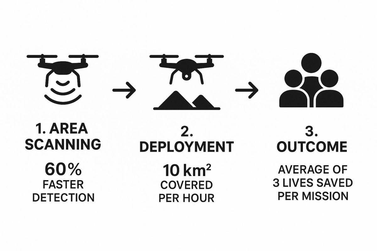
The numbers speak for themselves. Drones can cover huge areas incredibly quickly, which leads directly to finding people faster and, ultimately, saving more lives.
Choosing the Right Drone and Navigating Regulations
Getting a powerful rescue drone in your hands is a huge step, but it’s really only half the battle. To build a truly effective aerial program, you need to understand the rules of the sky and pick equipment that's a perfect match for your team's missions. It all comes down to making smart, informed decisions on both the hardware and the red tape.
For any Australian emergency service, getting to grips with aviation law is the first, non-negotiable step. The Civil Aviation Safety Authority (CASA) sets the rules for all drone operations. The good news is, they have specific provisions that make it easier for agencies like police, fire, and ambulance services to get on with their life-saving work, legally and effectively.
Understanding Australian Drone Regulations
Think of CASA’s rules as the road rules for the sky—they’re there to keep everyone safe. For any professional use, including rescue operations, your pilots will need a Remote Pilot Licence (RePL). This is the standard ticket that proves they have the knowledge and skills to fly safely.
But we all know emergencies don't stick to the rules. That's why CASA provides special authorisations for emergency services. These allow you to fly in ways that are normally off-limits, like operating at night, flying closer to people, or even flying beyond the pilot’s visual line of sight (BVLOS). Securing these approvals is a fundamental part of setting up a proper drones for rescue program.
It's crucial to remember that these special privileges come with great responsibility. Your organisation must have comprehensive training, rigorous safety procedures, and a deep understanding of the risks involved to maintain CASA's trust and operate effectively.
The rapid uptake of this technology really shows how vital it's becoming. Australia's drone market hit a value of USD 614 million and is on track for significant growth, partly because of how much they’re being used to manage bushfires, floods, and cyclones.
How to Select the Right Rescue Drone
Once the regulations are sorted, the next big job is choosing the right gear. It's easy to get bogged down in tech specs and jargon. The best way to approach it is to work backwards from your most common call-outs. What are the actual problems you’re trying to solve?
Instead of getting hung up on specific models right away, think about the core capabilities that will make the biggest difference in the field. This way, you invest in a tool that delivers real-world results, not just a list of flashy features on a brochure.
Comparing Rescue Drone Tiers
Picking the right drone often comes down to balancing capability with budget. Not every organisation needs the most expensive, top-of-the-line model. This table breaks down the different tiers to help you figure out where your needs fit.
| Drone Tier | Typical Cost Range (AUD) | Key Capabilities | Best Suited For |
|---|---|---|---|
| Entry-Level Pro | $3,000 – $8,000 | Good quality 4K camera, basic thermal imaging, 30-40 min flight time, some weather resistance. | Small volunteer teams, initial incident size-up, quick area scans, and supplementing larger programs. |
| Mid-Range Commercial | $8,000 – $25,000 | High-res thermal & zoom cameras, IP rating for rain/wind, 40-55 min flight time, interchangeable payloads. | Most fire brigades, police units, and SES teams for search and rescue, hazard assessment, and situational awareness. |
| High-End Enterprise | $25,000+ | Advanced sensor integration (LIDAR, gas detection), heavy-lift capacity, extreme weather resistance, long endurance. | Specialised government agencies, large-scale disaster response, and complex missions requiring unique payloads. |
Ultimately, the best drone is the one that reliably does the job you need it to do. A mid-range drone used frequently is far more valuable than a high-end one that’s too complex or expensive to deploy regularly.
Key Factors to Evaluate
Here are the key things to look at when you're weighing up your options:
-
Flight Time and Endurance: How long do you really need to be in the air? A search for a missing person in the bush demands long endurance, but a quick look over a car crash scene might only take 15 minutes. Aim for a drone that can comfortably fly for longer than your typical mission requires.
-
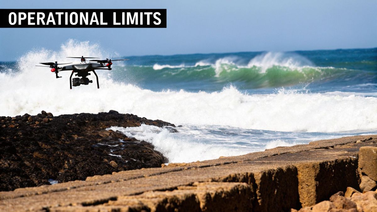
Weather Resistance: Emergencies don't happen on sunny days. You need a drone with a solid Ingress Protection (IP) rating, which tells you how well it handles rain and wind. For reliable rescue work, a rugged, weather-resistant airframe isn't a luxury—it's essential.
-
Payload Capacity and Flexibility: What tools does the drone need to carry? A simple high-zoom camera is light, but a thermal camera, loudspeaker, and a delivery system all add serious weight. Make sure the drone you choose can lift your entire payload without killing its flight time. Our guide on drones for firefighting digs into how different payloads are used in emergency scenarios.
-
Sensor Quality: The information you get is only as good as the camera sending it. A high-resolution thermal camera is a must-have for finding people at night or in thick smoke, while a powerful optical zoom lets you check out a hazard from a safe distance. Don’t cheap out on the camera system; it’s your eye in the sky.
By carefully matching these capabilities to your specific rescue scenarios, you'll build a fleet of drones for rescue that isn't just compliant, but is perfectly kitted out to save lives when every second counts.
What's Next for Automated Rescue Drones?
We're standing on the edge of a new frontier in emergency response. For all their current capabilities, the way we use drones for rescue is about to change dramatically, moving from remote-controlled tools to intelligent partners in the field. The goal is to make rescue missions faster, smarter, and ultimately, more successful. We're getting to a point where the technology won't just help responders; it'll actively take the lead in the search.
At the heart of this shift is much smarter Artificial Intelligence (AI). Think about it: soon, a drone won't need a pilot to painstakingly scan a search grid square by square. Instead, a rescue team could simply designate an area, and the drone would fly itself, executing complex search patterns and analysing its own video feed in real-time. This means a drone could spot a person in trouble, distinguish them from an animal, and ping back an alert with exact coordinates—all on its own.
Smarter, Faster, and Flying for Longer
This next leap forward isn't about one single invention; it's about several key technologies coming together. These innovations will be the backbone of future rescue missions, letting a single team manage an operation on a scale that's hard to even imagine today.
Here’s a glimpse of what's just around the corner:
- Autonomous Search Patterns: Drones will be programmed to systematically cover huge, tricky areas like dense bushland or rugged coastlines, making sure no ground is left unchecked.
- Collaborative Drone Swarms: Picture launching not just one drone, but a whole fleet of them working in concert. A 'swarm' could map out an entire disaster zone, like a flooded town, in a fraction of the time it takes now, all while sharing data to create one unified, live map.
- Hydrogen Fuel Cell Power: Let's be honest, battery life is the Achilles' heel of many drones. New hydrogen-powered models are starting to appear, and they can stay airborne for four to five hours or even more. This is a game-changer for long, drawn-out search missions over vast distances.
The real aim here is to build a system where technology and human expertise work in perfect harmony. A drone swarm could handle the initial broad search, leaving human responders fresh and focused for the difficult, hands-on work of getting someone out safely and providing medical care.
The Next Generation of Rescue Tech
This future isn't some far-off sci-fi concept; it’s the logical next step. These automated systems will help us build a more resilient and effective emergency response network, one that's capable of saving even more lives when every second counts. The combination of AI, swarm intelligence, and incredible flight endurance will completely redefine what's possible for drones for rescue, turning today's most advanced tools into tomorrow's standard operating procedure.
Got Questions About Rescue Drones? We’ve Got Answers.
As drones become a more common sight in emergency response across Australia, it’s natural for questions to pop up. Both emergency crews and the public want to know how these tools work, what they can and can't do, and how they’re making a real difference.
Let's clear the air and tackle some of the most common queries. Think of this as the practical, no-nonsense guide to how drones fit into modern lifesaving.
Why Use a Drone When You Have a Helicopter?
It really comes down to three things: speed, cost, and safety. You can have a drone in the air in under two minutes from the back of a ute, giving you instant eyes on a situation. A helicopter, on the other hand, needs a lot more time, space, and people to get going.
That rapid response can be the difference-maker when time is critical. Drones can also get into places that are simply too risky for a chopper – think flying close to cliff faces, under a thick tree canopy, or in poor visibility. This means you can get vital information without putting rescue teams in harm's way.
When you look at the budget, it's a game-changer. A single drone mission costs just a tiny fraction of a helicopter's hourly rate. This makes top-tier aerial support affordable for nearly any agency, including smaller volunteer-run teams.
What Does It Take to Become an Emergency Drone Pilot?
It’s a whole lot more than just learning to fly. The starting point in Australia is getting your Remote Pilot Licence (RePL) from the Civil Aviation Safety Authority (CASA). This covers all the essential rules of the air, safety protocols, and basic operations.
But for an emergency services pilot, that's just base camp. The real training happens in-house, where pilots are drilled on the specific skills they'll need when lives are on the line.
This advanced training often includes:
- Mastering the Sensors: Learning to expertly use thermal and high-zoom cameras to find a person in dense bush or spot a hidden hazard.
- Executing Search Patterns: Knowing how to systematically search large, tricky areas like coastlines or rugged terrain without missing a spot.
- Working with Ground Crews: Practising clear, effective communication with the team on the ground during intense, fast-moving rescues.
What About Privacy? Aren't These Just Flying Cameras?
That's a fair question, and one that emergency services take very seriously. Agencies operate under incredibly strict guidelines to ensure public privacy is protected. A rescue drone is always focused on a specific, urgent mission—like locating a missing hiker, tracking the edge of a fire, or assessing flood damage.
Strict rules are in place for how data is handled. Any footage captured is used only for that operation and is managed in line with Australian privacy laws. The goal is always public safety and saving lives, never general surveillance. It’s all about using the technology responsibly and ethically.
Ready to see how advanced aerial tools could support your operations? The team at Innoflight Technology designs high-performance drone solutions in Australia and manufactures them in the USA and Australia for emergency response. Explore our enterprise platforms and find out how our systems can keep your team safer and make them more effective.