Drones equipped with LiDAR are essentially flying 3D scanners, capable of creating astonishingly accurate maps of the world below. Unlike a camera that just takes a picture, a Light Detection and Ranging (LiDAR) sensor works by firing out thousands of laser pulses every second. It then measures how long each pulse takes to bounce back, building a detailed 3D model called a point cloud. This technology is brilliant because it can see right through things like dense forest canopies to map the true ground surface underneath.
What Are Lidar Drones and How Do They Work?
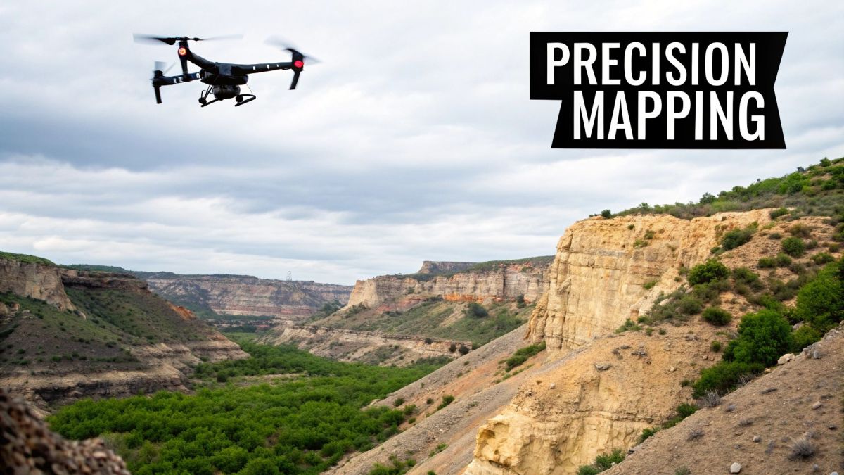
Picture trying to survey a thick patch of bushland. A normal camera would just give you a flat image of the treetops, completely hiding what’s on the ground. This is where LiDAR drones are a total game-changer, letting us peer through the noise to get the data that really matters.
The best way to think about it is to compare it to sight. A camera works a lot like our eyes, passively capturing light to form an image. LiDAR, on the other hand, is an active system, more like a bat’s sonar. It sends out its own signals—in this case, laser beams—and listens for the echoes. By timing how long it takes for a pulse to hit something and return, it can calculate the precise distance to that object with incredible accuracy.
Of course, a LiDAR sensor on a drone doesn’t work in isolation. It relies on a few key partners to make sense of all that data.
Key Components of a Lidar Drone System
To turn those laser measurements into a useful 3D map, the system needs to know exactly where it is and how it’s oriented at all times. Here’s a quick breakdown of the essential components that work together.
| Component | Function | Importance |
|---|---|---|
| LiDAR Sensor | Emits laser pulses and measures the time it takes for them to return. | This is the core data-gathering tool that measures the distances to create the 3D points. |
| GNSS (GPS) Receiver | Pinpoints the drone’s precise geographic location (latitude, longitude, altitude). | Provides the real-world coordinates for the drone, anchoring the entire point cloud to a specific spot. |
| Inertial Measurement Unit (IMU) | Tracks the drone’s orientation (roll, pitch, yaw) with high precision. | Corrects for any tilting or turning of the drone, ensuring every laser point is accurately placed. |
These three components work in perfect sync, giving every single laser point its own precise coordinate in 3D space. The result is what we call a “point cloud”—a massive collection of millions of data points that, when viewed together, form a stunningly detailed digital replica of the landscape.
The Real Power of a Point Cloud
A point cloud is so much more than just a 3D picture; it’s a goldmine of geospatial data. Because a single laser beam can get multiple “returns” as it travels down through a tree, it can capture the top of the canopy, the branches on the way down, and the bare earth beneath, all in a single flight. To really get into the nuts and bolts, you can explore our detailed guide on https://evolutionflight.com/lidar-for-drone/.
This unique ability to see through vegetation is a huge reason why the technology is taking off across so many industries. If you want to get a better handle on the kind of information these systems generate, diving into resources on understanding open-source geospatial data is a great next step.
This technology is also fuelling major growth in Australia’s commercial drone industry. Valued at roughly USD 614 million in 2024, the market is on track to hit USD 1.5 billion by 2033, with LiDAR applications in environmental management and infrastructure being a huge part of that expansion.
How LiDAR Drones Create Pinpoint-Accurate 3D Models
It might sound like something out of a sci-fi movie, but turning millions of invisible laser pulses into a precise digital copy of the real world is just another day at the office for a LiDAR-equipped drone. Think of it like a sophisticated game of echo-location. The drone methodically flies a pre-planned route, and its LiDAR sensor pings the ground below, building a picture of the landscape one point at a time.
This whole process relies on a fusion of smart planning and synchronised hardware.
It all starts on the ground with careful mission planning. We define the survey area, choose a flight altitude, and decide how much each flight path should overlap. Flying higher lets you cover more ground quickly but gives you a less dense point cloud. A lower flight path, on the other hand, captures incredible detail over a smaller patch. It’s always a trade-off, and the goal is to get all the data you need in one efficient flight.
Once the drone is airborne, the real work starts. The LiDAR sensor isn’t just firing off lasers randomly; it’s working hand-in-glove with the drone’s own navigation systems.
Fusing Data for Unbelievable Accuracy
For every single laser pulse that shoots out, the system needs to know exactly where it came from and which way it was pointing. This is where a couple of key pieces of tech come together, giving every data point a precise real-world address.
- Global Navigation Satellite System (GNSS): This is the drone’s GPS, but on steroids. It provides its exact geographic coordinates—latitude, longitude, and altitude—pinpointing its location anywhere on the globe.
- Inertial Measurement Unit (IMU): Think of this as a super-sensitive gyroscope and accelerometer. It tracks the drone’s orientation—its roll, pitch, and yaw—hundreds of times every second.
The IMU is critical. It compensates for every tiny tilt or gust of wind, ensuring that even if the drone gets jostled, the angle of each laser pulse is recorded with perfect precision. It’s this combination of position (GNSS) and orientation (IMU) data that gives LiDAR its remarkable accuracy.
The core process is a constant loop: the sensor emits laser pulses, receives their reflections, and then uses that information to generate the final point cloud.
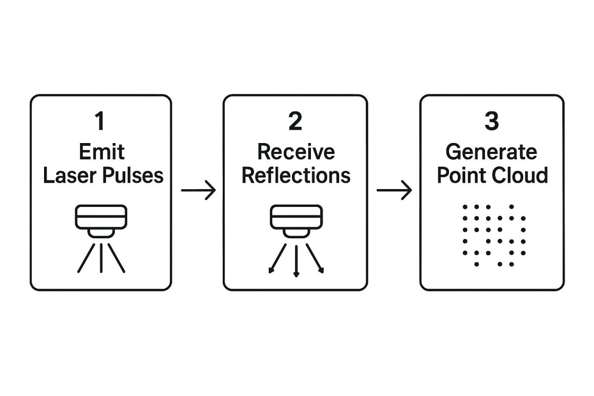
This simple three-step cycle is repeated millions of times over a single flight, building an incredibly rich and detailed three-dimensional dataset from the raw laser returns.
From Raw Data to a Digital Twin
What you get straight off the drone is something called a point cloud. It’s a massive file containing millions, sometimes billions, of individual points, each with its own X, Y, and Z coordinate. Visually, it’s impressive—a giant, floating 3D shape of the area—but in its raw form, it’s not particularly useful.
To unlock its value, the data needs to be processed. This is where we turn that cloud of dots into actionable intelligence.
During post-processing, the raw point cloud is cleaned up and classified. This is a crucial step where software algorithms identify and tag different types of points—like ground, vegetation, buildings, and power lines. It’s what turns a simple 3D model into a smart digital asset.
For example, by filtering out everything classified as vegetation or buildings, you can create a Digital Elevation Model (DEM). This “bare-earth” model is invaluable for engineers and hydrologists because it reveals the true contours of the ground without any obstructions.
The sheer complexity of LiDAR data means processing can get pretty advanced, and understanding the role of AI in data processing is quickly becoming essential for pulling out the most meaningful insights.
Ultimately, this refined data allows professionals to measure stockpile volumes, analyse slope stability, or plan new construction with confidence right down to the centimetre.
Real-World Applications Across Industries
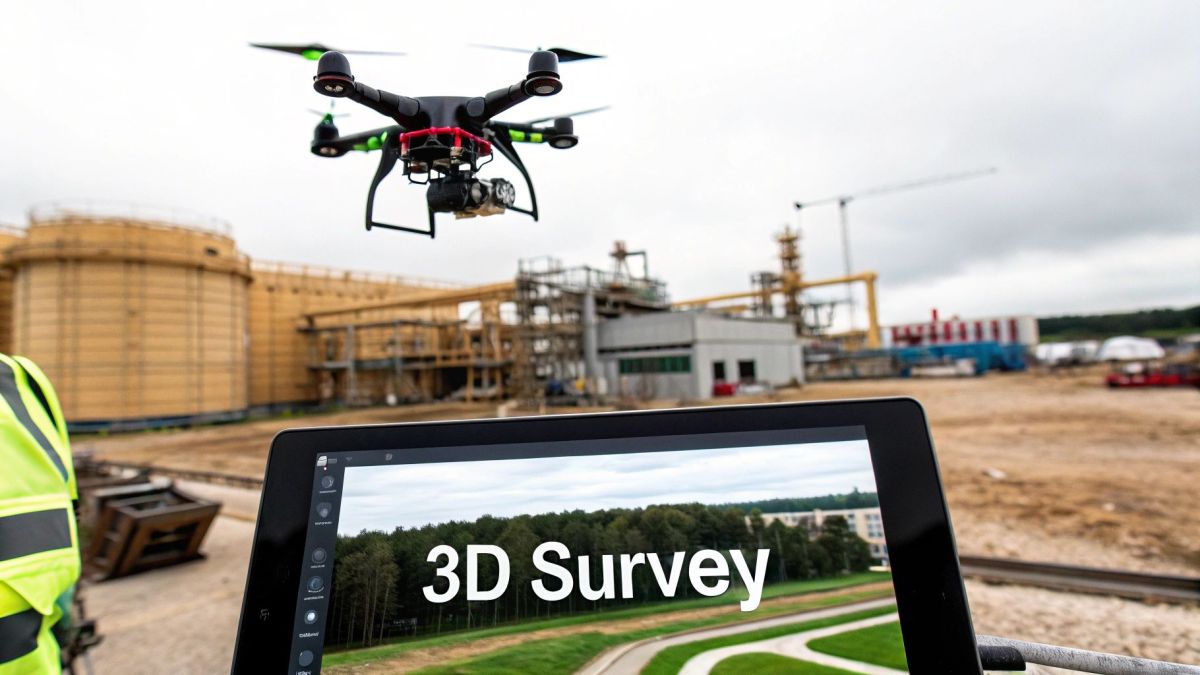
The theory behind drones with LiDAR is impressive, but their real power comes to life in the field. Across Australia, this technology isn’t just a fascinating concept—it’s a hands-on tool solving real-world problems, saving time, and boosting safety in some of our toughest industries. From the red earth of the Pilbara to the rich soils of the Riverina, LiDAR drones are making a tangible difference.
What we’re seeing is a consistent story. Complex or dangerous jobs that once took days or even weeks of manual work can now be wrapped up in a few hours. This isn’t just about getting things done faster; it’s about making smarter, data-driven decisions that directly improve productivity and safety on the ground.
Revolutionising Australian Mining and Construction
The mining and construction industries were among the first to see the huge potential of LiDAR drone technology. In these high-stakes environments, where precision and safety are non-negotiable, these drones offer an invaluable perspective from above.
Think about a mine manager who needs to calculate the exact volume of an iron ore stockpile. The old way involved a ground crew trudging over the pile with GPS rovers—a slow, painstaking, and often risky process. Now, a single drone flight that takes just a few minutes can capture millions of data points, generating a 3D model with centimetre-level accuracy. This makes inventory management and production forecasting incredibly fast and reliable.
The same logic applies to monitoring pit walls for any signs of instability or plotting out new haul roads. The detailed topographic data helps engineers design safer, more efficient operations right from the start. This rapid uptake is a big reason why the Australian drones market is tipped to grow at a compound annual growth rate of 27% between 2025 and 2034. The ability of drones with LiDAR to survey remote and hazardous areas is a key factor driving this growth.
Transforming Agriculture and Forestry Management
In Australian agriculture, every drop of water counts. A farmer planning a new irrigation system needs to understand the lay of their land intimately to make sure water flows where it’s needed most, without pooling or running off.
A LiDAR drone can map an entire farm in a single afternoon, creating a precise digital elevation model. This reveals the subtle slopes and dips that are impossible to see with the naked eye. With this information, the farmer can design a super-efficient irrigation system that saves huge amounts of water and improves crop yields. The map becomes a powerful tool for smarter, more sustainable farming.
It’s a similar story in forestry, where LiDAR’s knack for seeing through trees is a game-changer. It can:
- Measure Canopy Height: Accurately estimate timber volume without having to fell a single tree.
- Analyse Tree Density: Help plan selective harvesting or thinning to improve overall forest health.
- Assess Fire Risk: Map the fuel loads on the forest floor, giving fire management agencies crucial data.
By penetrating the canopy to scan the ground below, LiDAR drones give land managers a view of their assets they’ve never had before. This clarity leads to more sustainable logging, better conservation work, and more effective wildfire prevention.
Enhancing Utility and Infrastructure Inspection
Maintaining thousands of kilometres of power lines is a massive job for utility companies. One of the biggest headaches is vegetation—trees and branches getting too close to the lines, which can cause blackouts, especially during storms.
Traditionally, inspections meant sending up helicopter crews or ground patrols, both expensive and slow methods. Today, a LiDAR drone can fly along a power corridor, precisely mapping every wire, pole, and nearby tree.
The resulting point cloud clearly highlights where vegetation is encroaching, allowing maintenance crews to be surgical in their trimming. This proactive approach helps prevent outages, keeps the public safe, and makes better use of maintenance budgets. The data these drones gather is also vital for advanced analytical methods, including specialised fields like geospatial analysis in real estate for managing corridors.
Empowering Emergency Response and Environmental Monitoring
When a natural disaster hits, fast and accurate information can save lives. After a bushfire or a flood, emergency services need to quickly understand the scale of the damage to coordinate rescue and recovery efforts.
Drones equipped with LiDAR can rapidly map affected areas, even when smoke or treacherous terrain makes it impossible to get in on foot. They create detailed 3D models showing which buildings are damaged, where landslides might have occurred, and which roads are cut off. This intelligence is gold for first responders, helping them navigate safely and send resources where they’re most needed. This capability is a cornerstone of modern aerial surveying with UAVs, which you can learn more about in our detailed guide.
Key Advantages of Using Drones with LiDAR

When it comes to aerial mapping, the big question is always the same: how do you get the best possible data without breaking the bank or wasting time? While traditional surveying and even photogrammetry have their roles, drones paired with LiDAR are in a class of their own, offering a potent mix of benefits that deliver a real, tangible return.
The power of LiDAR drones really boils down to four key strengths. Once you grasp these, it’s easy to see why so many industries now rely on this technology for their most important work.
Achieve Unmatched Accuracy
The first thing everyone notices about LiDAR is its incredible precision. Other methods can be thrown off by shadows or struggle to define clean edges, but LiDAR doesn’t guess. It actively measures the world with millions of laser pulses, giving you data that is both razor-sharp and dependable.
With this tech, we’re talking about centimetre-level accuracy over huge areas. For anyone in engineering, construction, or mining, that’s not just a nice bonus—it’s essential. This level of precision is what ensures designs are built correctly, structural changes are tracked properly, and material volumes are calculated with total confidence.
Gain Radical Efficiency
Probably the most immediate “wow” factor is the speed. Let’s be honest, traditional ground surveying is slow. It’s a painstaking, manual process that can tie up a whole team for days or even weeks on a large site.
A LiDAR drone can do the same job in a tiny fraction of the time. Think about it: a ground crew might spend a full week surveying a 100-hectare property. A LiDAR drone can fly that same area, collect far more detailed data, and be done in a single afternoon. Weeks of work shrink to a matter of hours.
This isn’t just about saving time; it’s about fundamentally changing how projects are run. Slashing fieldwork from weeks to hours frees up your team, cuts operational costs, and lets you deliver results to clients faster than ever before.
This speed also makes it practical to survey sites more often, which is perfect for monitoring dynamic environments like active construction sites, shifting stockpiles, or areas prone to coastal erosion.
Enhance Operational Safety
Let’s face it, many surveying jobs are in dangerous places. Sending people to measure stockpiles, inspect unstable slopes, or assess post-disaster damage puts them right in the line of fire.
Drones with LiDAR take your team out of the danger zone entirely. The operator can stand a safe distance away while the drone navigates treacherous terrain, steep drops, or structurally compromised areas. This is a massive win for safety in fields like:
- Disaster Response: Mapping a flood or landslide zone without putting first responders at risk.
- Mining Operations: Inspecting the high walls of an open-pit mine without worrying about rockfalls.
- Infrastructure Inspection: Assessing storm-damaged power lines or bridges from a secure vantage point.
Keeping people safe is the top priority, but it also has the knock-on effect of reducing liability and insurance costs tied to high-risk fieldwork.
Collect Uniquely Rich Data
Beyond speed and safety, the kind of data LiDAR collects is simply on another level in certain situations. Its biggest edge over photogrammetry is its uncanny ability to see through vegetation.
A camera just sees the top of the trees. LiDAR, on the other hand, sends laser pulses that find the gaps between leaves and branches, bouncing off everything on the way down to the ground. This gives you multiple data points, or “returns,” from a single pulse, allowing you to map both the forest canopy and the true ground beneath it.
This ability to create a “bare-earth” model is a game-changer for forestry, land development, and environmental management. It reveals the actual topography that’s been hidden under dense tree cover, something a standard aerial photo could never show you. This rich, layered data gives you a far more complete picture to work with, leading to smarter, more informed decisions.
LiDAR Drones vs Other Surveying Methods
To really understand where LiDAR drones fit in, it helps to see how they stack up against the alternatives. Each method has its pros and cons, but LiDAR often hits the sweet spot between speed, detail, and versatility.
| Feature | LiDAR Drone | Photogrammetry Drone | Ground Surveying |
|---|---|---|---|
| Accuracy | Very high (centimetre-level) | High, but can be affected by light and texture | Highest (millimetre-level), but only at specific points |
| Speed | Extremely fast; can cover vast areas in hours | Very fast; similar flight times to LiDAR | Very slow; labour-intensive and time-consuming |
| Vegetation Penetration | Excellent; creates “bare-earth” models through canopy | None; captures the top surface of vegetation only | Excellent, but requires physically clearing sightlines |
| Cost | High initial investment, but lower operational costs over time | Lower initial investment for hardware and software | High labour costs, especially for large or complex sites |
| Safety | Very high; operator remains at a safe distance | Very high; keeps personnel out of hazardous areas | Low; surveyors are directly exposed to site risks |
| Data Type | 3D point cloud (direct measurement) | 3D model, orthomosaic photos (derived from images) | Individual survey points and measurements |
| Best For | Dense forests, complex topography, infrastructure inspection | Open areas, visual inspections, creating textured models | Boundary marking, construction staking, high-precision points |
As you can see, there’s no single “best” method for every job. But for projects that demand high accuracy over large, complex, or vegetated areas, the efficiency and data quality of LiDAR drones are hard to beat.
How to Choose the Right LiDAR Drone System
Picking the right LiDAR drone system is a big move. You’re shifting from just understanding the tech to making a serious investment. The key isn’t to find the single “best” drone on the market, but to find the one that fits what you actually do, day in and day out. What a forestry company needs to see through a thick tree canopy is worlds away from what a construction firm needs for tracking progress on-site.
Before you even glance at a spec sheet, the first thing you must do is get crystal clear on your project goals. This clarity is the foundation for every decision that follows. It’s about asking the right questions upfront so you don’t end up paying for fancy features you’ll never touch.
Define Your Project Requirements
Start by mapping out what your typical jobs look like. A solid grasp of your operational needs is the only way to pick a system that will give you a real return on your investment.
Think about these core factors:
- Accuracy Needs: How precise do you need to be? For engineering and construction, centimetre-level accuracy is often non-negotiable. Environmental monitoring, on the other hand, might have more wiggle room.
- Survey Environment: Where are you flying? Over dense bushland, open-cut mines, or complex urban landscapes? The sensor you choose will depend heavily on its ability to cut through vegetation or map hard, reflective surfaces.
- Area of Operation: Are you covering small, detailed sites or mapping vast corridors that stretch for hundreds of kilometres? This will have a huge impact on your choice of drone, especially when it comes to flight time.
Evaluate the LiDAR Sensor Specifications
The LiDAR sensor is the heart of your whole setup. Its specs will dictate the quality and type of data you can capture. Getting your head around a few key terms makes comparing different models much easier.
One of the most important metrics is Points Per Second (PPS). This number tells you how many laser measurements the sensor fires off every second. Generally, a higher PPS means you get a denser, more detailed point cloud. Another vital feature is the number of returns a sensor can handle from a single pulse of light. For any work involving vegetation, a sensor with multiple returns is a must-have, as it can capture points from the top of a tree, branches on the way down, and the actual ground underneath—all in one go.
Select the Right Drone Platform
The drone itself is just the vehicle for your expensive sensor, so it absolutely has to be up to the task. The two big things to look at here are payload capacity and flight time. Your drone must be able to comfortably and safely carry the weight of your LiDAR unit, plus any cameras, and of course, its own batteries.
Longer flight times are a massive advantage, letting you cover more ground in one go and minimising the time spent on the ground swapping batteries. This is a game-changer for large-scale jobs like mapping power line corridors or sprawling farms. If you need help matching a system to a specific job, looking into professional LiDAR service work can give you a great idea of what the pros use for different tasks.
Understand the Financial Investment
There’s no getting around it—a LiDAR drone system is a significant financial commitment. This is particularly true as the technology becomes more common across the Asia-Pacific region for jobs in agriculture and environmental management. While the price tags on components like high-precision lasers and GPS modules can seem steep, it’s crucial to see this as a long-term investment.
Often, a higher upfront cost translates directly into better efficiency, improved safety, and superior data quality, which can lead to huge savings down the track. You can discover more insights about the Asia-Pacific LiDAR market on renub.com.
Choosing a LiDAR system is about balancing initial cost with long-term value. The right system pays for itself through reduced fieldwork hours, enhanced safety, and the ability to deliver superior data that opens up new business opportunities.
Finally, don’t forget to factor in Australian training and certification. To fly advanced drone systems commercially, you’ll need a Remote Pilot Licence (RePL), and your business will likely need a Remotely Piloted Aircraft Operator’s Certificate (ReOC) to ensure all your operations are safe and legal.
Common Questions About Drones with LiDAR
As we’ve covered, drones with LiDAR are changing the game for mapping and understanding our world. But with any powerful technology, a few questions always pop up. Let’s tackle some of the most common ones to give you a solid, practical understanding of how this tech works in the real world.
My goal here is to clear up any lingering doubts. We’ll get straight into the practical stuff—accuracy, costs, and how LiDAR really stacks up against other methods you might be familiar with.
How Accurate Is Drone LiDAR Data?
This is usually the first thing people want to know, and for good reason. Accuracy is the whole point. The short answer? It’s incredibly accurate. A high-quality, properly calibrated LiDAR system will consistently give you centimetre-level precision.
That’s not just a number on a spec sheet; it’s a field-proven reality. For any serious engineering, construction, or surveying work, that level of detail is an absolute must-have. It’s what lets professionals measure stockpile volumes with confidence, design infrastructure down to the millimetre, and track tiny changes in the ground over time. The magic happens when the LiDAR sensor, a high-precision GNSS receiver, and a sensitive IMU all work in perfect harmony, making sure every single point in the 3D model has a precise, real-world coordinate.
Is LiDAR Better Than Photogrammetry?
This question comes up all the time. It’s a bit like asking if a hammer is better than a screwdriver—they’re both great tools, but you use them for different jobs. Neither one is universally “better,” but LiDAR definitely has the upper hand in a few key scenarios.
- Mapping through vegetation: This is where LiDAR truly shines. It can send laser pulses through gaps in a tree canopy to map the actual ground beneath. Photogrammetry just can’t do that.
- Dealing with uniform surfaces: Photogrammetry works by matching pixels in photos. On surfaces without much texture, like sand, snow, or a fresh patch of asphalt, it can really struggle to find enough unique points to build an accurate model. LiDAR, on the other hand, directly measures the surface no matter what it looks like.
- Working in tricky light: Because LiDAR is an active sensor (it brings its own light source via the laser), you can fly missions in low light or even at night. That’s something photogrammetry, which relies on ambient light, just can’t handle.
Don’t get me wrong, photogrammetry is often cheaper and is brilliant for creating visually stunning, full-colour 3D models of open areas. But when you need pure, uncompromised topographic accuracy, especially in tricky environments, drones with LiDAR are in a class of their own.
What Is the Biggest Limitation of LiDAR Drones?
As powerful as this technology is, it’s not without its challenges. The biggest hurdle for most is the initial financial investment. A professional-grade LiDAR system is a serious piece of kit, and the upfront cost is significantly higher than what you’d pay for a high-end photogrammetry drone.
Weather is another thing to think about. While LiDAR doesn’t mind the dark, it doesn’t like heavy rain, fog, or snow. Water droplets in the air can scatter the laser pulses, which messes with the data and can leave you with gaps or noise. So, just like most aerial survey work, you need to plan your missions around clear weather to get the best results.
Despite the initial cost, the return on investment for a LiDAR system is often realised quickly through radical gains in efficiency, improved safety, and the ability to deliver superior data that other methods simply can’t match. This makes it a worthwhile investment for many professional applications.
For robust, Australian-designed UAS solutions tailored for high-precision mapping and inspection, trust Innoflight International. Our advanced drone platforms are built to carry premium LiDAR sensors, delivering the accuracy and reliability your projects demand. Explore our versatile systems and discover how we can support your operations at https://evolutionflight.com.