Once considered a niche gadget for hobbyists and photographers, drones have rapidly matured into indispensable tools across countless industries. Their ability to provide a unique aerial perspective, collect vast amounts of data efficiently, and access hard-to-reach locations has fundamentally altered operational workflows. From monitoring sprawling agricultural fields to inspecting critical infrastructure, the practical applications of unmanned aerial vehicles (UAVs) are expanding at an unprecedented rate. This transformation is driven by significant advancements in sensor technology, flight endurance, and data processing capabilities.
This article moves beyond surface-level descriptions to provide a comprehensive breakdown of the most impactful uses for drones today. We will explore specific, real-world examples from diverse sectors, including emergency response, logistics, construction, and environmental conservation. For each application, we will analyse the underlying strategy, identify the specific tactics employed, and present actionable takeaways that you can apply to your own operations.
The goal is to offer a detailed playbook, not just a list. You will gain a clear understanding of how organisations are leveraging drone technology to improve safety, boost efficiency, reduce operational costs, and gather critical intelligence. Whether you are involved in asset management, public safety, or resource surveying, the insights within will demonstrate how these aerial platforms are delivering tangible, measurable results. We will cover everything from aerial cinematography and precision farming to infrastructure maintenance and scientific data collection, providing a clear roadmap of what is possible.
1. Aerial Photography and Cinematography
Perhaps the most well-known of all the uses for drones, aerial photography and cinematography have democratised the sky for visual creators. Drones provide an affordable and accessible way to capture stunning birds-eye views and dynamic tracking shots, perspectives that were once reserved for Hollywood-level budgets requiring helicopters and cranes.
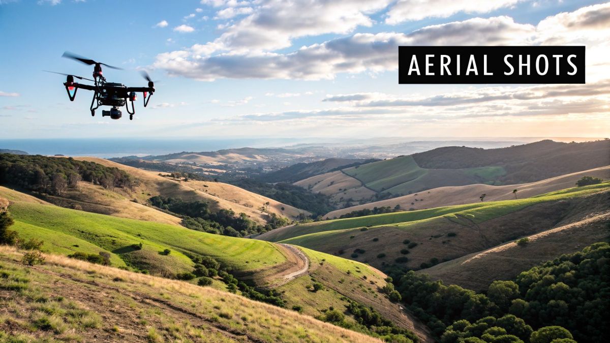
This technology allows filmmakers, marketers, and photographers to add incredible production value and unique angles to their projects. From sweeping landscape shots in a nature documentary to dynamic property tours in real estate, drones offer a powerful storytelling tool.
Strategic Breakdown
The core strategy behind using drones in media is to elevate the visual narrative. A high-angle shot can establish a scene's location, a smooth tracking shot can create a sense of movement and excitement, and a slow reveal over a landmark can build suspense and awe.
Key Insight: The strategic value of drone footage lies not just in its beauty, but in its ability to convey information and emotion more effectively than ground-based cameras. A drone can show scale, context, and relationships between objects in a way that is immediately understood by the viewer.
Practical Applications and Tactics
- Real Estate: Use a drone like the DJI Mavic to create a compelling virtual tour. Start with a wide shot showing the property's location relative to amenities like parks and coastlines, then move into closer shots highlighting architectural features and outdoor living spaces.
- Filmmaking: For cinematic shots, use Neutral Density (ND) filters on the drone's camera. This allows you to use a slower shutter speed in bright daylight, creating a natural and smooth motion blur that is pleasing to the eye.
- Event Coverage: At weddings or festivals, drones can capture the scale of the event and key moments from a unique perspective. Always ensure you have permission and are flying safely away from crowds.
- Tourism and Marketing: Showcase destinations with breathtaking aerial videos. A well-executed drone shot of a coastline, mountain range, or city skyline can be a powerful marketing asset for tourism boards and hotels.
2. Search and Rescue Operations
Drones are proving to be invaluable tools in emergency response, serving as a critical force multiplier for search and rescue (SAR) teams. These highly adaptable aircraft can be rapidly deployed to survey hazardous disaster zones, locate missing persons in difficult terrain, and provide real-time situational awareness to coordinate rescue efforts on the ground, all while minimising risk to human responders.
This technology revolutionises SAR by covering vast areas far quicker than ground teams. Whether it's mapping flood zones after a hurricane like Harvey, locating avalanche victims in the Swiss Alps, or identifying hotspots in a California wildfire, drones equipped with specialised sensors like thermal cameras offer a powerful eye in the sky.
Strategic Breakdown
The core strategy for using drones in SAR is to accelerate detection and improve situational awareness. By providing an immediate aerial perspective, drones reduce the time it takes to locate a subject or assess a scene, which is often the most critical factor in a life-or-death situation. This allows commanders to allocate ground resources more effectively and safely.
Key Insight: The strategic advantage of SAR drones is their ability to operate in conditions too dangerous for human teams. They can fly through smoke, over floodwaters, or across unstable terrain to provide crucial data that directly informs rescue priorities and tactics.
Practical Applications and Tactics
- Wildfire Monitoring: Use a thermal drone like the DJI Matrice 30T to fly over a fire's perimeter. The thermal camera can see through smoke to identify hotspots and pinpoint the fire's edge, helping crews to target their efforts and monitor for flare-ups.
- Missing Persons Search: Pre-program an automated grid search pattern to ensure maximum coverage of a large area. Fly during dawn or dusk when thermal contrast is highest, making it easier for a thermal sensor to detect a human heat signature against the cooling ground.
- Disaster Assessment: In a post-earthquake or flood scenario, use drones to quickly create high-resolution maps of the affected area. This allows emergency managers to identify damaged infrastructure, blocked roads, and safe access routes for rescue teams.
- Maritime Rescue: Equip a drone with a payload drop system to deliver a life vest or communication device to a person in the water. This provides immediate aid while Coast Guard or surf lifesaving crews are en route.
3. Agricultural Monitoring and Precision Farming
Drones are revolutionising the agricultural sector by introducing precision farming techniques that were once unimaginable. This technology empowers farmers with powerful data-driven tools to monitor crop health, manage resources efficiently, and ultimately boost yields. From vast soybean fields in Brazil to specialised vineyards in California, drones provide a detailed, real-time view of the farm.
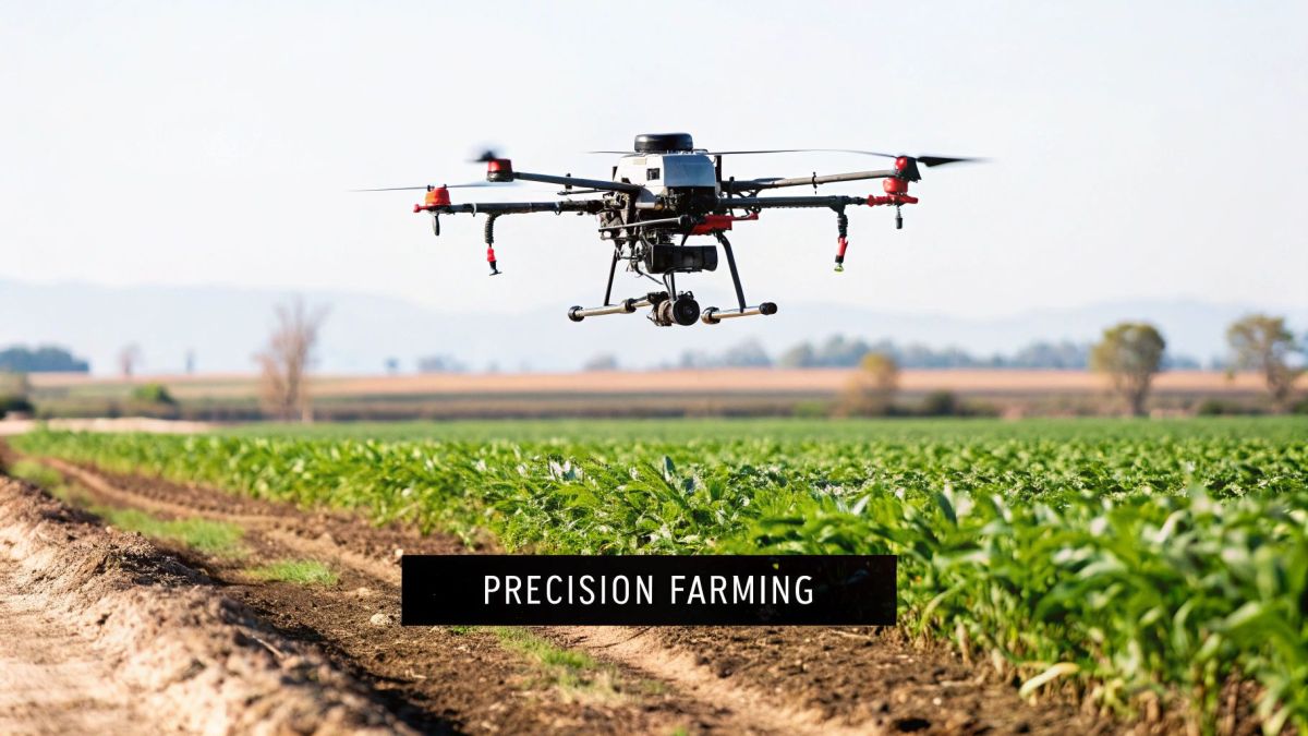
Equipped with multispectral or thermal sensors, these unmanned aerial vehicles can identify issues like pest infestations, irrigation problems, and nutrient deficiencies long before they are visible to the naked eye. This allows for targeted interventions, reducing the use of water, fertilisers, and pesticides, which saves money and lessens environmental impact.
Strategic Breakdown
The core strategy here is to transform farm management from reactive to proactive. By collecting highly granular data across large areas quickly, farmers can make informed decisions based on precise needs rather than broad, field-wide estimates. This data-centric approach maximises efficiency and output.
Key Insight: The strategic value of agricultural drones lies in their ability to deliver actionable intelligence. They convert raw field data into clear insights on plant health and soil conditions, enabling a shift towards precise, resource-optimised farming that increases profitability and sustainability.
Practical Applications and Tactics
- Crop Health Analysis: Use drones with NDVI (Normalised Difference Vegetation Index) sensors to create detailed health maps. These maps use colour-coding to highlight stressed or unhealthy areas, allowing for targeted soil sampling and treatment.
- Targeted Spraying: Employ specialised drones like the DJI Agras series for precise application of pesticides or fertilisers. This tactic minimises chemical runoff and ensures resources are only used where needed, protecting both the environment and the budget.
- Yield Estimation: Regularly fly over crops to monitor growth and density. This data can be analysed to forecast yields with greater accuracy, aiding in financial planning and logistics for harvest. You can discover more about how precision agriculture with drones works on innoflighttechnology.com.
- Water Management: Thermal imaging drones can detect variations in soil moisture and identify irrigation system leaks or inefficiencies. This ensures crops receive optimal hydration without wasting precious water resources.
4. Infrastructure Inspection and Maintenance
Drones have revolutionised how critical infrastructure is monitored and maintained. They provide a safe, cost-effective, and efficient way to inspect assets like bridges, power lines, wind turbines, and industrial facilities, often eliminating the need for dangerous and expensive manual inspections involving rope access or scaffolding.
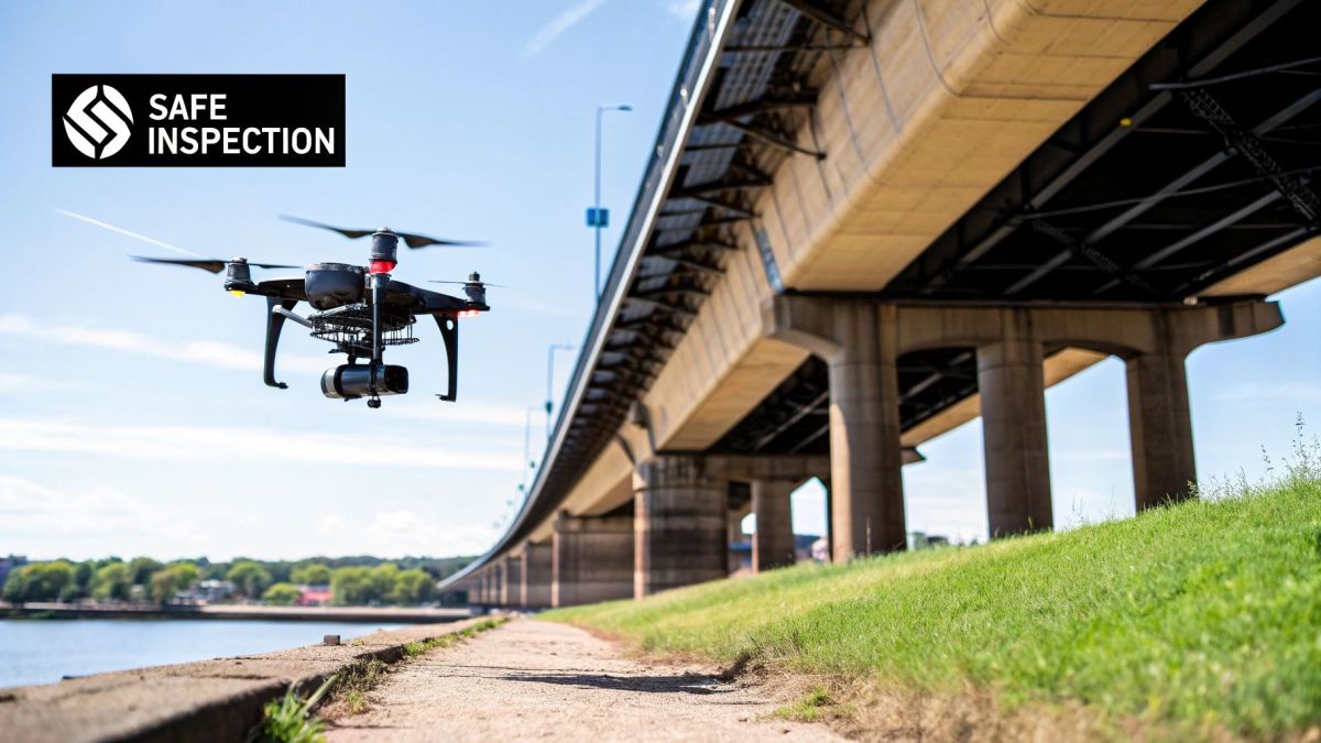
This technology allows asset managers to gather high-resolution data from difficult-to-reach areas, enabling proactive maintenance and reducing downtime. Companies like Con Edison in New York and major energy firms like Shell use drones to regularly inspect everything from urban power grids to offshore oil rigs, identifying potential faults before they become critical failures.
Strategic Breakdown
The core strategy here is to mitigate risk and optimise asset lifespan through data-driven insights. Drones transform inspections from a reactive, labour-intensive task into a proactive, digitised process. By creating a consistent and repeatable data collection method, organisations can build detailed "digital twins" of their assets to track degradation over time.
Key Insight: The strategic value extends beyond just taking pictures. It’s about creating a comprehensive, historical record of an asset's condition. This data empowers predictive maintenance, improves budget forecasting, and enhances safety by keeping human inspectors out of hazardous environments.
Practical Applications and Tactics
- Energy and Utilities: Employ drones equipped with thermal and LiDAR sensors to inspect power lines for hotspots or vegetation encroachment. You can learn more about how LiDAR for drones enhances these inspections. Automated flight paths ensure every metre of a transmission line is covered consistently.
- Telecommunications: Use drones like the Skydio to autonomously inspect cell towers. These flights can capture detailed imagery of antennas, cables, and structural components, reducing the need for tower climbs.
- Transportation: Inspect bridges and railways for structural fatigue, corrosion, or damage without disrupting traffic. The high-resolution data helps engineers make more informed repair decisions.
- Post-Disaster Assessment: After a major weather event, drones are invaluable for streamlining storm damage assessments for insurance claims on public infrastructure, allowing for rapid and safe evaluation of the extent of the damage.
5. Package Delivery and Logistics
Delivery drones are poised to revolutionise last-mile logistics. This technology involves using automated Unmanned Aerial Vehicles (UAVs) to transport lightweight packages directly to customers, offering a future of rapid delivery that bypasses road traffic and reduces operational costs for e-commerce, food, and medical services.
This chart illustrates two core metrics driving the drone delivery industry: the common payload capacity and the significant market growth forecast.
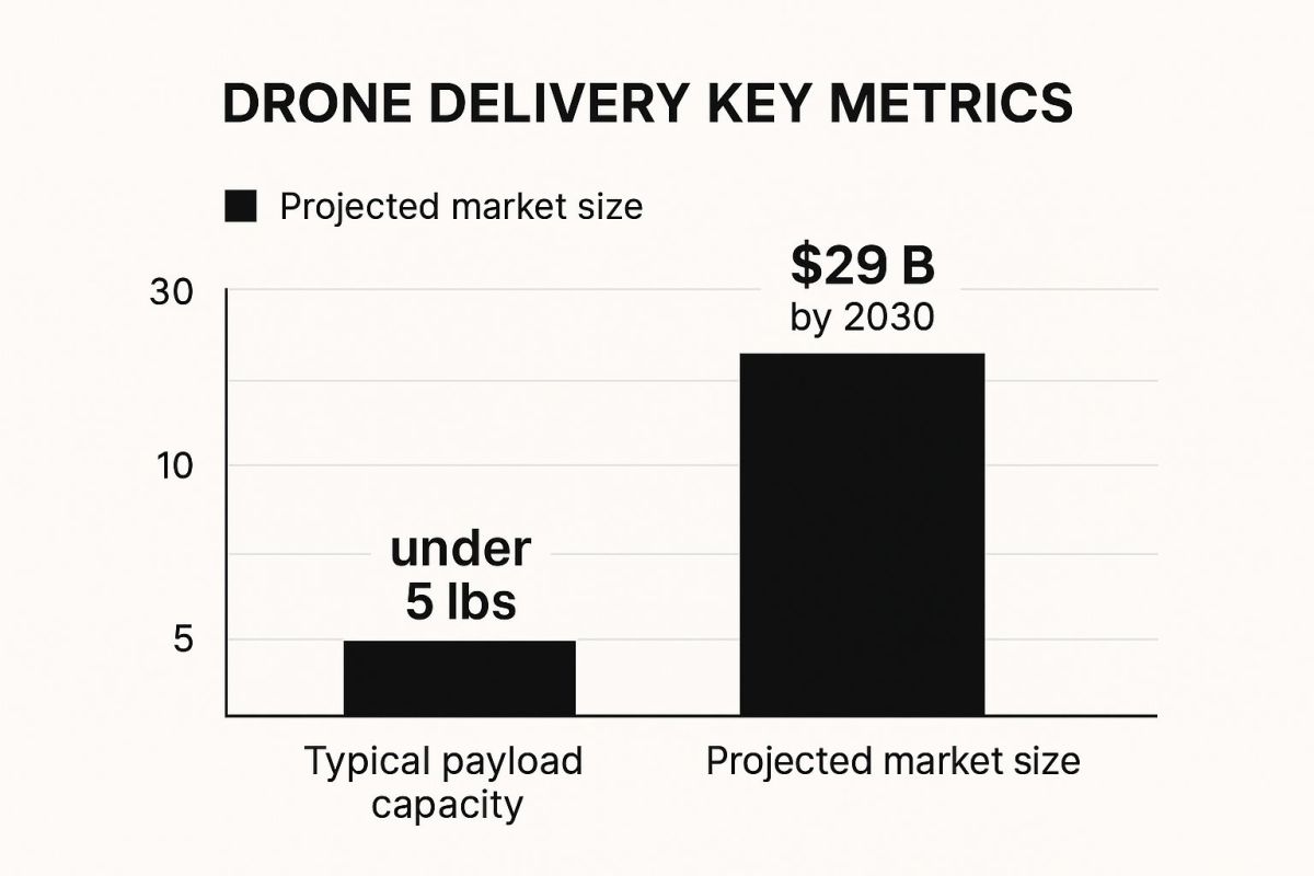
The visualisation highlights that while current drones focus on smaller, high-value goods, the market's projected expansion points to a massive scaling of this logistical model.
Strategic Breakdown
The core strategy is to optimise the final, most expensive stage of delivery. Drones offer a solution to the "last-mile problem" by creating a direct, automated, and efficient route from a local hub to the consumer's doorstep, sidestepping the complexities of ground-based transport like traffic and driver costs.
Key Insight: Drone delivery's strategic value is not just speed, but efficiency and scalability. It transforms logistics from a variable, labour-intensive process into a predictable, automated system, especially for urgent, high-value items like medical supplies or premium consumer goods.
Practical Applications and Tactics
- Medical Supplies: Zipline's operations in Rwanda and Ghana showcase the use of drones for delivering life-saving blood and vaccines to remote clinics. The key tactic is establishing centralised distribution hubs that can launch drones on-demand to a network of pre-approved healthcare facilities.
- E-commerce: Amazon Prime Air and Wing (Alphabet) are trialling services in suburban and rural areas. A crucial tactic is to start with low-density population areas to refine safety protocols and gain regulatory approval before expanding to more complex urban environments.
- Food Delivery: Companies can use drones to transport food from restaurants to designated neighbourhood drop-off points. This hybrid model avoids complex residential landings while still significantly speeding up the delivery process.
- Logistics Integration: UPS Flight Forward partners with medical campuses to transport lab samples between buildings. The tactic here is to create a closed-loop system within a specific, controlled area, proving the concept's reliability before broader public deployment.
6. Environmental Monitoring and Conservation
Drones are providing researchers and conservationists with a powerful, non-invasive method for protecting our planet. These unmanned aerial vehicles offer an efficient and cost-effective way to monitor wildlife, track deforestation, map habitats, and assess environmental damage from a safe distance, gathering crucial data without disturbing sensitive ecosystems.
This technology enables environmental organisations like the WWF and Greenpeace to cover vast, remote territories that would be difficult or impossible to access on foot. From counting whale populations off the coast to identifying illegal logging in the Amazon, drones deliver high-resolution data that informs critical conservation strategies and environmental protection efforts.
Strategic Breakdown
The core strategy is to leverage remote data acquisition for large-scale ecological insight. Drones can be equipped with various sensors, from high-resolution cameras to thermal and multispectral imagers, allowing for comprehensive data collection that goes far beyond what the human eye can see from the ground.
Key Insight: The strategic advantage of conservation drones is their ability to provide repeatable, high-frequency data from a safe and non-intrusive perspective. This enables the creation of detailed environmental baselines, making it possible to accurately track changes over time and measure the impact of conservation interventions.
Practical Applications and Tactics
- Wildlife Monitoring: Use drones equipped with thermal imaging cameras, like those from FLIR Systems, to conduct nocturnal wildlife surveys. This is particularly effective for counting elusive or nocturnal animal populations, as demonstrated by WWF's monitoring of tigers in Nepal.
- Deforestation Tracking: Employ high-resolution mapping drones to create detailed orthomosaic maps of forested areas. By comparing maps created at different times, organisations like SkyTruth can precisely identify and quantify illegal logging or habitat loss.
- Marine and Coastal Health: To monitor coral reef health, as researchers do on the Great Barrier Reef, use drones with multispectral sensors. These can help detect coral bleaching and assess water quality by analysing light reflectance patterns that are not visible to the naked eye.
- Pollution Assessment: After an oil spill or industrial accident, drones can be rapidly deployed to map the extent of the contamination and monitor clean-up efforts without exposing human teams to hazardous materials. Always coordinate with local environmental and wildlife authorities before any flight.
7. Law Enforcement and Public Safety
Drones are rapidly becoming a standard tool for police and public safety agencies, offering a transformative aerial perspective on operations. This technology provides an invaluable "eye in the sky," enhancing situational awareness, improving officer safety, and increasing operational effectiveness in a variety of scenarios.
From monitoring large crowds at public events to providing critical intelligence during tactical situations, drones give first responders a high-ground advantage without the cost or delay of deploying a helicopter. This capability allows for more informed decision-making, de-escalation opportunities, and safer outcomes for both officers and the public.
Strategic Breakdown
The core strategy is to leverage aerial intelligence to gain a tactical advantage and mitigate risk. Drones provide real-time data from a safe distance, allowing commanders to assess a situation comprehensively, deploy resources efficiently, and monitor events as they unfold without endangering personnel.
Key Insight: The strategic power of drones in public safety comes from their ability to provide persistent, on-demand oversight. This allows for proactive monitoring and reactive intelligence gathering, fundamentally changing how agencies manage everything from traffic accidents to search and rescue operations.
Practical Applications and Tactics
- Crime Scene Investigation: Use a drone to conduct an initial aerial survey of a large or complex crime scene. This creates an accurate, to-scale photographic map, preserving the scene's initial state before ground teams begin their work and potentially revealing patterns not visible from the ground.
- Search and Rescue: Equip drones with thermal imaging cameras to locate missing persons in difficult terrain or low-visibility conditions. The drone can cover vast areas far more quickly and safely than a ground team, significantly improving the chances of a successful rescue.
- Tactical Operations: During a standoff or high-risk warrant service, deploy a drone like the Brinc LEMUR S to provide an interior view of a structure without sending officers inside. This provides critical information on the location of suspects, hostages, or potential threats.
- Crowd and Traffic Management: Monitor large gatherings, protests, or major traffic incidents from the air. This allows agencies to identify potential bottlenecks or areas of conflict early and redirect resources to maintain order and public safety.
8. Construction and Site Surveying
Drones are revolutionising project management in the construction industry, providing capabilities that were once time-consuming and expensive. They enable accurate site surveys, continuous progress monitoring, and detailed 3D mapping, which significantly improve efficiency, cut costs, and enhance worker safety on job sites.
From large-scale infrastructure projects managed by firms like Skanska to residential site planning for smaller companies, this use for drones offers a powerful way to collect vast amounts of data quickly. This information stream helps teams make better-informed decisions, track earthwork volumes, and identify potential issues before they cause delays.
Strategic Breakdown
The core strategy is to create a high-fidelity digital twin of the worksite. By capturing precise, repeatable data from above, project managers can compare site conditions against plans, verify work quality, and maintain a comprehensive visual record of the project lifecycle from groundbreaking to completion.
Key Insight: Drones transform construction sites from physical spaces into data-rich environments. This data stream allows for proactive, rather than reactive, project management, leading to greater control over timelines, budgets, and safety protocols.
Practical Applications and Tactics
- Topographic Surveys: Before breaking ground, use a drone equipped with LiDAR or photogrammetry software like Pix4D to conduct a detailed topographic survey. This generates precise contour maps and digital elevation models, forming the foundation for accurate site planning.
- Progress Monitoring: Fly the same pre-planned route weekly to capture images of the site. This creates a visual timeline that can be used to track progress, verify contractor claims, and share updates with stakeholders who are off-site.
- Volumetric Calculations: Use drone data to accurately calculate the volume of stockpiles and earthworks. This is crucial for managing inventory, verifying material delivery, and ensuring accurate billing.
- BIM Integration: The aerial data collected by drones is invaluable for accurate site mapping and creating detailed 3D models. Learn more about advanced BIM Modeling practices to see how this data integrates with project designs.
9. Scientific Research and Data Collection
Drones are transforming scientific research by enabling data collection in environments that are too dangerous, remote, or delicate for humans to access. These unmanned aerial systems act as flying laboratories, equipped with specialised sensors to monitor natural phenomena, gather atmospheric data, and collect samples, driving forward our understanding of the planet and beyond.
From the icy expanses of Antarctica to the volatile plumes of active volcanoes, research drones provide scientists with a safe, efficient, and cost-effective method for gathering high-resolution data. Organisations like NASA and NOAA use drones to study everything from hurricane formation to potential landing sites on Mars, making this one of the most impactful uses for drones in expanding human knowledge.
Strategic Breakdown
The core strategy is to extend the reach of scientific observation. Drones overcome physical limitations, allowing for persistent, repeatable, and close-range data gathering that would be impossible with traditional methods like satellites, manned aircraft, or ground crews. This proximity and frequency yield data of unprecedented detail and accuracy.
Key Insight: The strategic advantage of research drones lies in their ability to provide low-risk, high-reward data acquisition. They can fly directly into a volcanic plume or hover just above a melting ice sheet, collecting pristine samples and measurements without endangering human lives.
Practical Applications and Tactics
- Volcanology: Equip a gas-resistant drone with sensors to fly into a volcanic plume and collect gas samples. This data helps scientists at agencies like the USGS predict eruptions and understand volcanic processes, a task far too dangerous for manned missions.
- Glaciology: Use a drone with LiDAR or photogrammetry payloads to create detailed 3D models of glaciers and ice sheets. Antarctic research stations can conduct these surveys regularly to measure ice melt and movement with centimetre-level accuracy.
- Atmospheric Science: Launch drones, like those used by NOAA, into the lower levels of developing storms. These missions gather critical data on temperature, pressure, and humidity, improving weather forecasting and climate models.
- Marine Biology: Deploy waterproof drones to observe marine mammal behaviour without disturbance. They can also collect water samples or monitor the health of coral reefs, providing crucial information for conservation efforts.
9 Key Uses for Drones Comparison
| Use Case | Implementation Complexity 🔄 | Resource Requirements ⚡ | Expected Outcomes 📊 | Ideal Use Cases 💡 | Key Advantages ⭐ |
|---|---|---|---|---|---|
| Aerial Photography and Cinematography | Medium — requires pilot skill and legal permits | Moderate — drones, cameras, batteries | High-quality aerial visuals; cost-effective media | Filmmaking, real estate, events | Affordable aerial shots; quick deployment; remote operation |
| Search and Rescue Operations | High — trained operators, mission planning needed | Specialized drones with thermal and GPS systems | Rapid victim location; risk reduction for teams | Emergency response, disaster zones | Fast deployment; access to hazardous terrain; cost-effective |
| Agricultural Monitoring and Precision Farming | High — needs technical expertise and complex sensors | High — multispectral drones, AI software | Improved crop health; resource optimization | Large-scale farming, pest/disease detection | Early detection; precision application; labor savings |
| Infrastructure Inspection and Maintenance | Medium-High — specialized training and equipment | High — cameras, LiDAR, thermal sensors | Faster, safer inspections; detailed reports | Power lines, bridges, industrial facilities | Safety improvement; faster inspections; access to hard areas |
| Package Delivery and Logistics | Very High — autonomous navigation and regulatory approval | Very High — drones, software integration, infrastructure | Faster, cost-efficient deliveries | Last-mile delivery, medical supplies, remote areas | Reduced delivery times; environmental benefits; lower costs |
| Environmental Monitoring and Conservation | Medium — specialized sensors, permit requirements | Moderate — drones with low noise and environmental sensors | Non-invasive monitoring; data for conservation | Wildlife tracking, pollution assessment | Remote access; continuous monitoring; cost-effective |
| Law Enforcement and Public Safety | Medium — operational training and legal compliance | Moderate-High — HD cameras, thermal, encrypted comms | Enhanced situational awareness; safety | Crowd monitoring, tactical operations | Safer monitoring; quick deployment; cost-effective |
| Construction and Site Surveying | Medium — requires software and training | Moderate-High — mapping drones, GPS/RTK systems | Accurate surveys; time and cost savings | Construction projects, mining, infrastructure | Faster surveys; improved accuracy; enhanced safety |
| Scientific Research and Data Collection | High — specialized sensors and scientific expertise | High — custom drone packages, sample collectors | Detailed scientific data; remote data collection | Atmospheric, geological, biological research | Access to inaccessible areas; repeatable data; personnel safety |
The Future is Airborne: Integrating Drones into Your Strategy
As we’ve journeyed through the diverse and transformative applications of unmanned aerial vehicles, a clear picture emerges: drones are no longer a niche technology for hobbyists or a futuristic concept. They are powerful, practical tools reshaping industries from the ground up. From optimising crop yields in precision agriculture to ensuring the structural integrity of our critical infrastructure and executing life-saving search and rescue missions, the various uses for drones have established them as indispensable assets. The core takeaway from these examples isn't just that drones can perform tasks, but that they unlock entirely new levels of efficiency, safety, and data-driven insight.
The common thread weaving through all these applications is the strategic advantage gained from a high-quality aerial perspective. By deploying the right drone with the right payload, organisations can gather vast amounts of accurate data faster, more safely, and more cost-effectively than ever before. This shift moves operations from being reactive to proactive. Instead of waiting for a powerline to fail, a utility company can identify a potential fault during a routine scan. Rather than relying on outdated maps, a construction firm can generate daily high-resolution topographic surveys to keep a project on schedule and under budget. This is the fundamental value proposition: aerial intelligence that drives smarter, more informed decision-making.
Key Strategic Takeaways and Actionable Steps
To truly harness the power of this technology, it's crucial to move from understanding the what to mastering the how. The examples explored in this article provide a strategic blueprint for successful implementation.
Here are the most critical, replicable takeaways for integrating drones into your operations:
- Define the Data, Not Just the Task: The most successful drone programs focus on the end goal: the data required to make a decision. Whether it's LiDAR data for a digital twin, thermal imagery for leak detection, or multispectral data for crop health analysis, your mission planning should start with the desired data output. This dictates your choice of sensor, platform, and flight parameters.
- Prioritise Platform Reliability and Endurance: For commercial, industrial, and governmental applications, reliability is non-negotiable. The ability of a drone to perform consistently in challenging environmental conditions, carry specialised, heavy payloads like high-end LiDAR scanners, and fly for extended durations is what separates a professional tool from a consumer gadget. Your platform is the foundation of your entire aerial data strategy.
- Embrace Workflow Integration: A drone is just one part of a larger data ecosystem. The true return on investment is realised when the collected data seamlessly integrates into your existing workflows, whether that's GIS software, asset management systems, or predictive maintenance models. Plan for data processing and analysis from day one.
The Way Forward: Building Your Aerial Capability
Mastering these concepts is no longer a luxury; it is becoming a competitive necessity. As technology continues to advance, the gap will widen between organisations that leverage aerial intelligence and those that remain grounded in traditional methods. The ability to conduct rapid, wide-area damage assessments, perform persistent monitoring of linear assets like pipelines and railways, or maintain up-to-date digital twins of infrastructure will define operational excellence in the coming years.
The uses for drones are continually expanding, driven by innovations in sensor technology, artificial intelligence, and platform engineering. By adopting a strategic, data-first approach, your organisation can not only participate in this revolution but lead it, unlocking unparalleled efficiencies and creating safer, more resilient operations for the future. The sky is not the limit; it is the new frontier of opportunity.
Ready to elevate your operations with a reliable, high-endurance aerial platform built for demanding industrial applications? Innoflight Technology designs and manufactures Australian-designed, USA- and Australian-manufactured, heavy-lift drones engineered for superior performance in asset inspection, LiDAR surveying, and long-endurance ISR missions. Explore how our purpose-built systems can become the cornerstone of your aerial data strategy at Innoflight Technology.