Unmanned Aerial Vehicles (UAVs), more commonly known as drones, have evolved far beyond their initial roles as military hardware or hobbyist gadgets. Today, they represent a pivotal technology, transforming entire industries by delivering unparalleled efficiency, enhancing safety, and providing powerful data-gathering capabilities. The practical uses of drones are expanding at an incredible pace, presenting innovative solutions to complex problems across sectors as diverse as agriculture, infrastructure management, public safety, and environmental conservation. This transformation is particularly evident in specialised fields requiring high-endurance and heavy-lift platforms for critical operations.
This article moves past the hype to deliver a comprehensive breakdown of 10 key drone applications that are making a significant impact. We will explore everything from search and rescue and infrastructure inspection to agricultural monitoring and disaster response. For each example, we will dissect the specific strategies employed, analyse the tactical execution, and provide actionable takeaways that can be adapted for your own operational needs. The focus is on providing a deep, practical understanding of how these aerial systems are successfully deployed in the real world.
Looking ahead, the integration of advanced sensor technology is crucial for enabling emerging concepts like Urban Air Mobility solutions, which promise to further revolutionise how we move and operate within our cities. By understanding the current landscape of drone applications, from large-area LiDAR surveys to persistent asset monitoring, professionals across industries can better prepare for and leverage the next wave of aerial innovation. Our analysis will showcase how these technologies are not just theoretical but are actively solving problems today, offering a clear roadmap for their effective implementation.
1. Aerial Photography and Videography
One of the most widespread and transformative uses of drones is in aerial photography and videography. By equipping unmanned aerial vehicles (UAVs) with high-resolution cameras stabilised by sophisticated gimbals, operators can capture breathtaking aerial perspectives once reserved for helicopters and cranes. This has democratised professional cinematography, making it affordable and accessible for industries ranging from filmmaking to real estate.
The core technology involves a drone, a high-quality camera (often 4K or 8K resolution), and a 3-axis gimbal. The gimbal is crucial, as it holds the camera steady, counteracting the drone's movements to produce smooth, cinematic footage. Operators can control the drone's flight path and the camera's angle independently, allowing for dynamic and complex shots that add immense production value to any project.
Strategic Applications and Benefits
This application revolutionises visual storytelling by providing unique viewpoints.
- Real Estate Marketing: Agents use drones to capture sweeping shots of a property's exterior, showcasing its size, layout, and surrounding neighbourhood. This provides potential buyers with a comprehensive view that standard ground-level photos cannot match.
- Filmmaking and Content Creation: Cinematographers, from Hollywood directors to YouTube creators, leverage drones for establishing shots, dynamic action sequences, and scenic vistas. The DJI Mavic series, for example, is renowned for its use in professional productions due to its portability and image quality.
- Event Coverage: Drones offer a bird's-eye view of concerts, sporting events, and weddings, capturing the scale and energy of the moment without being intrusive.
The infographic below summarises the key technical specifications for professional aerial imaging drones.
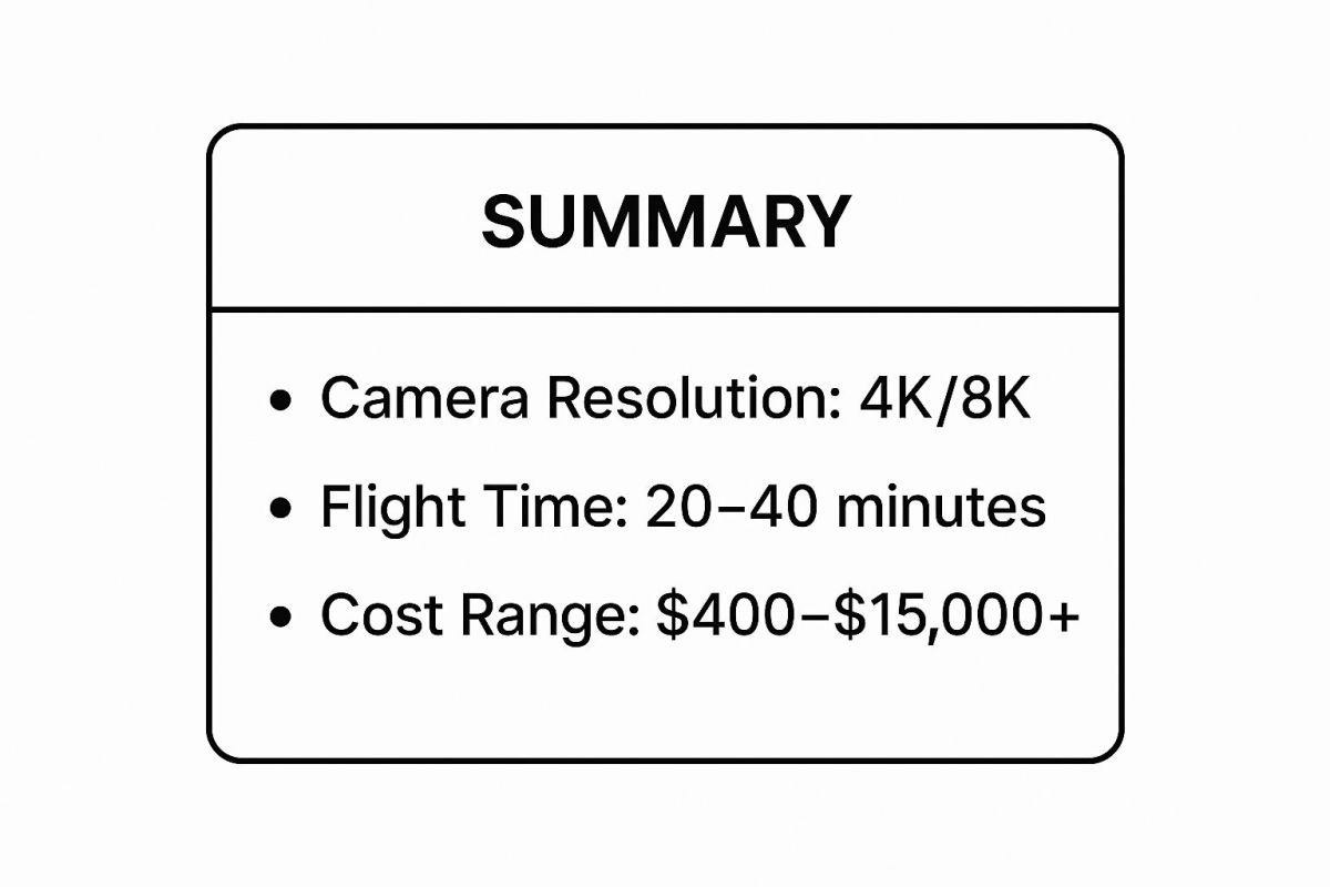
As the data shows, the balance between flight time and equipment cost is a critical consideration for professionals planning complex or lengthy shoots.
2. Search and Rescue Operations
One of the most critical and life-saving uses of drones is in search and rescue (SAR) operations. Emergency responders deploy UAVs equipped with advanced technologies like thermal cameras, high-zoom lenses, and GPS to quickly survey vast or dangerous terrain. This capability allows teams to locate missing persons or assess disaster zones far more efficiently and safely than traditional ground or manned-aircraft methods.
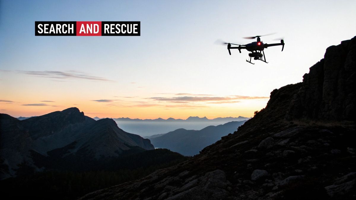
The core technology involves rugged, weather-resistant drones, often from manufacturers like DJI, carrying specialised payloads. A thermal imaging camera is essential, as it detects heat signatures, making it possible to find a person in dense foliage, at night, or after an avalanche. Loudspeakers and spotlights can also be attached to communicate with victims or illuminate an area, transforming the drone into a vital first-response tool.
Strategic Applications and Benefits
This application dramatically increases the speed and success rate of rescue missions by extending the reach of emergency services.
- Disaster Response: Following events like Hurricane Harvey, drones provided real-time aerial intelligence, identifying flooded areas and stranded individuals, which guided boat rescue teams directly to those in need.
- Wilderness Search: In national parks and alpine regions, SAR teams use drones to cover immense, rugged areas when searching for lost hikers. The Swiss Alpine Rescue, for example, uses the DJI Matrice series to locate victims in hazardous mountain environments.
- Avalanche Victim Location: Drones with thermal sensors can rapidly scan avalanche debris fields for heat signatures, a task that would take ground teams significantly longer and expose them to further risk.
- Wildfire Evacuations: During fast-moving wildfires in California, drones have been used to monitor the fire's progression, locate trapped residents, and guide them to safe evacuation routes.
The ability of drones to provide immediate situational awareness without endangering personnel is a game-changer for emergency management. You can learn more about the specifics of drones for rescue operations and how they are integrated into modern response protocols.
3. Agricultural Monitoring and Crop Management
One of the most impactful uses of drones is in precision agriculture, where UAVs are transforming how farmers manage their land and crops. By equipping drones with advanced sensors like multispectral and thermal cameras, agricultural professionals can gather detailed data on crop health, soil conditions, and irrigation needs. This technology enables a data-driven approach to farming, increasing yields while reducing waste and environmental impact.
The core technology combines a robust drone platform with specialised imaging sensors. Multispectral sensors capture data from specific light wavelengths, which can reveal plant stress or disease before it's visible to the human eye. This information is processed using specialised software to create detailed field maps, such as NDVI (Normalised Difference Vegetation Index) maps, which visually represent crop health. This allows farmers to make highly targeted interventions, a practice often referred to as precision agriculture.
Strategic Applications and Benefits
This application optimises resource management and boosts operational efficiency in farming.
- Crop Health Monitoring: Drones can quickly survey vast areas of farmland to identify issues like nutrient deficiencies, pests, and diseases. For example, vineyards in Napa Valley use multispectral imaging to monitor vine stress, ensuring optimal grape quality for wine production.
- Targeted Spraying: UAVs like the Yamaha RMAX series, used extensively in Japan's rice fields, can apply pesticides or fertilisers with pinpoint accuracy. This targeted application significantly reduces chemical runoff and protects surrounding ecosystems.
- Yield Optimisation: Farmers in regions like the Iowa corn belt use drone data to analyse plant populations and predict yields. This allows for better planning and resource allocation throughout the growing season, a key focus in modern farming. Learn more about drones in Australian agriculture to see regional applications.
The infographic below outlines the typical workflow for integrating drones into agricultural operations.
As shown, the process from data capture to actionable insight is a cyclical workflow that empowers farmers to respond proactively to changing field conditions.
4. Infrastructure Inspection and Maintenance
One of the most valuable and safety-critical uses of drones is in the inspection and maintenance of critical infrastructure. Drones equipped with high-resolution cameras, thermal sensors, and LiDAR technology can safely and efficiently examine assets like bridges, power lines, wind turbines, and pipelines. This modern approach replaces dangerous, costly, and time-consuming manual inspections that often required rope access, helicopters, or facility shutdowns.
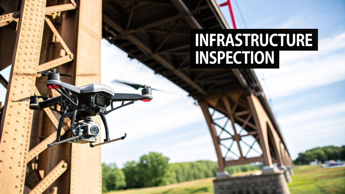
The core technology involves deploying specialised drones, such as those from DJI Enterprise or Skydio, to capture detailed data from various angles. Thermal sensors can detect hotspots on power lines indicating a potential failure, while LiDAR creates precise 3D models to identify structural deviations. This data provides asset managers with a comprehensive and actionable understanding of their infrastructure's condition, enabling predictive maintenance.
Strategic Applications and Benefits
This application enhances safety and operational efficiency by providing precise, repeatable data.
- Energy and Utilities: Companies like Pacific Gas & Electric use drones to inspect thousands of kilometres of power lines, identifying vegetation encroachment and equipment faults before they cause outages. Similarly, wind turbine blade inspections are completed in a fraction of the time compared to traditional methods.
- Transport and Civil Engineering: State Departments of Transport (DOTs) use drones to conduct bridge inspections, capturing high-resolution imagery of hard-to-reach areas to check for cracks, corrosion, and structural fatigue without disrupting traffic.
- Telecommunications: Major carriers like Verizon deploy drones for routine cell tower maintenance. This reduces the need for tower climbs, which is one of the most hazardous jobs, and speeds up diagnostics and repair planning.
- Oil and Gas: Drone fleets monitor extensive pipeline networks for leaks, corrosion, and unauthorised activity, providing persistent surveillance over vast and often remote territories.
This shift from manual to automated inspection dramatically lowers risks for human workers and provides more consistent, high-quality data for maintaining essential services.
5. Package and Medical Supply Delivery
One of the most rapidly evolving and impactful uses of drones is in automated package and medical supply delivery. This application leverages autonomous UAVs to transport goods, from commercial products to life-saving medical supplies, directly to consumers or patients. By bypassing traditional ground-based logistics, drones offer a solution to the "last-mile" delivery problem, drastically reducing delivery times and reaching locations that are remote, congested, or otherwise difficult to access.
The core technology integrates advanced GPS navigation, sense-and-avoid sensors, and secure payload systems. A drone is dispatched from a central hub, follows a pre-programmed flight path, and delivers its package by landing in a designated zone or lowering the item via a tether. This process is particularly transformative in healthcare, where speed is critical. Companies like Zipline and UPS Flight Forward are pioneering these services, proving their viability in both developing nations and regulated Western markets.
Strategic Applications and Benefits
This application is revolutionising logistics by enabling on-demand, time-critical deliveries.
- Medical and Emergency Services: Drones are used to deliver blood, vaccines, medications, and other critical medical supplies to rural clinics and emergency sites. Zipline's operations in Rwanda and Ghana have become a global benchmark, showcasing how drones can fortify a nation's healthcare supply chain.
- E-commerce and Retail: Companies like Amazon (Prime Air) and Google's Wing are developing and trialling drone delivery networks to get packages to customers within minutes of ordering. Wing's service is already operational in parts of Australia, delivering items like coffee and groceries.
- Food and Beverage Delivery: In Ireland, Manna Drone Delivery partners with local businesses to deliver takeaway food and other goods, demonstrating a commercially successful model for short-distance, high-frequency urban deliveries.
The key benefit is the ability to provide rapid, reliable service in situations where traditional methods are too slow, expensive, or impractical. As regulatory frameworks mature, the scale of drone delivery networks is expected to expand exponentially, fundamentally altering consumer expectations and supply chain efficiency.
6. Environmental Monitoring and Conservation
One of the most impactful uses of drones is in environmental monitoring and conservation, offering a non-invasive and highly efficient way to protect our planet's ecosystems. Researchers and conservation organisations deploy UAVs equipped with specialised sensors to gather crucial data on wildlife, deforestation, and climate change effects. This technology provides an aerial perspective that is safer, cheaper, and less disturbing than traditional methods like piloted aircraft or ground-based teams.
The core technology involves fitting drones with various payloads, such as high-resolution cameras, thermal sensors, or LiDAR scanners. Thermal cameras are instrumental in locating animals through their heat signatures, even in dense foliage or at night, while LiDAR can map forest canopies and measure biomass. This data allows for precise and scalable monitoring, providing conservationists with the actionable intelligence needed to protect vulnerable species and habitats from threats like poaching and illegal logging.
Strategic Applications and Benefits
This application provides an invaluable toolkit for safeguarding biodiversity and managing natural resources.
- Wildlife Population Surveys: Organisations like the World Wildlife Fund (WWF) use drones to conduct accurate counts of animal populations, such as whales or nesting sea turtles, without causing stress to the animals. This provides reliable data for conservation strategies.
- Anti-Poaching Operations: In Africa, drones with thermal imaging cameras are used for night-time surveillance of national parks, helping rangers detect and intercept poachers before they can harm endangered species like rhinos and elephants.
- Deforestation and Habitat Assessment: Drones are used to monitor the Amazon rainforest, mapping areas of illegal logging and assessing the health of coral reefs. The high-resolution imagery helps quantify habitat loss and target reforestation efforts effectively.
By minimising human disturbance and providing comprehensive data, drones have become an essential asset in modern environmental science and conservation efforts.
7. Military and Defence Operations
One of the most profound and high-stakes uses of drones is in military and defence operations. These advanced unmanned aerial systems (UAS) serve as a critical force multiplier, performing tasks that range from intelligence gathering to tactical strikes. By deploying drones, armed forces can gain superior situational awareness, extend their operational reach, and significantly reduce the risk to human personnel in dangerous or hostile environments.
The core of this application involves highly sophisticated drones equipped with an array of sensors, including high-resolution electro-optical/infrared (EO/IR) cameras, synthetic aperture radar (SAR), and signals intelligence (SIGINT) payloads. These systems are often designed for long-endurance flights, allowing them to provide persistent surveillance over a target area for hours or even days. Operators, often located thousands of kilometres away, control the drone via secure satellite communication links, receiving real-time data to inform strategic decisions.
Strategic Applications and Benefits
This technology has fundamentally reshaped modern warfare by providing unmatched intelligence and precision capabilities.
- Intelligence, Surveillance, and Reconnaissance (ISR): Drones like the Northrop Grumman RQ-4 Global Hawk are used for high-altitude, long-endurance surveillance, monitoring vast areas to track enemy movements, identify targets, and gather crucial intelligence without alerting adversaries.
- Precision Strikes and Tactical Support: Armed drones, such as the General Atomics MQ-9 Reaper, can carry precision-guided munitions. This allows for targeted strikes against high-value targets with minimal collateral damage, providing vital close air support to ground troops.
- Border Patrol and Security: Drones offer a cost-effective method for monitoring long stretches of national borders, coastlines, and critical infrastructure. They can detect illegal crossings, smuggling activities, and potential threats in real-time, enabling rapid response from security forces.
8. Surveying and Mapping
One of the most efficient and accurate uses of drones is in surveying and mapping. Professional surveyors utilise drones equipped with advanced sensors like high-precision GPS, LiDAR, and photogrammetry systems to create detailed topographic maps, 3D models, and precise land measurements. This technology dramatically reduces the time and cost associated with traditional ground-based surveys, while often improving data accuracy and keeping personnel safe from hazardous terrain.
The core technology involves flying a drone over a designated area along a pre-programmed flight path. The onboard sensors, whether a high-resolution camera for photogrammetry or a LiDAR unit for laser scanning, capture thousands of data points. This data is then processed through specialised software to generate orthomosaic maps, digital elevation models (DEMs), and point clouds, providing a comprehensive digital representation of the surveyed area.
Strategic Applications and Benefits
This application provides unprecedented speed and detail for geospatial data collection, transforming project management and land analysis.
- Construction Site Monitoring: Drones provide frequent, accurate updates on site progress. This allows project managers to track earthwork volumes, verify as-built conditions against design plans, and improve overall site logistics.
- Mining and Aggregates: Operators use drones to safely and quickly calculate stockpile volumes, monitor pit walls for stability, and map haul roads. This leads to better inventory management and enhanced operational safety.
- Urban Planning and Development: Drones help create highly detailed 3D models of urban environments. Planners use this data for site selection analysis, infrastructure planning, and visualising the impact of new developments.
- Environmental and Flood Plain Mapping: Authorities can rapidly map large and often inaccessible areas to model water flow, assess flood risks, and monitor environmental changes over time with high precision.
For those interested in the technical specifics, you can learn more about how aerial surveying with UAVs works here. The ability to capture high-resolution data quickly and safely makes drones an indispensable tool in modern surveying.
9. Law Enforcement and Public Safety
One of the most rapidly expanding uses of drones is in law enforcement and public safety, where they serve as a critical force multiplier. Police and emergency services deploy unmanned aerial vehicles (UAVs) to gain vital situational awareness, document complex scenes, and enhance officer safety. By providing an aerial perspective, drones offer a strategic advantage in situations that are often dangerous or difficult to assess from the ground.
The core of this application involves rugged, often specialised drones equipped with high-zoom thermal and optical cameras. These tools provide real-time video feeds to command centres and officers on the ground, allowing for informed, data-driven decision-making during high-stakes operations. Drones can be deployed rapidly to provide overwatch, gather intelligence, and de-escalate situations without putting personnel in harm's way.
Strategic Applications and Benefits
This technology transforms public safety operations by providing immediate, low-cost aerial support.
- Tactical Operations: During a standoff or high-risk warrant service, a SWAT team can use a drone to look inside windows, clear a perimeter, or track a suspect's movements. This provides critical intelligence without exposing officers to direct threats. Drones like the Brinc Lemur S are specifically designed for indoor tactical situations.
- Search and Rescue: When a person goes missing in a remote or difficult-to-access area, drones equipped with thermal cameras can scan vast areas far more quickly and effectively than a ground team. This drastically reduces search times and increases the probability of a successful rescue.
- Crime and Accident Scene Investigation: Drones can create detailed 3D models and high-resolution maps of crime scenes or major traffic accidents. This provides investigators with a comprehensive and permanent record of the scene, preserving evidence that might otherwise be missed or disturbed.
- Crowd and Event Monitoring: For large public gatherings like festivals or protests, drones offer a non-intrusive way to monitor crowd dynamics, identify potential safety issues, and manage traffic flow, ensuring a safer environment for everyone involved.
10. Disaster Response and Assessment
One of the most critical and impactful uses of drones is in disaster response and assessment. When natural disasters strike, emergency management agencies deploy drones to gather real-time intelligence from hazardous environments, allowing them to coordinate relief efforts and save lives. These unmanned systems provide rapid situational awareness in areas that are inaccessible or too dangerous for human responders.
The core technology involves rugged, weather-resistant drones equipped with a suite of sensors, including high-resolution cameras, thermal imaging, and LiDAR. These sensors provide a comprehensive overview of the post-disaster landscape, from identifying stranded individuals with thermal cameras to mapping the extent of floodwaters with LiDAR. This data is transmitted in real-time to a command centre, enabling incident commanders to make informed decisions swiftly.
Strategic Applications and Benefits
This application fundamentally changes how first responders approach disaster scenarios, prioritising safety and efficiency.
- Damage Assessment: Following events like hurricanes or earthquakes, drones are used to quickly survey vast areas, identifying damaged infrastructure, collapsed buildings, and blocked roads. Agencies like FEMA use this data to prioritise resource allocation and expedite recovery funding.
- Search and Rescue (SAR): In situations like wildfire perimeters or collapsed structures, drones with thermal sensors can detect heat signatures, helping locate missing persons far more quickly than ground teams. This is a crucial function when every second counts.
- Situational Awareness: Drones provide live video feeds to incident command posts, offering a bird's-eye view of evolving situations like flood levels or wildfire progression. This real-time information is invaluable for coordinating response teams and ensuring their safety.
Organisations like the Red Cross and local emergency services leverage this technology to deliver aid more effectively and protect both victims and responders. Coordinated flights with other agencies are essential to avoid airspace conflicts and maximise the operational benefits.
Uses of Drones: Top 10 Applications Comparison
| Application | Implementation Complexity 🔄 | Resource Requirements ⚡ | Expected Outcomes 📊 | Ideal Use Cases 💡 | Key Advantages ⭐ |
|---|---|---|---|---|---|
| Aerial Photography and Videography | Moderate – requires operator skill and some equipment setup | High – advanced drones with 4K/8K cameras and gimbals | High-quality stabilized aerial footage | Filmmaking, real estate marketing, events, content creation | Cost-effective vs helicopters, unique angles, ease of use |
| Search and Rescue Operations | High – needs trained operators and coordination | High – thermal cameras, communication systems, durable drones | Rapid area coverage, real-time situational awareness | Emergency response, disaster zones, missing person search | Access to hazardous areas, 24/7 operation, safety |
| Agricultural Monitoring and Crop Management | High – technical expertise for sensors and data analysis | High – multispectral sensors, mapping software | Increased crop yields, resource optimization | Precision agriculture, crop health monitoring | Data-driven decisions, reduced pesticide/water use |
| Infrastructure Inspection and Maintenance | Moderate to high – skilled operators and tech integration | High – LiDAR, thermal sensors, AI defect recognition | Faster, safer inspections, comprehensive defect detection | Bridge, power line, wind turbine inspection | Up to 90% cost reduction, enhanced safety |
| Package and Medical Supply Delivery | Moderate – automated systems with GPS and payload security | Moderate to high – secure payload, long-range comms | Rapid, reliable deliveries to remote areas | Medical emergencies, rural deliveries, time-critical logistics | Reduced costs, 24/7 potential, environmental benefits |
| Environmental Monitoring and Conservation | High – specialized sensors and data interpretation | Moderate to high – thermal/infrared cameras, long missions | Non-invasive monitoring, large area coverage | Wildlife tracking, deforestation, anti-poaching efforts | Cost-effective, real-time detection, minimal ecosystem impact |
| Military and Defense Operations | Very high – advanced tech, secure comms, and autonomy | Very high – encrypted systems, multi-sensor payloads | Extended surveillance, tactical support, reduced personnel risk | Surveillance, reconnaissance, target acquisition | 24/7 ops, cost-effective vs manned aircraft, stealth |
| Surveying and Mapping | High – precision GPS and LiDAR require training and calibration | High – RTK GPS, photogrammetry software, LiDAR | Accurate topographic maps, 3D models | Construction, mining, urban planning | Sub-cm accuracy, faster & safer than traditional methods |
| Law Enforcement and Public Safety | Moderate – requires training, regulatory compliance | Moderate to high – thermal, zoom cameras, encrypted comms | Improved situational awareness, officer safety | Crowd monitoring, crime scene, traffic management | Rapid deployment, cost-effective surveillance |
| Disaster Response and Assessment | Moderate to high – multi-agency coordination | High – multi-spectral sensors, weather-resistant drones | Quick damage assessment, resource prioritization | Natural disasters, emergency management | Operates in marginal weather, improves communication |
Harnessing the Future: Key Takeaways on Drone Technology
As we have explored throughout this article, the diverse and expanding uses of drones showcase a technology that has firmly moved from a niche interest to a fundamental operational tool across countless industries. The journey from simple aerial photography to complex, data-driven missions in sectors like emergency management, mining, and infrastructure inspection highlights a remarkable technological evolution. The applications we’ve detailed are not just theoretical possibilities; they represent a tangible shift in how modern operations are conducted, delivering unprecedented levels of efficiency, safety, and data accuracy.
The common thread weaving through these successful implementations is a strategic approach that goes beyond merely deploying a drone. It is about integrating an entire aerial intelligence ecosystem. This involves selecting the right airframe, equipping it with purpose-built sensors, and leveraging sophisticated software to transform raw data into actionable insights.
Synthesising the Core Strategic Insights
Reflecting on the wide array of applications, from agricultural monitoring to defence operations, several key strategic takeaways emerge for organisations looking to harness this technology.
-
Data as the Primary Asset: The true value of a drone is not its ability to fly, but its capacity to be a platform for data acquisition. For geospatial firms conducting LiDAR surveys or environmental agencies monitoring coastal change, the focus must be on the quality, accuracy, and actionability of the data collected. The drone itself is the vehicle; the data is the destination.
-
Safety and Risk Mitigation: A foundational benefit across all sectors, from infrastructure inspection to public safety, is the removal of personnel from hazardous environments. Drones can inspect transmission lines at height, survey unstable mining pits, and provide situational awareness in disaster zones, drastically reducing human risk and associated costs.
-
Operational Efficiency at Scale: Drones enable tasks to be completed in a fraction of the time required by traditional methods. Large-area mapping for transport agencies, repeatable surveys for resource operators, and rapid damage assessments for emergency services all demonstrate a significant return on investment through accelerated timelines and optimised resource allocation.
Key Takeaway: Successful drone integration is not a plug-and-play solution. It requires a deep understanding of the specific operational challenge, the regulatory environment, and the end-to-end data workflow to truly unlock its transformative potential.
Actionable Next Steps for Your Organisation
Understanding the potential uses of drones is the first step. The next is to build a strategic implementation plan tailored to your unique requirements.
-
Define Your Core Objective: Clearly identify the problem you are trying to solve. Are you aiming to reduce survey costs, improve asset inspection safety, or gain faster situational awareness? A well-defined objective will guide every subsequent decision.
-
Evaluate Platform and Payload Needs: Not all drones are created equal. An operator mapping a pipeline right-of-way needs long-endurance capabilities, while an infrastructure firm creating a digital twin requires a heavy-lift platform for premium LiDAR scanners. Match the technology to the task.
-
Plan for Data Integration: Consider how the data collected by the drone will be processed, analysed, and integrated into your existing workflows and systems. The goal is to make the data accessible and useful to the stakeholders who need it most.
Mastering these concepts is crucial because drone technology is no longer a competitive advantage, it is fast becoming an operational necessity. As capabilities in autonomous flight, AI-powered analytics, and sensor miniaturisation continue to advance, the gap between early adopters and those left behind will only widen. The organisations that embrace these tools today are positioning themselves to lead their industries in efficiency, safety, and innovation tomorrow.
The future of drones is not simply about what they can do, but how they empower us to see, analyse, and interact with our world more intelligently. From ensuring the integrity of our critical infrastructure to protecting our natural environment, the view from above is providing the insights we need to build a better, safer, and more efficient future on the ground.
Ready to move from theory to application? To leverage a purpose-built, high-performance drone platform designed for the most demanding industrial and governmental challenges in Australia, connect with the experts at Innoflight International. Explore our range of secure, compliant, and long-endurance solutions tailored for your specific mission at Innoflight International.