When we talk about drones in firefighting, we're not just talking about a gadget with a camera. We're talking about a fundamental shift in how fire services get eyes on a scene. These are purpose-built unmanned aerial vehicles, loaded with specialised sensors like thermal cameras, giving crews the ability to see through smoke and darkness.
They act as a persistent eye in the sky, providing real-time intelligence that helps crews map fire perimeters, pinpoint dangerous hotspots, and ultimately, make safer and more effective decisions on the ground.
The New Eyes in the Sky for Modern Firefighting
Picture a wildfire, but instead of seeing it from the chaotic, smoke-filled ground level, you have a clear, stable view from high above. That's the advantage drones bring to the table. They’ve quickly become an indispensable tool, offering firefighters a kind of superhuman vision to spot fires earlier, track their spread in real-time, and keep crews out of harm's way.
This guide will take you beyond the hype. We’ll get into the specific drones, advanced sensors, and operational tactics that are actually being used in the field today. We'll unpack how this technology is changing the game, from finding hidden embers in a smouldering forest to mapping a fire's perimeter with incredible accuracy.
A Strategic Advantage in Fire Management
The real value of using drones for firefighting is their power to gather critical intelligence without putting a single person at risk. Before drones, incident commanders had to piece together a picture from ground reports, expensive manned aircraft flyovers, and sometimes, plain old guesswork. This often led to an incomplete view, especially in rough terrain or when thick smoke wiped out visibility.
Drones offer a steady, low-altitude perspective that manned aircraft simply can't maintain safely or cost-effectively. This constant flow of information allows for smarter, more strategic decision-making when it matters most.
Here’s what that looks like in practice:
- Enhanced Situational Awareness: Drones stream live video, giving commanders a bird's-eye view of the entire fireground as it unfolds.
- Improved Firefighter Safety: By spotting hidden dangers like potential flare-ups or structurally unsound buildings, drones help keep boots on the ground away from unnecessary risks.
- Efficient Resource Allocation: With precise data on a fire’s location and intensity, crews and equipment can be sent exactly where they’ll have the biggest impact.
Proactive Monitoring and Early Detection
In vast landscapes like the Australian bush, getting on top of a fire early is everything. Drones are becoming a key part of managing these areas proactively. Small drones can be sent up overnight to patrol remote, tinder-dry bushland, searching for smouldering tree roots or wisps of smoke from tree hollows—the very first signs of a blaze.
These drones can keep watch all night, tracking how small fires develop and spread. As dawn approaches, larger drones could be dispatched to drop fire retardants, all while the smaller drones feed continuous data back to human crews. This allows them to act decisively before the morning winds turn a small spot fire into an uncontrollable megafire. You can read more about this concept in the article How drones may soon be fighting Australia’s bushfires on Australian Geographic.
By providing intelligence during the critical early stages of a fire, drones give firefighters a crucial head start. This capability can mean the difference between a small, manageable incident and a large-scale disaster.
Choosing the Right Drone for the Mission
When you're on the fire ground, having the right tool for the job can literally be a lifesaver. Drones are no different. You wouldn't use a small scout vehicle to haul water, and you wouldn't send a heavy tanker to do quick reconnaissance. The same logic applies here.
The key is matching the drone's capabilities to what the mission actually needs. A small, fast-moving grass fire requires a completely different eye in the sky than a massive, slow-burning bushfire chewing through remote, rugged country. Getting this right is the first step to using this technology effectively.
This image gives you a fantastic visual breakdown of how different drones fill different roles over a fire.
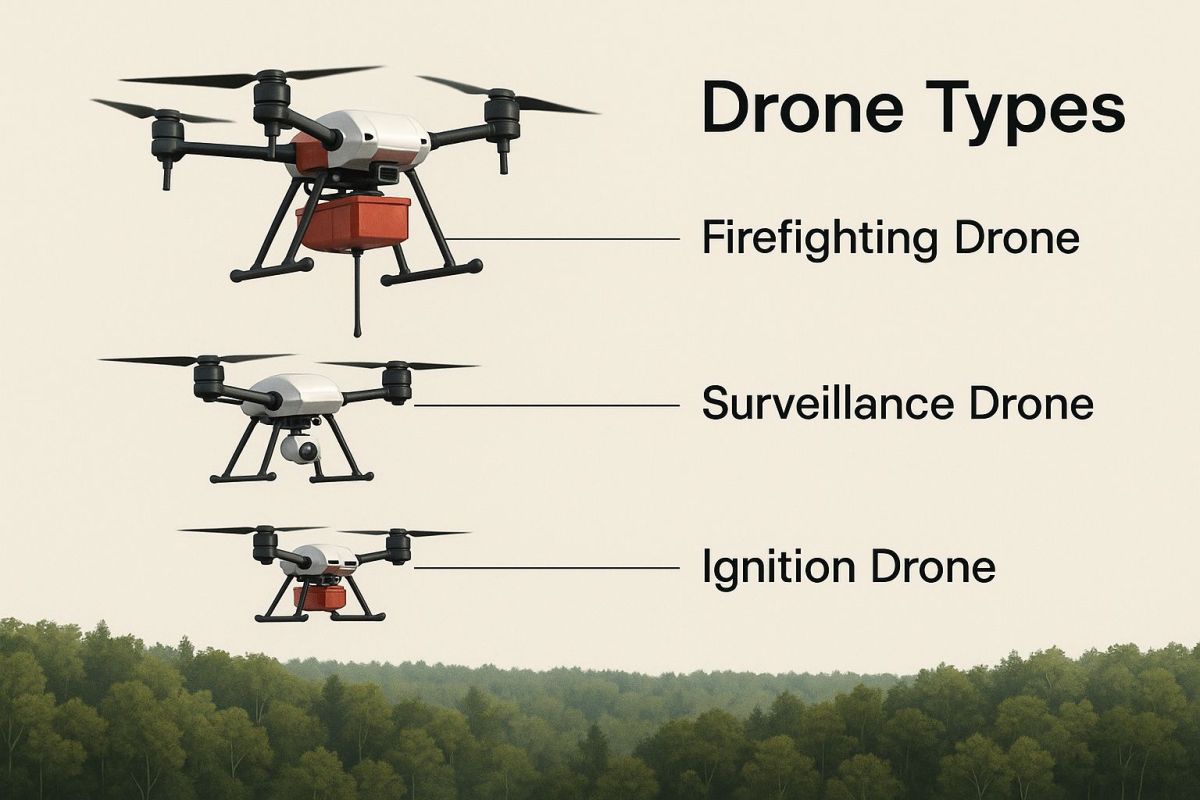
As you can see, each type operates at a different altitude and is built for a specific job, from getting up close for a detailed look to staying high for wide-area surveillance.
To make this even clearer, let's break down the main types you'll encounter and see where each one shines.
Comparing Key Firefighting Drone Platforms
This table offers a quick comparison of the primary drone platforms used in firefighting. It highlights their core strengths and typical jobs, helping you see at a glance which tool fits which scenario.
| Drone Type | Key Strengths | Primary Use Case | Flight Time |
|---|---|---|---|
| Multi-Rotor | Hovering, agility, close-quarters inspection | Situational awareness, search & rescue, damage assessment | < 60 minutes |
| Fixed-Wing | Endurance, speed, wide-area coverage | Large-scale fire mapping, perimeter monitoring | Several hours |
| Hybrid VTOL | Combines endurance with vertical take-off | Missions needing both long flight and tight deployment | 1-3+ hours |
Understanding these differences is crucial for any incident commander looking to build an effective aerial strategy. Each platform brings something unique to the table.
Multi-Rotor Drones: The Aerial Swiss Army Knives
When most people picture a drone, they're thinking of a multi-rotor. These are the workhorses for getting a close-up, detailed view of the fire ground. Think of them as an aerial Swiss Army knife—versatile and incredibly handy in tight spots.
Because they can take off vertically and hover perfectly still, they're brilliant for detailed inspections in complex areas. They can duck and weave between trees or buildings, giving crews a perspective that's impossible to get from a helicopter or a plane.
This makes them perfect for:
- Situational Awareness: Getting a live feed of a fire in an urban area or dense bushland.
- Search and Rescue: Using a thermal camera to find someone trapped inside a building or lost in thick scrub.
- Damage Assessment: Hovering to get crystal-clear photos of damaged homes or infrastructure after the fire front has passed.
The main trade-off? Battery life. Most multi-rotors can only stay in the air for less than an hour, so you need a good system for swapping batteries to keep a continuous eye on the scene.
Fixed-Wing Drones: The Marathon Runners of the Sky
If multi-rotors are the sprinters, fixed-wing drones are the marathon runners. These look and fly more like traditional aeroplanes, and what they lose in hovering ability, they more than make up for in endurance.
A fixed-wing drone can stay airborne for hours on end, soaring over massive areas. This makes it the go-to choice for monitoring the perimeter of a huge bushfire or mapping the full extent of the devastation. It's all about providing that 'big picture' view.
This strategic intelligence is invaluable. By covering huge distances, fixed-wing drones help commanders see where the fire is heading hours in advance, allowing them to move crews and resources into place before it's too late.
Hybrid VTOL Drones: The Best of Both Worlds
Now, this is where things get really interesting. Hybrid VTOL (Vertical Take-Off and Landing) drones are a newer class of aircraft that truly combine the best features of both multi-rotor and fixed-wing models.
They take off and land straight up, just like a helicopter, but once they're in the air, they transition to fly like an aeroplane. This is a game-changer.
It means you get the long flight times and range of a fixed-wing, but you don't need a runway. You can launch them from a small clearing in the bush or the back of a vehicle. It's interesting to see how other industries are figuring out how to manage this kind of tech; for instance, some of the planning principles behind utilizing drones for construction have parallels here. For firefighters, this hybrid capability is perfect for long-duration missions in tricky terrain where you need both endurance and flexibility.
Seeing Through Smoke with Advanced Drone Sensors
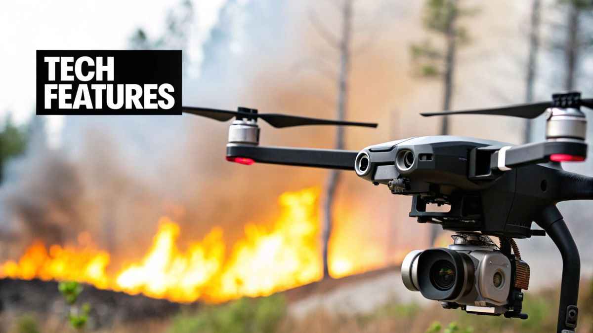
A drone is just an empty shell until you equip it for a specific mission. In a fire emergency, its real power comes from the advanced sensors it carries, giving firefighters an incredible eye in the sky. These payloads cut straight through the chaos, delivering clear, actionable data when smoke and darkness would otherwise leave crews flying blind.
Think of these sensors as specialised tools in a high-tech toolkit, each designed for a different job. You've got cameras that see heat and instruments that map terrain with pinpoint accuracy. It's this technology that turns a simple aerial platform into a formidable intelligence-gathering asset, helping everyone make smarter, safer decisions on the ground.
Every piece of equipment translates to a real-world outcome, whether that's guiding a crew to a hidden flare-up or finding a person trapped in a zero-visibility building.
Thermal Cameras: The Ultimate Game Changer
If there's one piece of kit that has completely changed the game for drones in firefighting, it's the thermal camera. A standard camera captures visible light—what we see. A thermal imager, on the other hand, detects infrared radiation. Essentially, it sees heat. This gives it the amazing ability to peer through thick smoke, dense fog, and total darkness.
For a firefighter, this is nothing short of revolutionary. It takes a situation where you can’t see your hand in front of your face and turns it into a clear picture of what’s really happening. Ground crews can be directed with absolute precision to the hottest parts of the fire, even when those hotspots are completely invisible to the naked eye.
This technology is absolutely critical for a few key tasks:
- Hotspot Detection: Finding those sneaky, smouldering embers during mop-up operations that could easily reignite a fire days later.
- Search and Rescue: Spotting the heat signature of a person trapped in a smoke-filled building or lost in dense bushland at night.
- Fire Line Monitoring: Seeing the true edge of a fire front through heavy smoke to understand where it's most active and where it's likely to go next.
A thermal drone doesn’t just show you where the fire is; it reveals the fire’s intensity and its behaviour. This insight lets incident commanders deploy their resources with surgical precision, sending crews where they'll have the biggest impact while keeping them out of unseen danger.
High-Resolution Visual and Zoom Cameras
While thermal imaging is vital, you can't discount the importance of high-resolution visual cameras for overall situational awareness. These are powerful RGB cameras—like what you’d find on a high-end photography drone—but often beefed up with incredible zoom capabilities.
In daylight, they provide a crystal-clear, detailed view of the incident. A drone can hover hundreds of metres away from the danger zone and use its zoom lens to inspect a building's structural integrity, spot hazards like fallen powerlines, or simply monitor crew movements on the fireground. This kind of detailed visual information is essential for effective planning and management.
When you combine thermal and visual sensors on a single drone, you get a powerful dual-view system. A pilot can flick between the two feeds, using the thermal view to find a hotspot and then immediately zooming in with the visual camera to see exactly what's on fire.
Multispectral and LiDAR Payloads
Moving beyond thermal and visual, more specialised payloads are coming into play for predictive analysis and detailed mapping. Multispectral sensors, for instance, capture light from specific frequencies that the human eye can't see. This is incredibly useful for assessing the health of vegetation over vast areas.
By analysing this data, experts can identify patches of drought-stressed forest that are at a much higher risk of catching fire. It’s a proactive approach that helps authorities plan hazard reduction burns and position resources long before a fire season kicks off.
LiDAR (Light Detection and Ranging) is another powerful tool. It works by shooting out laser pulses and measuring their return to create stunningly detailed 3D maps of the terrain. After a fire has passed, a drone with a LiDAR sensor can be used for:
- Burn Severity Mapping: Accurately measuring the fire's impact on the landscape and tree canopy.
- Erosion Risk Assessment: Identifying steep, unstable slopes that could become a landslide risk now that the vegetation is gone.
- Infrastructure Damage Analysis: Creating precise models of damaged roads, bridges, and buildings to help with recovery efforts.
These advanced mapping techniques borrow from the world of professional aerial surveying using UAVs, where precision and high-quality data are everything. The information gathered helps communities get back on their feet faster and build resilience for whatever comes next.
How Drones Are Used in a Wildfire Response
It’s one thing to list what a firefighting drone can do, but it’s another to see how it all fits together during a live incident. To really get a feel for the technology's impact, let's walk through a realistic scenario—from the first spark to the final all-clear—and see how drones give responders an edge at every single stage.
Picture a remote, tinder-dry stretch of bushland, deep in the night. A lightning strike zaps a patch of dry grass, and a fire is born. Long before a person could ever spot it, an automated patrol drone flying a pre-set route picks up a sudden temperature spike with its thermal camera. This isn't just a blind alert; the system’s software flags it as a new ignition, instantly pinging the coordinates and a thermal snapshot straight to the regional fire command centre.
The incident commander gets the alert in minutes, not hours. They have eyes on the scene immediately, instead of trying to piece together a vague report from a passerby.
The First Hour: Initial Assessment and Deployment
The commander wastes no time, dispatching a faster, more agile multi-rotor drone to the coordinates for a closer look. A live video feed streams directly to the command post, showing a small but growing grass fire being pushed by a light breeze. This real-time view is priceless.
From the drone’s high-definition and thermal feeds, the commander can quickly size up several critical factors:
- Rate of Spread: How fast is this thing moving?
- Fuel Type: What kind of scrub and vegetation is in its path?
- Nearby Risks: Are there any properties, roads, or power lines nearby?
- Safe Access Points: What are the best and safest routes for incoming ground crews?
Armed with a clear, live picture, the commander can deploy the first-response crews with total confidence. They aren't driving into the unknown. They know exactly where to go, what to expect, and where to set up a safe staging area. This kind of early intel massively reduces risk and makes the initial attack far more effective.
The Main Battle: Tracking the Fire and Protecting Crews
As the teams get to work on the ground, the drones’ mission changes. One drone might hover closer, acting as a dedicated eye in the sky for the ground teams. Its thermal camera cuts right through the thick smoke, spotting dangerous hotspots just ahead of the firefighters. This allows team leaders to direct their efforts with pinpoint accuracy and avoid walking into a sudden flare-up.
At the same time, a long-endurance fixed-wing drone launches to handle the big picture. It flies a wide pattern around the entire fire, constantly mapping the perimeter. This data is fed into mapping software, creating a live, evolving map of the fire's true shape and size.
This constant stream of data from multiple drones provides a single source of truth for everyone involved. The incident commander sees the fire’s progress, crew leaders see immediate threats, and air attack supervisors can coordinate water-bombing runs without getting in each other's way.
This strategic oversight is surprisingly similar to how advanced systems are used in large-scale land management, where the principles of precision agriculture with drones inform how wide areas are monitored and analysed. The goal is identical: use aerial data to make smarter decisions on the ground.
The Final Stages: Mop-Up and Damage Assessment
After hours of hard work, the main fire front is contained. But the job isn't over. Now comes the long, slow work of "mopping up," and it's absolutely critical. A single hidden ember can reignite and undo everything.
This is where thermal drones truly shine.
A drone flies a systematic grid pattern over the entire burnt area, its sensitive thermal camera hunting for any lingering heat. On the operator's screen, the blackened landscape is a cool, dark blue, but a smouldering tree stump or a hot spot deep in a root system glows like a bright white beacon.
The drone operator logs the GPS coordinates for each hotspot and sends them straight to the ground crews. Instead of spending days wandering around looking for a needle in a haystack, firefighters can walk directly to each potential threat and put it out for good. This makes the mop-up process dramatically faster and gives everyone a much higher level of confidence that the fire is truly out.
Once the "all-clear" is finally given, the drones have one last job. They fly over the area one more time, capturing high-resolution imagery to create detailed maps for post-fire analysis. This is used for:
- Damage Assessment: Documenting the extent of damage to property, infrastructure, and the natural environment for insurance claims and recovery efforts.
- Burn Severity Mapping: Analysing the fire's impact on soil and vegetation to predict erosion risks and plan for land rehabilitation.
From the very first automated detection to the final recovery survey, drones provide a continuous thread of vital intelligence that makes the entire firefighting operation safer, faster, and more effective.
Navigating the Rules for Emergency Drone Operations
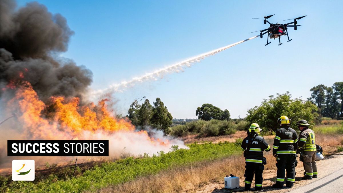
Putting a drone into the sky during an active emergency isn't a simple case of 'up and go'. Firefighting drones work in some of the most complex and high-stakes environments imaginable, often sharing the air with helicopters and massive air tankers. Because of this, every single flight has to follow strict rules and safety protocols to avoid making a bad situation catastrophic.
Think of the airspace over a major fire like a chaotic, multi-lane highway in the sky. If there aren't clear rules of the road, the chance of a disastrous collision is just too high. These regulations exist to make sure every aircraft, whether it has a pilot on board or not, can do its job without getting in anyone else's way.
Understanding Controlled Airspace
When a large incident kicks off, aviation authorities will almost always set up a Temporary Flight Restriction (TFR) over the area. This essentially creates a "no-fly zone" for any aircraft that isn't part of the official response, and that absolutely includes recreational drones. Flying your personal drone into a TFR isn't just a bad idea; it's illegal and comes with some very serious penalties.
This restriction is vital. It gives the Air Operations Manager a clean slate to safely coordinate all the official aircraft. Just one unauthorised drone can force every firefighting plane and helicopter to be grounded, which stops water-bombing runs and puts lives on the ground at risk.
The rule of thumb here is brutally simple: if you fly, we can't. The safety of our pilots and ground crews hinges on having a completely clear and controlled airspace. It’s why unauthorised drone flights near fires are taken so seriously.
Advanced Operations and Pilot Certification
Getting the most out of drones for firefighting often means getting permissions that go well beyond what a standard commercial operator has. Fire services need pilots and equipment that can handle tough conditions and fly complex missions. This is where specialised certifications are non-negotiable.
-
Beyond Visual Line of Sight (BVLOS): This is the approval to fly a drone where the pilot can't physically see it. BVLOS is absolutely essential for mapping the perimeter of a huge fire or checking on remote hotspots where keeping the drone in sight just isn’t possible.
-
Night Flying Operations: Fires don’t clock off when the sun goes down, and our surveillance can't either. Getting the green light for night operations is a game-changer for tracking how a fire is behaving overnight and planning the next morning's attack.
To fly these kinds of advanced missions, pilots need to be far more than just enthusiasts. They must be professionally certified and highly trained, often holding specific qualifications that aviation safety authorities require. These pilots have a deep understanding of complex airspace rules, emergency procedures, and how to plug straight into the incident command structure.
The Importance of Communication and Coordination
At the end of the day, a solid communication plan is the glue holding all aerial operations together. Drone teams have to be in constant contact with the Air Operations Branch and any other aircraft working the fire. This is the only way to ensure everyone knows exactly where the drones are and at what altitude.
The standard practice is to assign drones to fly at lower altitudes, keeping them well clear of the flight paths used by helicopters and air tankers. This vertical separation is a basic but critical strategy for deconflicting the airspace. Every drone mission is briefed, tracked, and managed as part of the wider incident action plan, making the drone team a truly integrated part of the response, not just an add-on.
The Future of Drones in Australian Emergency Services
Drones are quickly becoming an indispensable part of Australia's emergency management toolkit. What started as a support tool is now a core operational asset on the fireground. The reason for this shift is simple: drones make firefighting safer, responses faster, and strategies smarter. These real-world advantages are making a powerful case for expanding their use in everything from remote bushfires to complex urban incidents.
This isn't just a trend; it's backed by serious investment. The Australian drone market was valued at a whopping USD 614 million in just one year, and it's not slowing down. Projections estimate it will soar to USD 1.5 billion by 2033, with emergency services being a major driver of that growth. This level of investment shows a clear commitment to weaving aerial intelligence into the very fabric of our national response systems. You can dig into the numbers in more detail with IMARC Group's market analysis.
The Next Wave of Innovation
The future of drones for firefighting isn't just about having more drones in the sky—it's about having smarter ones. We're stepping into a new phase where artificial intelligence and automation will take operational capabilities to a whole new level. This isn't a far-off dream; it's the next practical step in making our emergency response more robust.
Here are a few game-changing technologies on the horizon:
- AI-Powered Fire Prediction: Drones will soon feed live thermal and visual data into AI models that can predict a fire's next move with incredible accuracy. This means anticipating spread, not just reacting to it.
- Autonomous Drone Swarms: Picture a coordinated team of drones operating as one. Some could map the fire's edge while others execute precise water or retardant drops on spot fires, all overseen by a single operator.
- Advanced Training Simulations: As missions get more complex, so will the training. Understanding the 8 key benefits of virtual reality training highlights how pilots can rehearse high-stakes scenarios in a completely safe and controlled setting, honing skills without risk.
The ultimate goal here is to build a unified aerial intelligence network. Imagine data from drones, manned aircraft, and ground crews all flowing into a single, real-time picture of the incident that every agency can see.
This connected approach will shift firefighting from being purely reactive to increasingly predictive. By embracing these advancements, and with the support of dedicated Australian drone manufacturers, our emergency services are building a far more effective defence against the fires of the future.
Got Questions About Drones on the Fireground?
As drones become a more common sight over fires, it’s only natural to wonder what they’re actually doing up there. It's a powerful tool, no doubt, but it's important to understand what they can—and can't—do. Let's tackle some of the most frequent questions we hear.
First and foremost, think of most firefighting drones as information-gathering tools, not fire extinguishers. They are our eyes in the sky, giving crews on the ground the intel they need to work smarter and, most importantly, safer.
Can a Drone Actually Put Out a Big Fire?
While most drones are there for a bird's-eye view, some heavy-lift models can drop water or retardant. But we're talking about small, targeted drops, not the kind of payload you'd get from a traditional air tanker. It's more like a precision extinguisher than a full-blown fire hose.
Their real value in suppression is hitting small spot fires in tricky-to-reach places before they can take hold. They can also help slow a fire's advance in a specific area to buy ground crews time. They are not built to tackle a large, raging fire front.
How Can Drones See When There's So Much Smoke?
This is where the magic happens. Firefighting drones use thermal imaging cameras to see what our eyes can't. These sensors don't rely on visible light; instead, they read heat signatures (infrared radiation).
This technology lets a pilot peer right through thick smoke, fog, or the dead of night. It clearly shows the fire's true perimeter, reveals hidden hotspots that could flare up later, and can even pick up the heat signature of a lost or trapped person. In a zero-visibility situation, a thermal drone turns a chaotic scene into a clear, actionable map.
How Do You Stop Drones from Hitting Helicopters?
Keeping the sky safe is all about strict airspace coordination. On any major incident, a dedicated air operations manager has the critical job of deconflicting every aircraft in the sky, from choppers and air tankers to our drones.
It all boils down to a few non-negotiable safety protocols:
- Altitude Separation: Drones are almost always flown at lower altitudes, keeping them well clear of the flight paths used by manned aircraft.
- Constant Communication: Everyone with an aircraft in the air is on the same radio channels, ensuring every pilot knows where the others are.
- Clear Boundaries: Drones are often assigned to specific grids or zones, so they never stray into airspace where helicopters are actively working.
These rules create an organised and safe environment, ensuring every aerial asset can do its job without getting in anyone else's way.
At Innoflight Technology, we build advanced drone platforms specifically for the tough demands of Australian emergency services. Our Aussie-made systems are designed from the ground up for critical incident response. Find the right platform for your mission at https://evolutionflight.com.